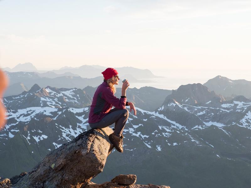
Vous êtes un cycliste expérimenté, décidé à explorer la Norvège, ses nombreux fjords et ses montagnes, simplement en enfourchant votre vélo ? Si oui, les véloroutes nationales sont faites pour vous.
Traversez la Norvège à deux roues
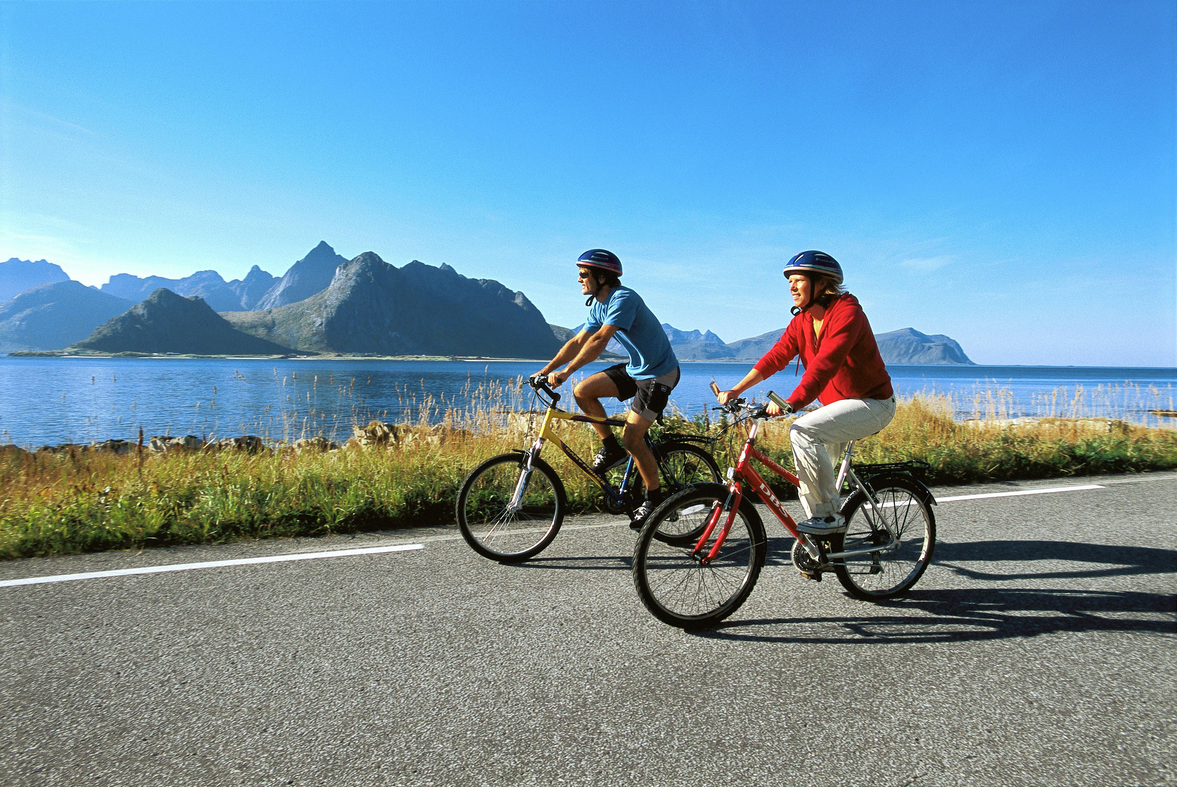
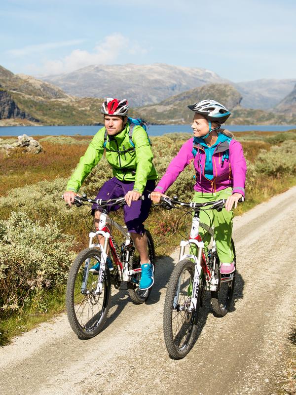
De nombreux pays, comme la Norvège, ont des véloroutes nationales - un réseau de pistes cyclables de longue distance destinées à ceux qui cherchent un défi à leur hauteur. Quand on vous dit longue distance, on sait de quoi on parle - certaines de ces routes sont réservées aux aventuriers et aux cyclistes expérimentés uniquement.
Si vous n'avez plus fait de vélo depuis un certain temps, vous pouvez quand même opter pour certains tronçons de l'une de ces longues routes, et bien que certaines soient très exigeantes, d'autres sont plus courtes et conviennent à tous.
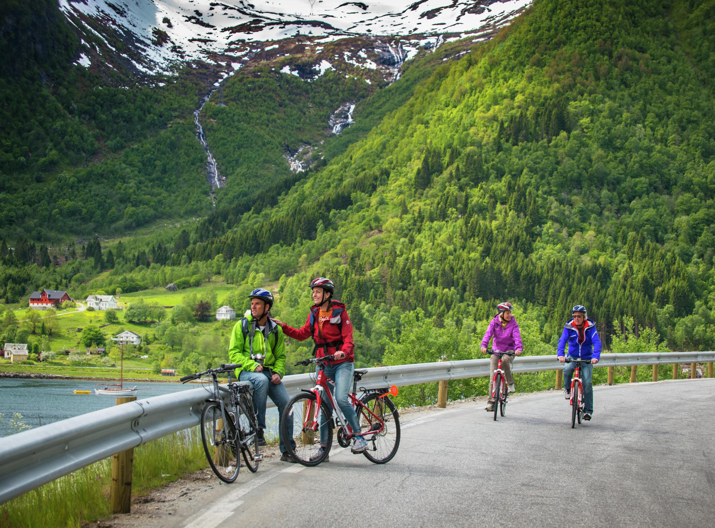
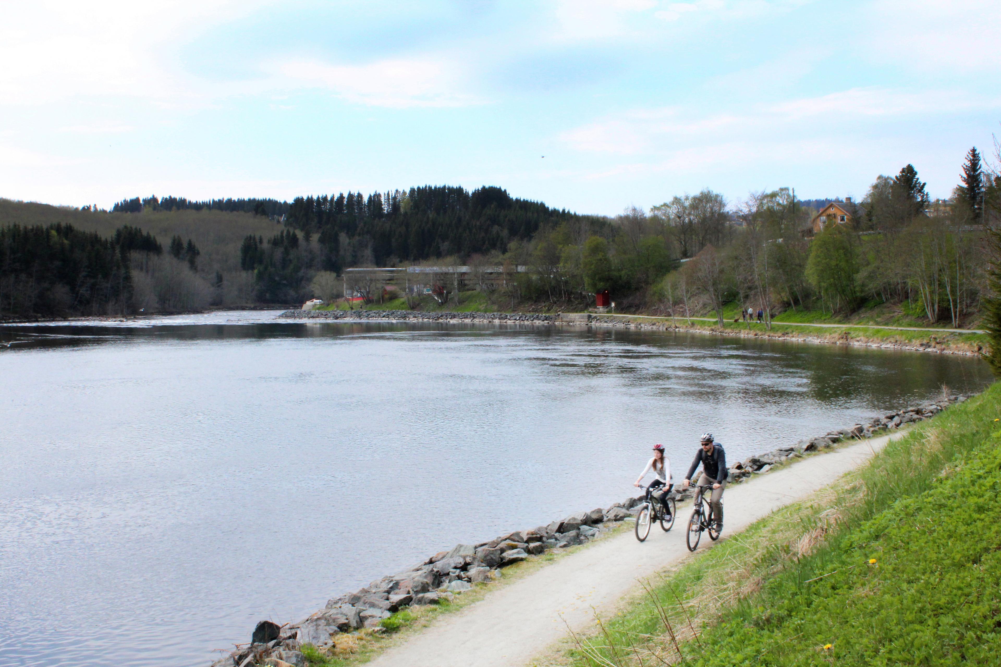
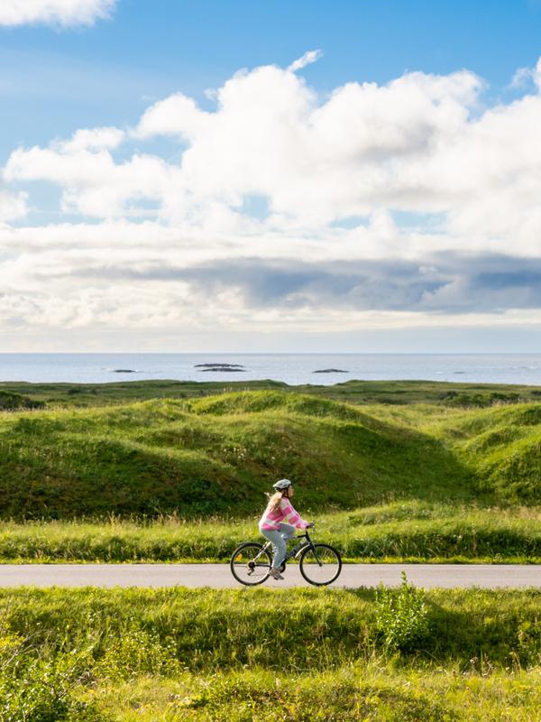
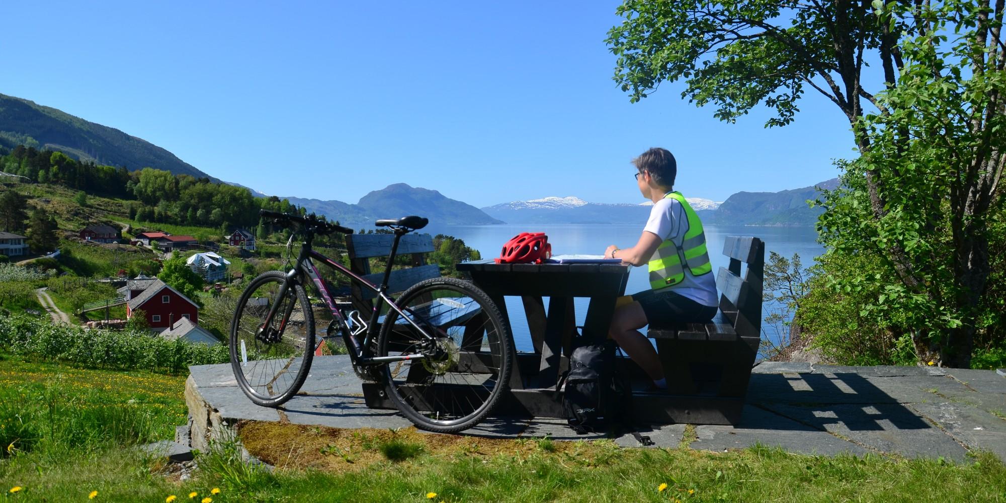
Les itinéraires cyclables nationaux vous permettent de découvrir les villes et les différentes régions de Norvège, tout en évitant la plupart des routes à fort trafic. Vous pouvez faire du vélo le long des fjords, à travers les forêts et les vallées, ou même à la montagne. En chemin, visitez des sites culturels et historiques fascinants, ainsi que des villes charmants, des paysages pittoresques et d'autres attractions. Emportez votre canne à pêche ou dégustez les spécialités culinaires locales.
Préparez votre séjour
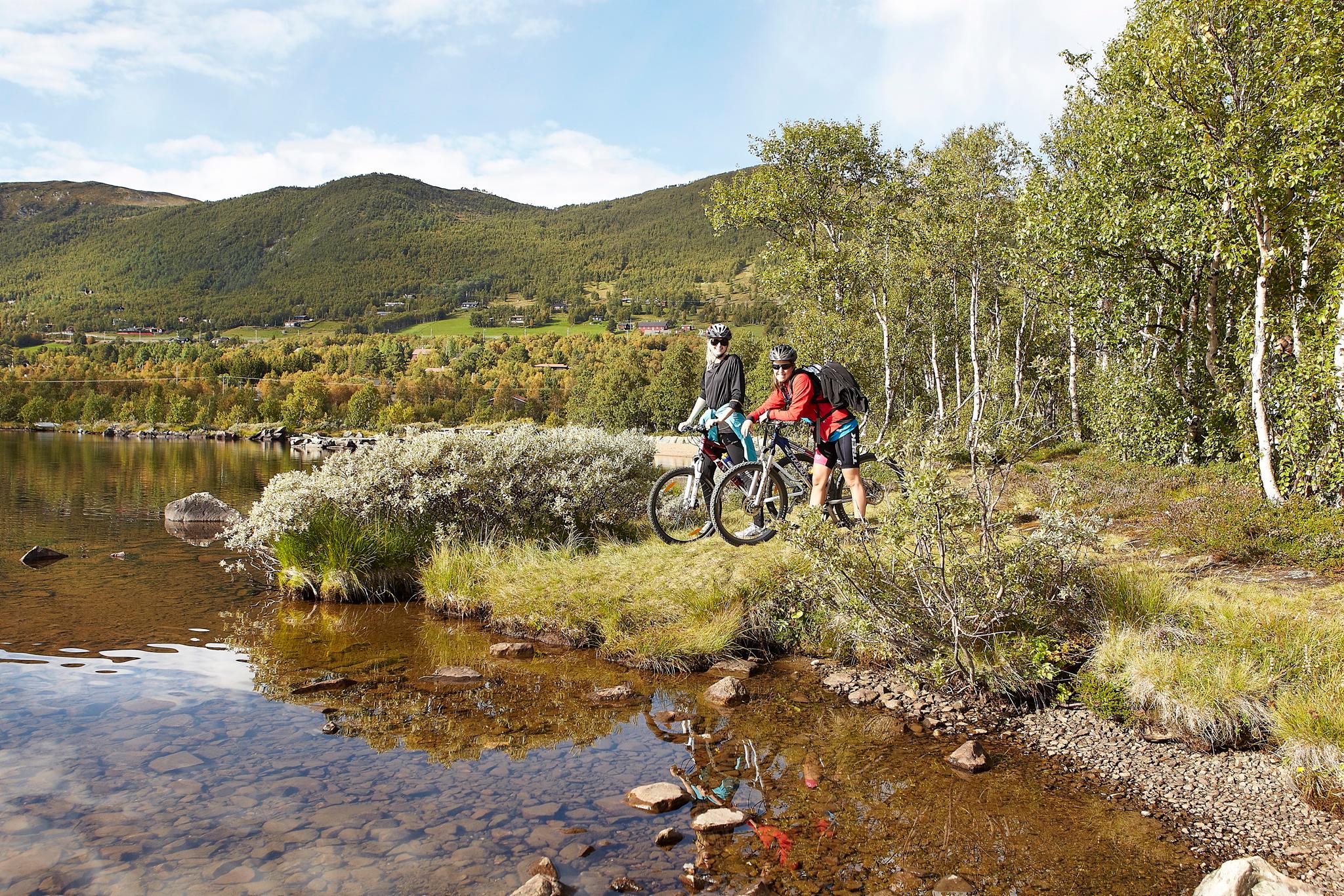
Si vous êtes tenté par l’un de ces itinéraires, nous vous recommandons de contacter les offices de tourisme concernés, qui vous renseigneront sur les régions traversées. Certains de ces itinéraires font également partie du réseau des itinéraires cyclables européens EuroVelo.
Ces itinéraires ne sont pas encore tous très bien signalisés. Aussi prenez une carte avec vous et étudiez-la avant de vous lancer ! Vous trouverez également de nombreuses informations sur les itinéraires sur bikemap.net.
Il est possible de louer des vélos et des vélos électriques partout dans le pays. Vous pouvez également solliciter un guide, faire transférer vos bagages, trouver des lieux d’hébergement et de restauration avec accueil cyclistes et acheter des forfaits séjours à vélo. Pour toutes les offres cyclo, allez directement au bas de cette page.
Avant de vous lancer à l’aventure, sachez que de nombreux tunnels, en Norvège, sont interdits à la circulation cycliste.Vous trouverez sur le site cycletourer.co.uk une carte très utile indiquant les tunnels norvégiens ouverts aux cyclistes.
Vous trouverez ci-dessous une description des neuf véloroutes nationales. Maintenant, en selle ! Et pensez à toujours mettre votre casque.
L’itinéraire côtier
Svinesund – Kristiansand – Bergen – Trondheim – Cap Nord – Kirkenes
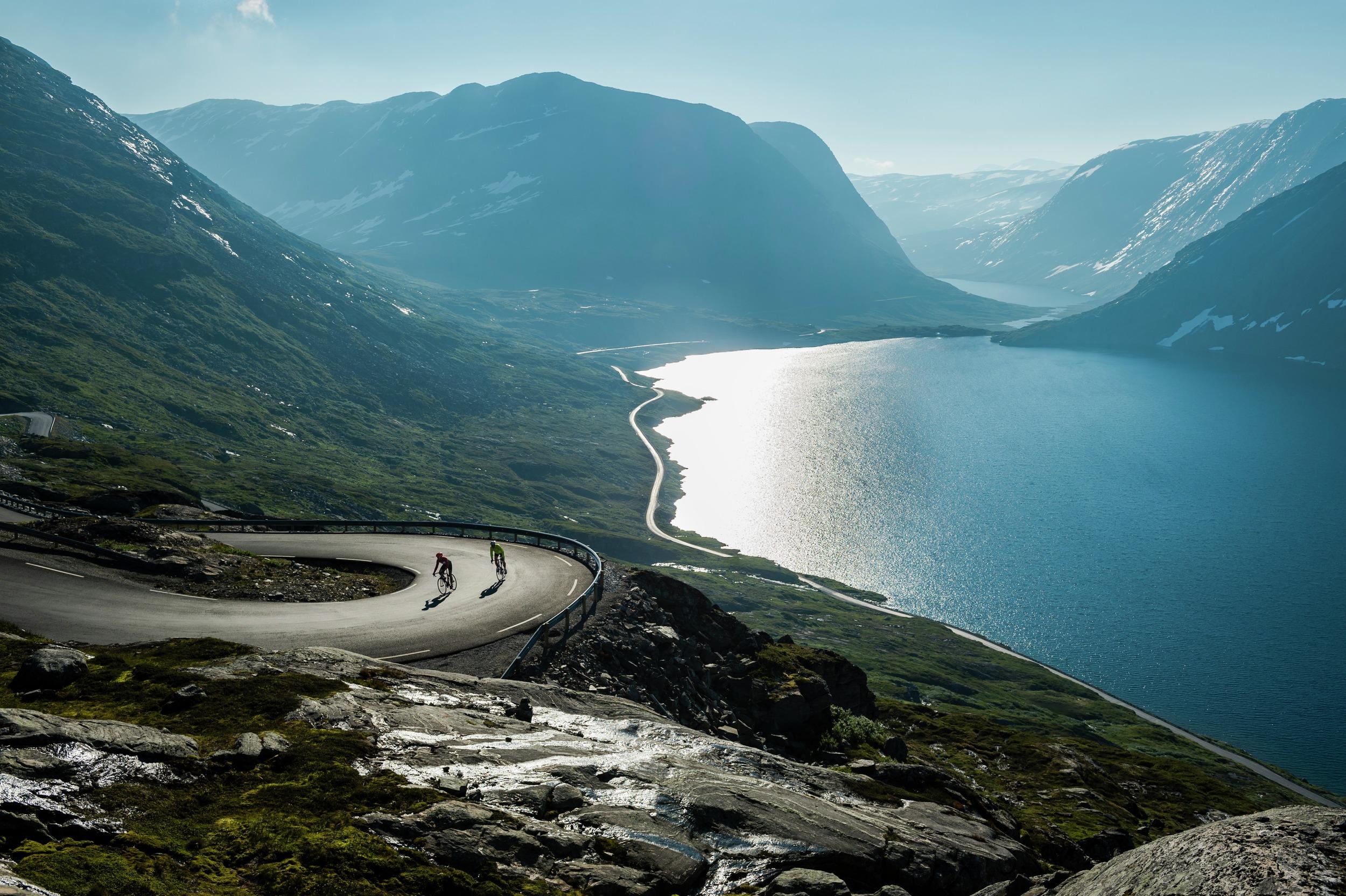
L’itinéraire côtier, avec environ 4 500 kilomètres, est la plus longue des véloroutes nationales. Il conjugue passages faciles et plus ardus. Il suit le long et pittoresque littoral norvégien, de l’est au sud, en passant par la Norvège des Fjords et les fjords les plus connus, pour aboutir à Kirkenes, à la frontière russe, en Norvège du Nord. Il s’intègre aussi au réseau des routes cyclables longue distance EuroVélo.
Dans les nombreux fjords que traverse la Route, il est souvent nécessaire d’emprunter un traversier, un pont ou un tunnel sous-marin afin d'éviter de longs détours sur le rivage des fjords.
La Route du canal
Porsgrunn – Canal du Telemark – Dalen – Stavanger
La Route du canal vous mènera à travers toute la Norvège du Sud, de Porsgrunn via Skien et au canal Telemark, creusé dans la montagne il y a plus de 100 ans et surnommé « huitième merveille du monde » lors de son inauguration à Dalen ; puis le chemin continue vers la ville côtière de Stavanger. Bien qu'elle permette de traverser le pays d'un bout à l'autre, cette véloroute nationale est l'une des plus courtes, avec une longueur de 466 kilomètres.
La Route du canal
Fjords et montagnes
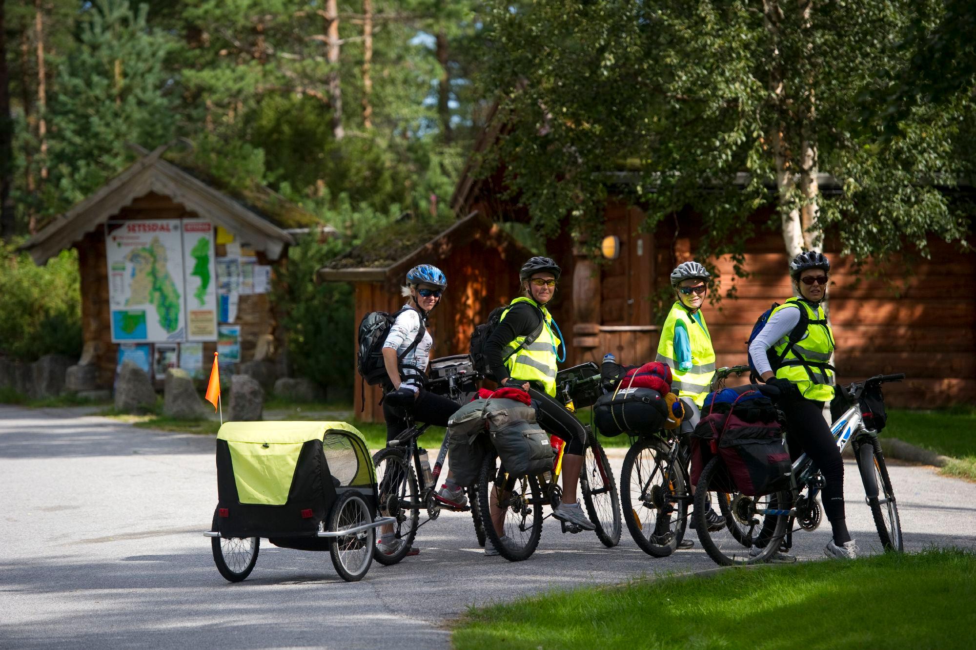
Kristiansand – Setesdal – Hardanger – Kristiansund
Partant de Kristiansand, en Norvège du Sud, l’itinéraire Fjords et montagnes passe par la région du Hardangerfjord et traverse le Sognefjord avant d'aboutir à Kristiansund, dans le Nord-Ouest. Les monts escarpés et fjords profonds de Norvège des Fjords sont le trait marquant de ces 1 000 kilomètres d'itinéraire, qui vous font sillonner certains des plus jolis paysages du sud et de l’ouest du pays.
La Rallarvegen (route des Terrassiers)
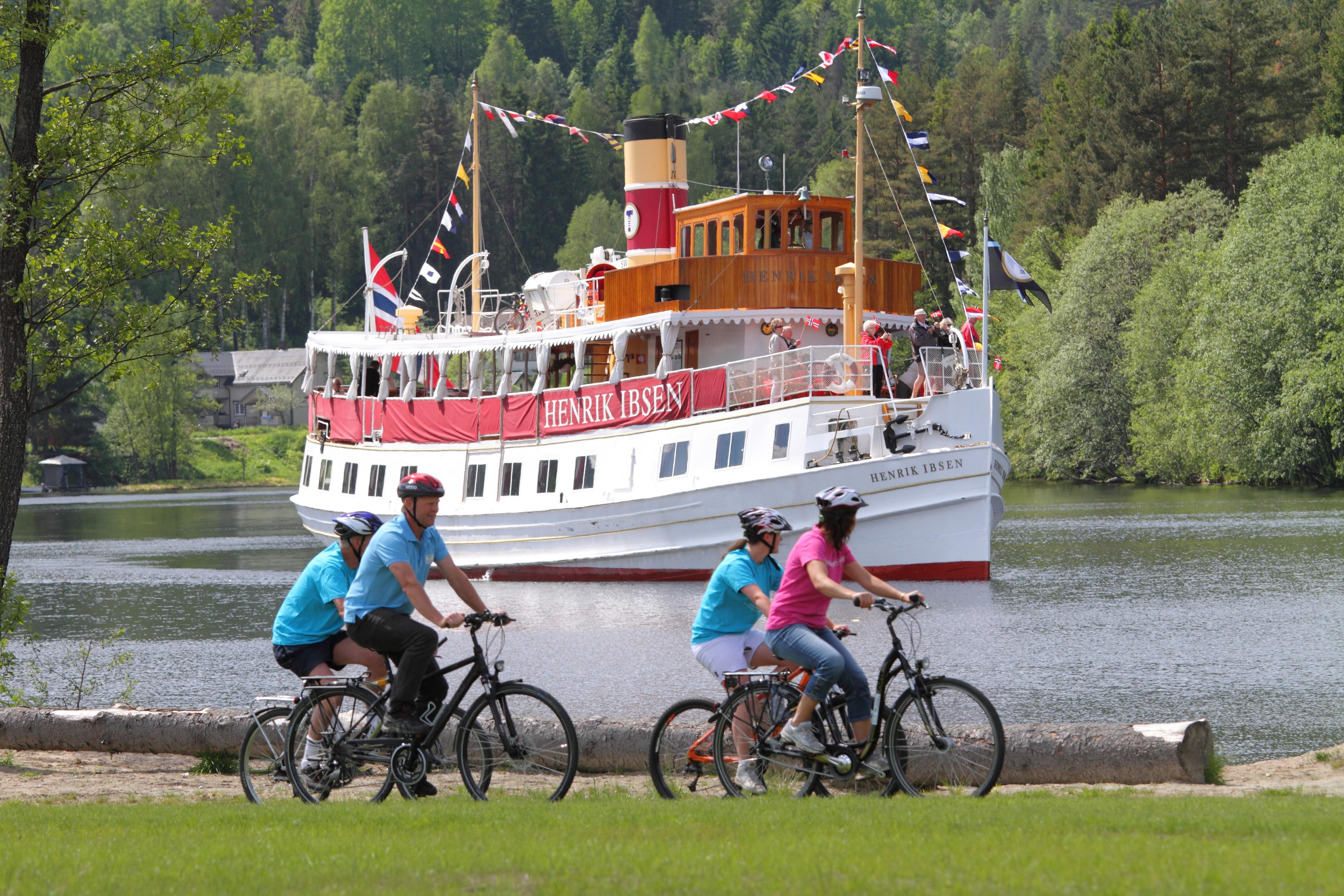
Bergen – Finse – Oslo
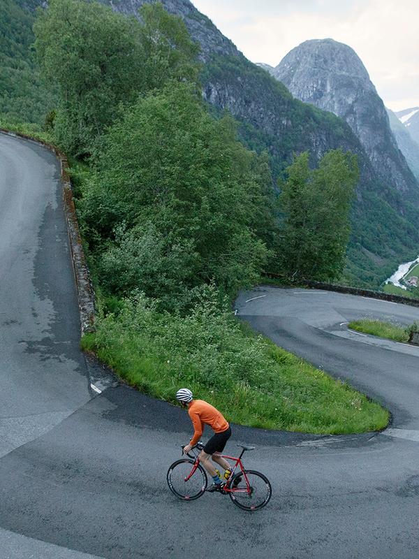
À l’origine, cette route fut utilisée pour la construction des lignes ferroviaires de Flåm et de Bergen. La véloroute nationale de Rallarvegen possède une dimension à la fois historique et de proximité avec la nature. Mais cette véloroute de 614 km s'aventure bien au-delà de la Rallarvegen et vous conduit de Bergen à Finse, en passant par Voss. Une fois arrivé à Finse, point culminant de la ligne de Bergen, il ne vous reste pratiquement plus qu'à vous laisser rouler en descente jusqu’à Oslo.
Toutefois, la majorité des cyclistes optent pour le trajet en sens inverse, soit l’itinéraire de 82 km reliant Haugastøl à Flåm par l’Aurlandsfjord, qui est l’itinéraire cyclable le plus populaire de Norvège.
Véloroute nationale 4 : Rallarvegen
L’itinéraire de Numedal
Larvik – Kongsberg – Geilo
Partant de la charmante ville côtière de Larvik, l’itinéraire de Numedal déploie ses 950 km le long des routes de Norvège de l'Est, à travers l’ancienne ville minière de Kongsberg et les hautes montagnes de Dagalifjellet et Geilo. De Larvik à Dagalifjellet, point culminant de l’itinéraire, il y a un dénivelé de 1 000 mètres.
La route du Sognefjell
Røros – Hardanger
Cet itinéraire part de la ville minière de Røros, site du patrimoine mondial de l'UNESCO connu pour ses vieux bâtiments en bois et pour être l'une des principales régions norvégiennes pour la production locale de spécialités du terroir. La véloroute du Sognefjell vous emmène à travers les montagnes du Trøndelag et continue à travers les célèbres attractions naturelles de la Norvège des Fjords, avant de se terminer dans le Hardanger.
L’itinéraire des pèlerins
Halden – Oslo – Nidaros (Trondheim)
La ville de Halden, proche de la frontière suédoise, en Norvège de l'Est est le point de départ de l’itinéraire des pèlerins, qui couvre 600 kilomètres. Traversez la capitale norvégienne Oslo, puis suivez l’ancienne voie de pèlerinage jusqu'au lac Mjøsa, visitez les vestiges séculaires de la cathédrale à Hamar, avant de mettre cap au nord, direction Trondheim. Dans cette ville se dresse la cathédrale de Nidaros, sanctuaire national.
La route des pèlerins est la dernière des trois routes EuroVélo traversant la Norvège. Si vous envisagez de la parcourir intégralement, soyez bien entraîné, car la route démarre à Saint-Jacques-de-Compostelle, en Espagne.
La route nature sauvage
Halden – Trondheim
Le début de la route sauvage est tout à fait semblable au sentier des pèlerins. Ensuite, elle passe par un chemin à travers la forêt vierge plus à l'intérieur de la Norvège, puis continue par les villes de Elverum et Trysil dans le Hedmark, et ensuite par Røros et Selbu avant d'arriver à Trondheim. Sa longueur totale est de 825 kilomètres.
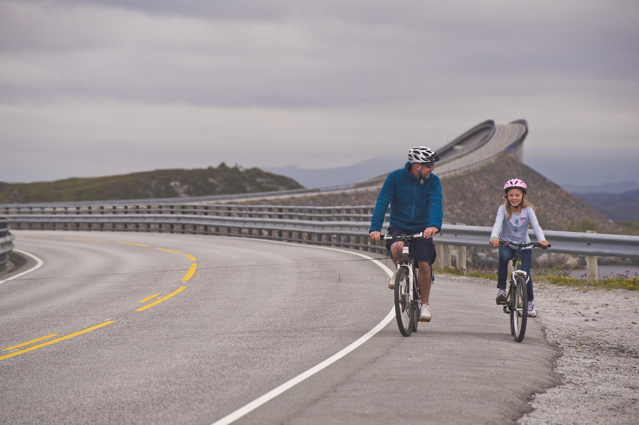
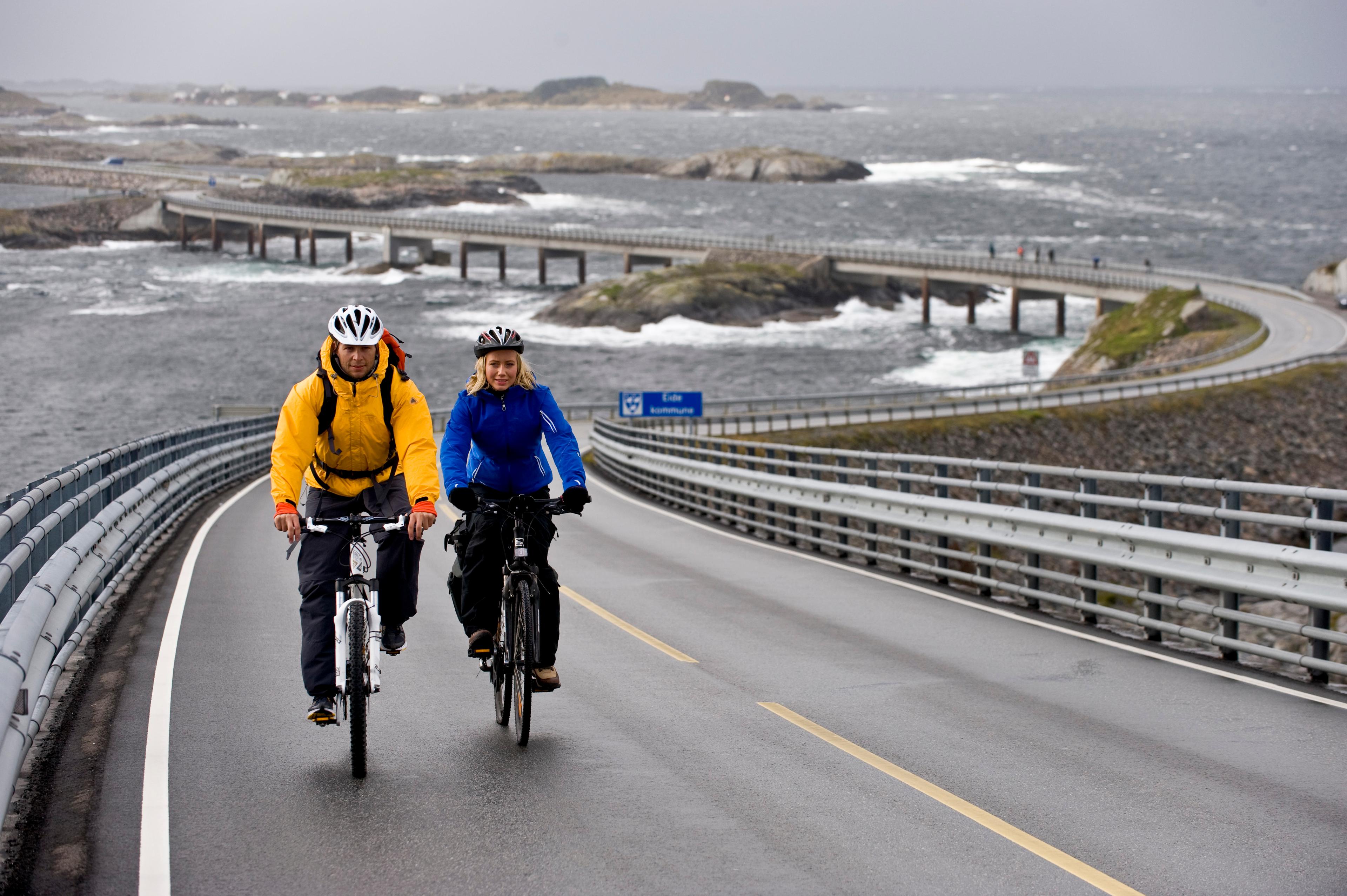
Du cap Nord à Lindesnes : la Norvège du nord au sud
Cap Nord – Lindesnes
L’itinéraire du cap Nord à Lindesnes est l’un des plus longs des neuf véloroutes nationales. Il relie le point situé le plus au nord de la Norvège – le cap Nord – à celui situé le plus au sud, à Lindesnes. Sachez que sur certaines portions, il vous faudra opter pour un mode de transport alternatif, de type train ou bus, en raison des tunnels fermés aux cyclistes.
Faites le plein d'idées
 Rødberg
Bicycle tours in Destination Uvdal.
Bicycle tours in Destination Uvdal. This bicycle tour goes around the Kravik fjord. The bicycle tour starts in Norefjord centre. You follow the low traffic county road west of the Nore Fjord and Kravik fjord. After 10 km cross the Kravikfjorden, then cycle back on county road 40. This is a round trip of about. 20 km in total, paved all the way. Bicycle ride Smådøl valley. A particularly nice trip is to cycle from Ånevatn on Dagali Mountain down on the gravel road in Smådøl. You can follow this gravel road all the way to Rødberg about 35 km. This trip takes you past many great picnic sites, both by small lakes and along the river. The stretch is part of the National Cycle "Numedalsruta" which continues right down to Larvik. Follow county road 40 to Dagalifjell, Exit at Ånevann and follow the gravel road with the sign Smådøl. Down Smådøl trail bike along a cozy dirt road where you will pass old mountain pastures and new cabins. A nice lodging place, the new rambling cottage "Duse Horse", is only a 20 minute walk from Smådøl road. Take off from the road a little after Frygne Shieling (about 9 km from the exit of county road 40). Here it is marked with the sign Duse Horse. T-marked trail up the hillside runs right beside a road to the cottages. This is also part of the National Cycle Route No. 5 which you can read more about here: "Http://www.numedalsruta.no"> National Cycling Route No. 5 Bicycle tour from Uvdal through Solheimstulen to Imingfjell. Bicycle tour from Uvdal through Solheimstulen to Imingfjell Uvdal. This bicycle tour is about 50 km and offers both asphalt biking, dirt roads and an old tractor road over the mountain! Mountain bikes are required!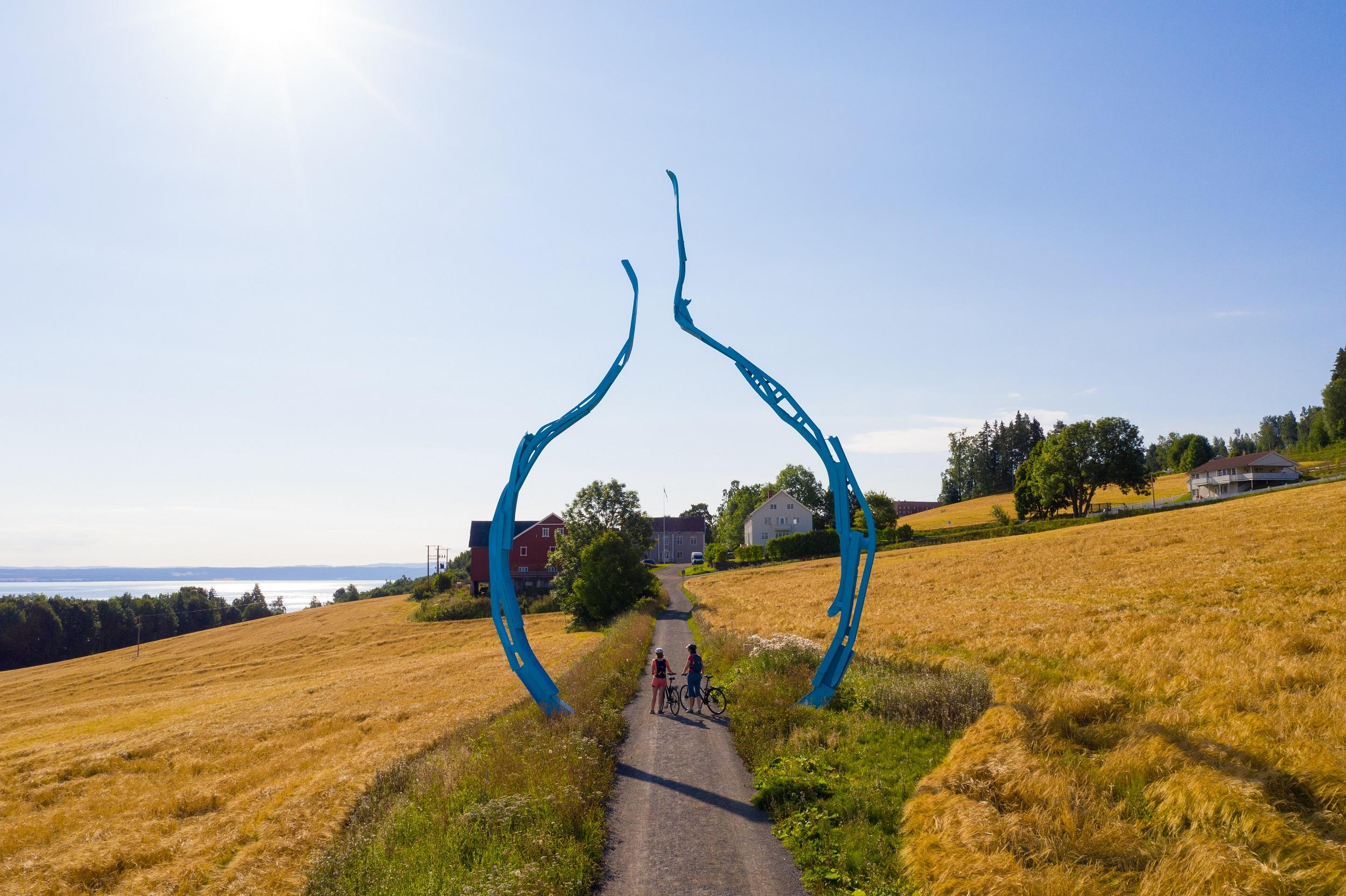 Gjøvik
Mjøstråkk
Mjøstråkk Mjøstråkk is the name of the 250 km long cycling route around Mjøsa, Norway’s greatest lake. Travelling on two wheels around Mjøsa lets you experience this beautiful cultural landscape with its rolling fields and green hills close up. A detailed map from 2013 is on sale for NOK 100 from the tourist offices in Gjøvik, Hamar and Lillehammer. The map has information about the route, topography and tips on accommodation, eateries and attractions in Norwegian and English. Click to see the Mjøstråkk map. You can download the GPS data: - Download Mjøstråkk as a .GPX-file Route You can choose your own starting point. If you start in the south and cycle along the western shore of Mjøsa, the route will take you from Minnesund via Hurdal and Totenåsen to Skreia, Kapp and Gjøvik. The route continues north via Biri to Lillehammer at the north end of the lake, and then turns south via Brøttum, Moelv and Brumunddal to Hamar. The final section takes you past Stange and Tanken before you return to your starting point in Minnesund. You can cycle the entire route or parts of it, and you choose the distance that suits you best. Some sections of the route have steep inclines, for example from Minnesund to Totenåsen, a stretch that is classified as challenging. The reward is the fantastic views of Toten and Mjøsa when you get to the top. The rest of the route varies between fairly easy and fairly demanding. Children over 10 can cycle part of the route, for example between Totenåsen and Gjøvik. - Minnesund–Gjøvik 72 km – Demanding - Gjøvik–Lillehammer 48 km – Fairly demanding - Lillehammer–Hamar 61 km – Fairly easy - Hamar–Minnesund 53 km – Fairly easy Other accommodation If you want to cycle the entire route there is a wide range of accommodation to choose from along the way. Great hotels and hostels are available in the towns of Gjøvik, Lillehammer og Hamar. If you want the spend the night in charming rural surroundings, you can stay at one of the many farms along the route, such as Stokke Nedre, north of Gjøvik, and Annexstad Gård, south of Gjøvik. We recommend that you book accommodation in advance. Sight-seeing If you are looking for additional adventures along the cycling route, there are numerous attractions and sights you can visit. The Peder Balke centre at Kapp is well worth a visit. The centre has an art gallery with various exhibitions, in addition to wonderful murals by Peder Balke. The centre also has a shop selling interiors and a cafe. In Gjøvik, we recommend that you visit Gjøvik Gård, the olympic mountain hall and Norway’s smallest chocolate factory, Gjøvik Chokolade, in the town centre. Many of the sights are marked and described in the “Mjøstråkk” map. Food Good food is important. You will find everything from well-known chains like Peppes and Egon to cozy farm cafes which serve food and refreshments along the route. Opening hours vary so it may wise to plan meal stops in advance. There are grocery shops in the towns and villages along the way. Bicycle hire If you haven’t brought your own bike you can hire one at the tourist office at Gjøvik station. Transport If you wish to combine the cycling trip with a voyage on Skibladner, the white swan of Mjøsa, you can bring you bike on board. Space is limited, so it is important to book in advance. Send an e-mail to Skibladner at [email protected] Every Saturday from the end of June until the middle of August you can bring your bike aboard the boat “Besta”, which sails between Hamar and Helgøya. Book a place on tel. +47 944 34 582 If you arrive in the Mjøsa region by train, you can also bring your bike on board. The Gjøvik railway line runs between Oslo S and Gjøvik, while the Dovrebanen line runs from Oslo S to Hamar and Lillehammer. We recommend that you book a space for your bike in advance. Call Vy on +47 815 00 888. Do you have any questions? You will find more information about accommodation, sight-seeing and restaurants in the Gjøvik region, Hadeland, Ringerike and Ringsaker (This means the majority of the Western side of Lake Mjøsa) on our website www.visitostnorge.no. Information about other sections of the route is available from the following websites www.visitromerike.no, www.lillehammer.com and www.hamarregionen.no Røros
RørosCycling in the World Heritage site of Røros
You can take bike rides in beautiful scenic environments, choose between three to seven hour rides in three different, well marked trails with easy to average difficulty and a different theme for each. Exploring the wide open country and mountain forests. Routes Røros and its Circumference is on the UNESCOs World Heritage list, and many are surprised to find a particularly urban small town in the historical districts. As a sustainable destination it is important for us to also have a sustainable industry. This is reflected in our goal for more cycling tourism. The themes for the signposted cycling trails are based on the local history: The Nordgruva Field – in the realm of Falkberget The novelist Johan Falkberget lived and worked in this area, and he found great inspiration in the mining communities. The trails pass remains of several copper mines, as well as the Falkberget museum in his home in Rugeldalen. Storwartz – in the miners footsteps. This is where the mining started in 1646. Experience the history of Røros and the Copper Company by attending a guided tour in the Olav mine. In the Miners’ Hall down in one of the mines you may even see concerts etc. Mølmannsdalen – Traces of the Ice Age. See how the last Ice Age has shaped the landscape and contributed to the unique fauna and flora in the area. Bike along lakes and gravel ridges in a varied, but child-friendly terrain. The Mølmannsdalen farm has a peculiar (ghost-)story. Other Routes Visit Røros og Østerdalen covers the whole region, and we can also offer a variety of good cycle routes. There are old traffic- , summer- and gravel roads with little traffic, trails and paths. Cycle along Femunden, in rural villages and pastoral valleys, were you can find accommodation on the way. Plan a trip into the mountain farm areas of the national park village Vingelen, and in cross-country skiing World Champion Therese Johaugs hometown Dalsbygda. Many of the mountain farms are open, were you can enjoy traditional food either full meal or just a snack. The parts around Aursunden are also popular for combining cycling and local food. Bike rental Bicycle rental is available at Tolga Sykkelmekka - Salg av sykler og sykkelopplevelser and BUA Local food, culture and shopping Røros is known as the capital of local food in Norway, and we recommend at the strongest to try some of the areas best restaurants and farm outlets. Likewise, we are among the best in the country when it comes to culture, and there are always some event to attend during your stay. In Røros and other little towns and villages in the region, there are exiting clothing- and design shops, outlets, galleries and museums to visit. For more information, tour suggestions, trail maps and -descriptions, contact Røros Touristoffice.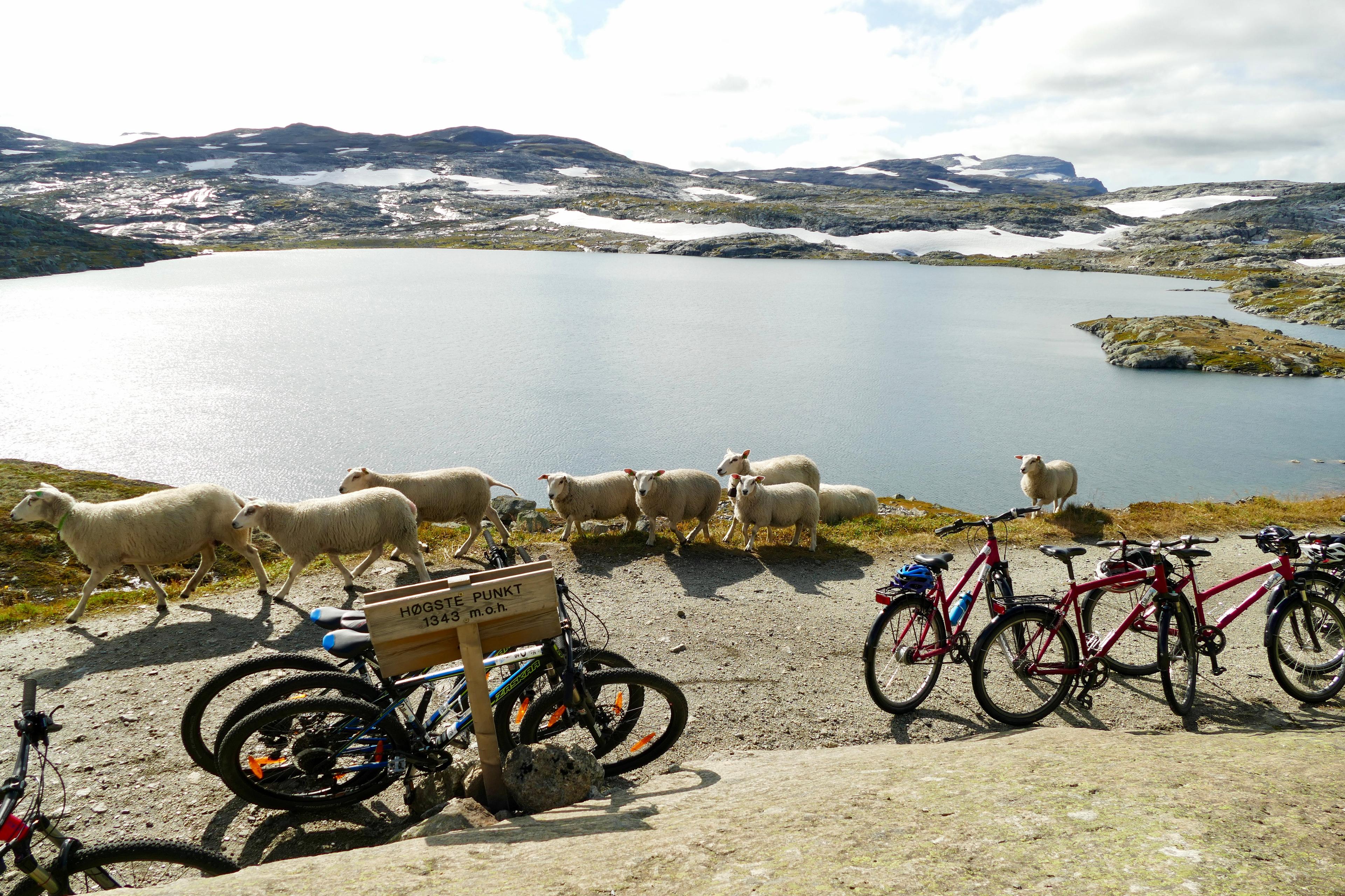 Geilo
GeiloRallarvegen
Rallarvegen – the navvy road – runs through a dramatic, lush and challenging landscape rich in culture, history and unique nature. The road was built by hand at the turn of the last century to transport equipment and food during the construction of the Bergen railway. Today Rallarvegen is one of Norway’s most popular bicycle routes and runs 80 km from Haugastøl – Finse – Hallingskeid by Vatnahalsen to Flåm. Along the way you can learn more about Finse, the Bergen railway and Rallarmuseet (the Navvy Museum) at Finse. You can add an extra 23 km by travelling east along highway 7 from Geilo to Haugastøl and from Myrdal to Voss. If you come from the west, you can continue into the mountains around Hallingdal. Because of the difference in altitude from Haugastøl, 988 m.a.s.l, through Finse 1222 m.a.s.l. Most people chose to take the bicycle train to Finse before returning to Geilo. Rallarvegen starts at Haugastøl and has a slight ascent up to Storurdi and Finse. Partly on rough surface (pebbles and gravel) the route runs west, slightly ascending up to Fagernut and then down to Hallingskeid. The road through Klevagjelet to Myrdal is steep and partly unsecured, so you should be careful and it is recommended to step off the bike. From Myrdal, by Vatnahalsen Hotel, there is a steep descent down the 21 road bends (Myrdalssvingene). From Kårdalen (summer dairy with Norwegian goat cheese) the last lap runs through the lush and dramatic Flåmsdalen down to Flåm. The train journey by Flåmsbanen is a highlight. The 20 km by train between the mountain stations Myrdal and Flåm by the fjord take about 55 minutes. Along the way you will see some of the most magnificent Norwegian mountains, with an ever-changing panorama of mountains and thundering waterfalls. The train runs slowly or stops completely to let the passengers enjoy the finest views. At Myrdal Flåmsbanen corresponds with the Bergen railway back to Geilo. Distance: From Geilo: 103 km. From Haugastøl: 80 km. If you wish to take your time and stop many times you should allow for spending 3-4 days. Accommodation is available at tourist cabins and hotel. However, it is also possible to cover the whole distance in one day. Surface: Fine gravel road Rent your bike at Haugastøl 1000moh! Geilo
GeiloThe Hallingdal Route
The Hallingdal Route runs from Geilo to Nesbyen, a 77 km distance through fairly easy terrain. It is part of National cycle route no. 4, which connects Bergen and Oslo. Geilo - Ål (28 km), day 1 The first lap descends 330 metres and is relatively easy with mainly downhill terrain. Before starting the descent down to Ål, we recommend taking detour around Ustedalsfjorden (10 km). This will take you past several cultural attractions, including Fekjo Culture Monument Park, Tuftebrui and Geilojordet (local museum). From Geilo to Ål you will travel through a tranquil forest until you reach Kleivi, and then along the charming Strandafjorden. At the end of the fjord there is a beach suitable for the whole family, highly recommend for a rest and a swim. In central Ål you will find a variety of shops, and Gallery Syningen, the Rolf Nesch Museum, the Hallingrosa exhibit, a tourist office, a library and a cinema. Ål - Gol (29 km), day 2 Lap two from Ål follows an asphalted road with little traffic to Gullhagen where you will cross the river. The trip continues on good gravel roads past Torpo to Rotneim. The last 6 km to Gol you will travel on the asphalted bicycle path along highway 7. Along the way you can take a detour and visit Torpo. Here you will find Torpo stave church from 1160, a grocery shop and a bicycle repair shop. When you reach central Gol you can visit Tropicana Badeland (water park), Oline SPA, the Medieval Park with Gol stave church, Hallingglass, Skinnfellmakern, Gol Motor and Fritidspark (activity centre) – or simply have a look in some of the many shops. There are also several restaurants and cafés. Gol - Nesbyen (20 km), day 3 The last lap runs through central Gol, past the station and along a charming gravel road running along the river Hallingdalselva. About halfway the gravel road ends and you will follow the asphalted old road to the station in central Nesbyen. Between Svenkerud and Nesbyen you can take a detour to Gardnos Meteorite Crater where you will see how a meteorite shaped the landscape many thousand years ago. Scenic trail and guiding available. In Nesbyen you can visit Hallingdal Museum, an large open-air museum. This is also a nice place to eat your packed lunch. Old Nes (the old town) is also worth a visit. When the time comes to leave, you can take the train from Nesbyen. Distance: 77 km. If you wish to take things slowly, you should allow for 3 days Surface: Fine gravel road For map, hight profile a bigger description of the route and alternatives, look at Outdoor Active. Grimstad
Cycling tour "Vestlandske hovedvei" 24 km
Start by the tourist office, and ride southwest along the quay. Continue past Odden Shopping Centre, and follow Bark Silas vei until you reach a roundabout. Continue on route 420. After approx. 500 m turn left, and follow the signs for Groos. After 800 m, the road will cross a small stream. Turn right at this point, and follow the dirt road running alongside the stream. You will ride past a tarn along the way. Follow the stream all the way up to Terje Løvås vei. Cross Terje Løvås vei, and continue past Løvåsvollen farm with its large, yellow barn. Then continue on the foot and cycle path. By Bergemoen, use the crossing to get to the other side of the E18 and then follow signs for Landvik Church. Turn left by Landvik, and follow signs for National Cycle Route no. 1. After some 2 km you will see Vestlandske hovedvei – the old main route to Western Norway. Follow this forest lane. After 1.5 km, you will reach a junction with a tarmac road – turn left. Continue on this road. You will now have the lake on your right hand side. Where the tarmac ends, turn right past the barrier and follow the dirt road. At Tyssekil (after 12 km in total), you will again pick up Vestlandske hovedvei. This is an idyllic spot – ideal for a break. Turn right, and continue along Vestlandske hovedvei. Back at the junction, leave Vestlandske hovedvei and follow the tarmac road to the left. At the next junction, keep right. Follow this road past Landvik Church, towards Roresanden. When you reach the top of the hill, take first right. Follow Gjærbrøndveien and then Vesterled (route 420) back to the tourist office. Comments: Mainly flat and gentle terrain. However, some sections of Vestlandske hovedvei are hilly with a relatively soft surface. Please show consideration if you meet horses along the route. Map Don't forget that you can rent a bike at Grimstad Tourist Office, you can also get many good tips for your trip. Grimstad
Cycling tour "Homborsund via Vestlandske hovedvei" 38 km
Start by the tourist office, and ride southwest along the quay. Continue past Odden Shopping Centre, and follow Bark Silas vei until you reach a roundabout. Continue on route 420. After approx. 1.6 km, cross under the E18, and follow the cycle path to the left. Continue along the E18 until you reach Bergemoen. On Bergemoveien, turn left and follow signs for Landvik Church. As you reach the church, turn left. After 2 km, follow the road signposted Vestlandske hovedvei ("the western main road"). This is the old main route to Western Norway, and is a hilly and challenging – but very idyllic – ride. After some 4 km, you will reach beautiful Tyssekil. If you need a break, this is the perfect spot. Continue along Vestlandske hovedvei all the way to Kaldvell – an area of outstanding natural beauty, offering excellent fishing opportunities. From Kaldvell, the safest route back is via Vestlandske hovedvei. After approx. 1.3 km, you will meet a tarmac road. Turn right and then left to follow route 420 back towards Grimstad. After 500 m you will reach Svennevig recreation ground with toilet facilities and excellent swimming. From Svennevig bridge, the route continues along a foot and cycle path. As you reach Lindtveit, follow signs towards Eide. Turn right by Eide Church, and continue along KNA-veien. Follow this dirt road for 2.5 km, past Breivik Camping, and you will meet Kistevigveien. Turn left, and when you reach Homborsundveien continue straight ahead. After 300 m, turn right for a detour to Kalvehageneset – a stunning area, ideal for walks (signposted Kjekstad, and also Kalvehageneset). Without the detour, continue straight ahead on Homborsundveien. After the bridge across Bufjorden, take the first dirt road, Vågsholt, on your right. Continue straight ahead, and then take a sharp left when you can see the second lake. After 850 m, you will be back on route 420. Turn right. This will take you past Nørholm, the old manor farm where Knut Hamsun lived from 1918 to 1952. Follow signs for National Cycle Route no. 1 back to Grimstad. Comments: Vestlandske hovedvei is the old main road to Western Norway from Christiania (former Oslo) to Stavanger. Between Dolholt and Kaldvell the dirt road is hilly and can be challenging in places. But you will experience a beautiful nature. Map Don't forget that you can rent a bike at Grimstad Tourist Office. Fagernes
Mjølkevegen cycling route, complete southbound: Vinstra-Gol (230 km)
Mjølkevegen is a long distance cycling route through beautiful mountain landscapes and mountain pastures between Vinstra in Gudbrandsdalen and Gol in Hallingdal, across large parts of Valdres. It is signposted in both directions from Ruten Fjellstue in Espedalen, alt. Skåbu Fjellhotell, to Storefjell Resort at Golsfjellet. Mjølkevegen has been voted one of Norway's finest cycling tours and is part of National Cycle Route No. 5. Tour description Alt. 1 Vinstra - Ruten (29 km; 1090 m elevation gain) Alt. 2 Vinstra - Skåbu (27.5 km; 950 m elevation gain) Alt. 3 Lemonsjø - Ruten/Skåbu (59 km; 970 hm elevation gain) Your cycling tour along Mjølkevegen can start at Vinstra Train station (with your own bike) or, alternatively, the Mountain Lodge Lemonsjø Fjellstue along road 51 (with rental bikes or own bike). 1) From Vinstra to Ruten Fjellstue: Follow the cycling route over the river Lågen and then follow the signage towards Fefor/Peer Gyntvegen. Where the road to Gålå exits, keep right towards Fefor/Perr Gyntvegen mot Espedalen. From Fefor, keep going along Peer Gyntvegen. It is now gravel all the way via Lomsætra until you reach road 255 at Dalssæter. Turn right onto road 255 and after a little less than one kilometer, you reach Ruten Fjellstue. Tip: Ruten Fjellstue offers pick up at Vinstra train station (prebooking only). There's also a local bus service from Vinstra via Skåbu and Ruten towards Espedalen: entur.no. 2) From Vinstra to Skåbu Fjellhotell: Follow the cycling route over the river and then follow road 255 towards Skåbu. In Skåbu, keep straight ahead to Skåbu Fjellhotell and Mjølkevegen. The road up is partly very narrow, steep and windy, so cycle with great care. 3) From Lemonsjø Fjellstueto Ruten/Skåbu: Follow the driveway through the cabin center and the old road towards Randsverk (take to the left at the containters!). Just before Randsverk Camping, in the forest, turn left and follow the cycling signs to the main road Heidalsvegen. Exit onto Heidalsvegen to the left and follow it for 2 km until the exit towards Murudalen (signed). Pay attention to the exit into Murudalen just after the bridge over the river! Follow the whole Murudalen Valley until the intersection with Jotunheimvegen. Turn left and then follow the signage to either Ruten Fjellstue or Skåbu Fjellhotell. Ruten/Skåbu - Haugseter (47 km; 935 m elevation gain) From Ruten, cycle along Lake Olastappan towards Jotunheimvegen; from Skåbu, follow Skåbuvegen and Slanglivegen to Jotunheimvegen which you then follow all the way to Haugseter. This leg, too, starts with a tough climb until you reach the mountain plateau. At the juction with Hinøgslivegen you reach a Mjølkevegen restshelter with an outhouse. Shortly after, there's a rest area with information about the Langsua National Park and a toilet. This the trailhead for a 20 min. hike to a former falconary trap at Veslfjell. Now you start the climb to the pass between Austhøi and Buhø and from here the route descends to the northern shore of Lake Vinstre. Haugseter Fjellstue offers good food and accommodation in a beautiful setting on the lakeshore. Haugseter - Bygdin (14 km; 220 m elevation gain) and Bygdin - Beitostølen (12 km; 150 m elevation gain) From Haugseter, continue for approx. 12 km along Jotunheimvegen and exit onto the main road 51 towards Bygdin Høifieldshotel which makes a splendid stop for a bite to eat and a rest or, if you feel that the leg to Haugseter is a bit short, an overnight in historical surroundings, before you continue along road 51 over the Båstskaret mountain pass to Beitostølen where you will find a wide variety of restaurants and top quality accommodation, including the Beito Resort Hotel and Riddergaarden Mountain Lodge. It is also possible to headstart the next leg and continue downhill and a few km past Beito to spend the night at Gronolen Fjellgard. Beitostølen - Ryfoss/Rogn Camping - Syndinstøga (46 km; 1530 m elevation gain) This is the hardest leg of the whole tour, containing two long and tough climbs. From Beitostølen town centre, turn right down towards Beito, and then follow the signposts towards Slettefjellvegen. There is a good climb up to the top of Slettefjellet (1315 m), which is the highest point of the whole trip. Shortly before Mugnestølen you will find a Mjølkevegen rest shelter. At the top there is a picnic area where you get an amazingly beautiful view over large parts of Jotunheimen. The road now descends steeply towards Vang - another breathtaking view! Drive carefully down here and make a few stops to take in the view! At Slettefjelliosken, turn left and follow Høresvegen past Høre Stave Church (worth a stop) and then continue downhill to Ryfoss where you find a gas station, grocery store and cafe. Turn left onto Ryfossvegen and after 200 m right onto the pathway under the E16. After the bridge over the Begna River, turn left onto Kvednavegen, then, after 550 m, right onto Nordabergsvegen and after 1 km left onto Strøsvegen. Now you face another tough climb approx. 10 km length and 655 m elevation gain unto the next mountain plateau and to your next accommodation, Syndinstøga. We recommend to make use of the pick-up service offered by Syndinstøga (prebooking) or, alternatively, stay for an overnight in a cabin at Rogn Camping. To get there, after having finished the Slettefjellet mountain pass, or coming from Tyin along Lake Vangsjøse as described below, from Slettefjellet/Dalsbru intersection, follow the signs to Åsvang and descend along Tørpegardsvegen to Rogn Camping (order a breakfast package to be placed in your fridge). On the nest day you need to cycle for approx. 4 km along the E16 - take great care! - until Kvismo, where you tun right onto Nordabergsvegen until you reach Mjølkevegen again at the exit onto Strøsvegen (right turn). ___________________ Alternative route between Bygdin and Ryfoss with boat trip to Eidsbugarden and via Tyin Eidsbugarden - Filefjellstuene (24 km; 150 m elevation gain) Filefjellstuene - Ryfoss (41 km; 470 m elevation gain) Eidsbugarden - Ryfoss via Opdalstølen (64,5 km; 595 m elevation gain) This is an alternative to cycling via Beitostølen and over the Slettefjell mountain pass. During the summer you can take the historic boat M/B Bitihorn from Bygdin to Eidsbugarden. Remember to check the boat schedule and make a reservation for yourself and your bike at jvb.no/mb-bitihorn. From Eidsbugarden, cycle over to Lake Tyin and Tyinholmen. Tyinholmen Fjellstue is our recommended place to stop for refreshments, a meal or a good night's sleep, as well as to explore the beautiful surroundings on your bicycle or on foot. Continue along Lake Tyin and turn left onto road 53 towards Tyinkrysset. After a little more than 3 kilometers, Mjølkevegen exits to the left on a side road via Opdalstølen to Tyinkrysset. This is the route you follow if you are headed towards Ryfoss, Rogn Camping or Syndinstøga on the same day. If you stay at Filefjellstuene for the night, however, ignore the Mjølkevegen signage and keep straight ahead along road 53 until you reach the old E16! Exit to the right (Nystøgovegen) and follow it for approx. 400 m until the exit to alpine skiing center. Exit here to the left and cycle uphill to Filefjellstuene. On the next day, continue uphill to Grovstølen and turn left towards Tyinkrysset. At Tyinkrysset, you find a convenience store and the Filefjell Turist office / Intersport store where you can recharge your e-bike battery. There's an electricity outlet inside the store and on the wall outside (where the garbage container are) in case you arrive outside the opening hours. They also have chargers for Shimano, Bosch and Yamaha for use on the spot. From Tyinkrysset you can choose to follow the signage along the historical Kongevegen to Øye (some trail sections where you might have to push your bike), instead of cycling along the E16 (if you choose the latter, exit to the right onto Strøndafjordvegen at Grihamar). At the intersection of Strøndafjordvegen and the E16, just north of Øye, be careful to exit onto Vennisvegen (welcome back to Mjølkevegen signage) and cycle along the northen shore of lake Vangsmjøse. Follow Vennisvegen and later on Liagardsvegen to the intersection with Slettefjellvegen, where you meet the Mjølkevegen route that crosses the Slettefjellet mountain pass. From Slettefjellkiosken, you can choose to cycle back to Beitostølen via the Slettefjell mountain pass or to continue towards Syndin, Vaset and Gol as described above. ___________________ Syndinstøga−Vaset (20 km; 230 m elevation gain) From Syndinstøga, Mjølkevegen continues to Vaset in a friendly and open, undulating mountain terrain. Make sure not to miss the right turn at the southern end of Lake Søre Syndin. You are now entering a 2 km trail section which can have wet parts where it might be necessary to push the bike in some places. From Nørre Trollhovd, the route continues on a firm gravel road to Murkelie and all the way to Vaset, with lake Vasetvatnet on your left-hand side. At Vaset there are several lodging options, such as Vasetstølen and Gomobu Fjellstue. The latter is situated 3 km uphill further along the route towards Brattåsen. Vaset−Golsfjellet (via Gauklie 30 km; 600 m elevation gain) From Vaset, take the exit uphill to Gomobu (if you didn't do this bit already the day before) and continue to the Brattåsen crossing. Here you can choose to take the direct route via Gauklie to Furuset or to make a detour via Tyrishølt and Langestølen where there is a café and small shop. Both routes meet again at Furuset from where you cycle along Naustedokkvegen and cross over the dam at Tisleifjorden (there's a resting area on the dam top with a stunning view over the lake towards distant mountains) towards Oset Fjellhotell. Update 2025: Due to constructing works on the dam cyclists must use the road next to the dam instead. You can either stay at Oset or continue on tracks through the terrain uphill to Storefjell Resort, situated below the top of Storefjell mountain. Another accommodation option is Kamben Høyfjellshotell. The alternative route via Tyrishølt and Langestølen is 4 km longer and has 20 extra m in elevation gain. Golsfjellet/Storefjell−Gol station (24 km; 125 m elevation gain) From Oset, follow Mjølkevegen to Storefjell. From Storefjell, cycle approx. 400 m downhill. Mjølkevegen exits to the right. From Kamben, cycle towards Storefjell until approx. 400 m before the hotel. Mjølkevegen exits to the left. Follow the signage via Einarset to Gol. The route avoids the main road almost entirely. Beware of a very! sharp exit to the left just before the bridge towards road 52 at Robru to Gol, onto the side road along the northern side of the river. At Gol you can spend the night at First Camp Gol - Hallingdal, relax and rewind after an unforgettable cycling tour. Alternative route from Golsfjellet to Fagernes If you cycle Mjølkevegen with a rental bike or have parked a car between Fagernes and Lemonsjøen and ned to take a bus back there, your last leg is to Fagernes instead of Gol, since there is no bus connection from Gol to Lemonsjø on the same day. From Storefjell/Kamben or Oset, cycle back along Mjølkevegen over the dam to the Furuset crossing. Here you exit to the right onto Tisleivegen which you follow all the way to road 51 in Tisleidalen. Here you exit onto road 51 to the rights and after 500 m, exit to the left, over the bridge and towards Merket. Follow the gravel road around Lake Pardisvatnet and Ølsjøen and continue to Åbjør. Keep straight downhill to Vestringsbygde. Here you exit to the left onto Vestringslinna which you follow to Leira (approx. 1.5 km is on road 51 - cycle with care!). From Leira, follow the lakeside walk/cycling path to Fagernes. This leg is not signed. You can order the GPX-track by email to [email protected]. ___________________________________________________________________________ The complete route from Vinstra to Gol via Slettefjellet: approx. 230 km / 4150 m elevation gain The complete route from Vinstra to Gol via Tyin: 250 km / 4120 m elevation gain Mjølkevegen can be cycled in both directions, but is somewhat more demanding if you start from Gol than from Vinstra. Transportation App/web page for bus connections across different providers (ticket sales for local bus routes only): www.entur.no For trains to/from Vinstra and Gol, see VY www.vy.no For buses from Visntra to Skåbu, see www.innlandstrafikk.no, route 240 For buses from Gol to Fagernes (stop Fjellheim), see www.innlandstrafikk.no, route 139 For buses from Oslo via Fagernes and Beitostølen to Gjendesheim, see www.nor-way.no (bicycles must be booked) For buses from Gjendesheim to Lemonsjø, see www.innlandstrafikk.no, route 204 For the boat on Lake Bygdin, see www.jvb.no/bitihorn Transport from Vinstra to Ruten Fjellstue can be requested at Ruten Fjellstue, tel. (+ 47) 61 29 73 20. Transport from Gol to Storefjell Resort Hotel can be requested at Storefjell Resort, tel. (+ 47) 32 07 80 00. Taxis are available at the train stations. For baggage transport, please book a tour package. Bicycle rental Bicycal rental between Vinstra and Gol is unfortunately not possible. If you need a rental bike, we recommend the route alternative with starting point at Lemonsjøen (as described above). Book your bike at Fjellkjeden or Bike&Hike Jotunheimen. FAQ You'll find answer to frequently asked questions and useful tips, a.o. charging stations for e-bikes, packing list and other useful information at our FAQ-pages.


Voir les grands sites touristiques
Ne ratez pas certaines étapes incontournables durant votre périple en Norvège.
Réservez vos vacances à vélo.
Bénéficiez des meilleures offres pour vos vacances actives grâce à nos partenaires.
 6 Days ・ May - AugustBook now
Bike the Hardanger fjord route
Experience Norway’s best scenerySelf-guided bicycle tour in an exciting landscape of fjords, mountains, waterfalls, and even a glacier. The tour starts and ends in Bergen, a UNESCO World Heritage city and the Gateway to the Fjords of Norway. / Discover NorwayPrix Du 16 950 NOK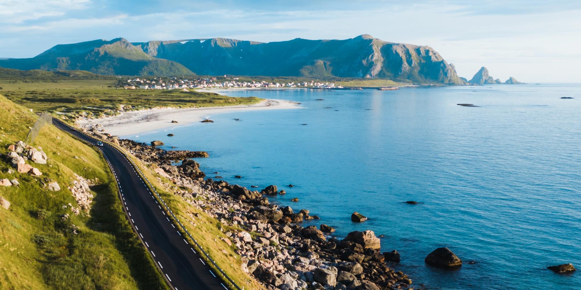 8 Days ・ June - AugustBook now
Arctic coast cycling
Bicycle tour in the Land of the Midnight SunDiscover the dramatic Arctic coast, sandy beaches, and traditional fishing villages. A self-guided bicycle tour from Tromsø to Svolvær in Northern Norway - a paradise for those who want a real bicycle adventure. / Discover NorwayPrix Du 17 000 NOK 8 Days ・ June - SeptemberBook now
Bike the Lofoten Islands
Stunning nature and picturesque villagesSelf-guided tour from Svolvær to Reine. Includes accommodation, meals, luggage transfer, a boat transfer, and more. A cycling vacation in Lofoten is a once-in-a-lifetime experience! / Discover NorwayPrix Du 19 550 NOK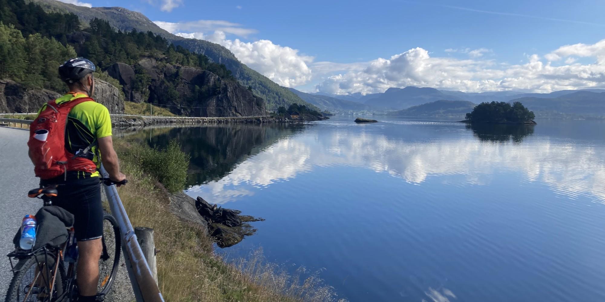 6 Days ・ June - SeptemberBook now
Bike tour south of Bergen
Fjords and coastal landscapesSelf-guided roundtrip from Bergen. Beautiful surroundings and delicious culinary experiences. Includes express boat, accommodation, meals, luggage transfer and more. / Discover NorwayPrix Du 15 750 NOK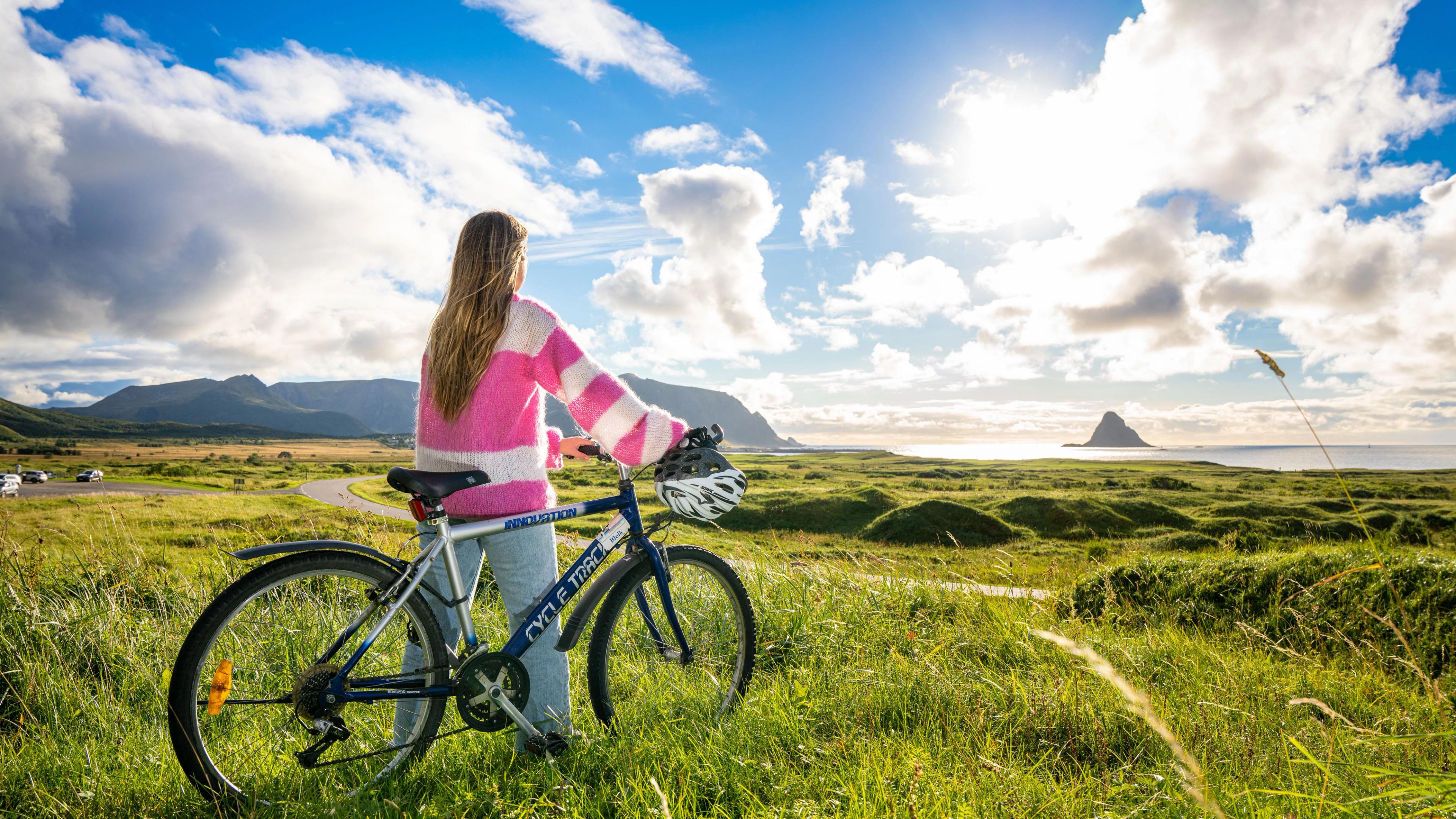 8 Days ・ June - AugustBook now
Vesterålen – a hidden gem
Bicycle tour of the archipelago north of LofotenRelax and enjoy quiet nature as you bike through varied, beautiful and exciting landscapes. A self-guided tour along stunning fjords and sea, impressive mountain peaks, colourful wetland, and lush cultural landscapes. / Discover NorwayPrix Du 17 350 NOK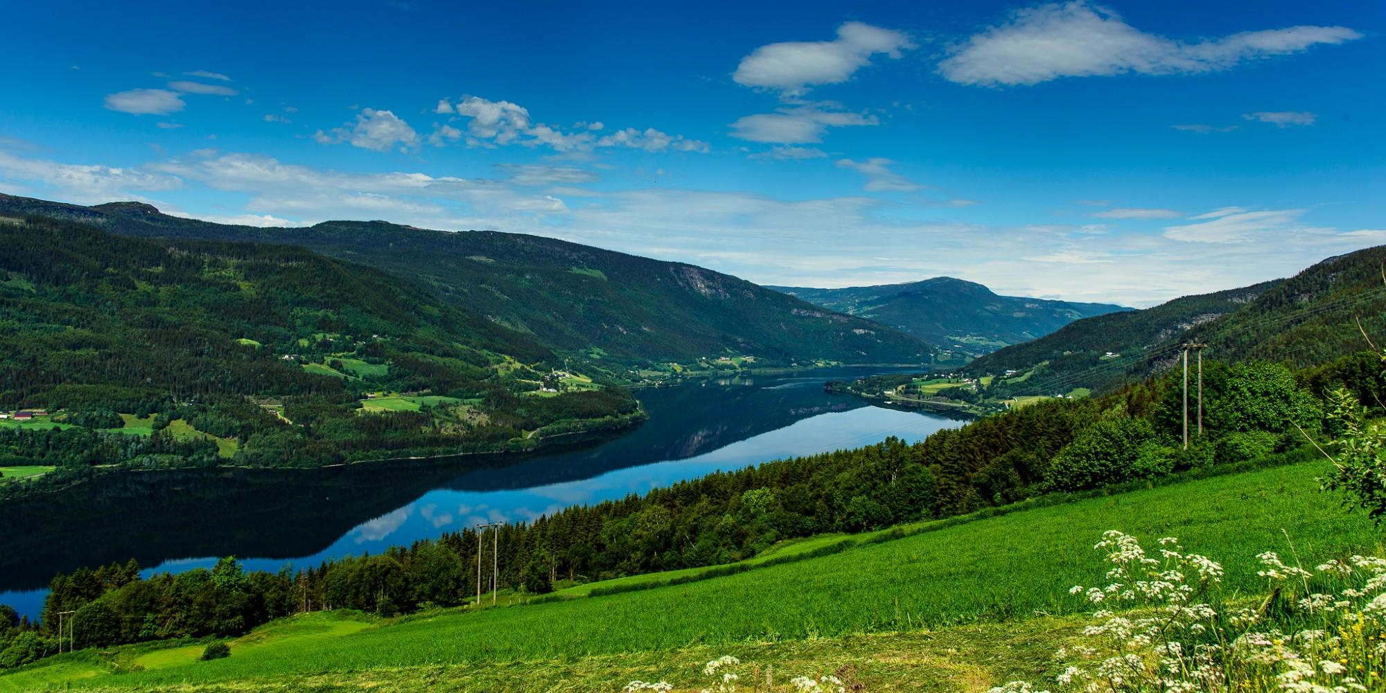 7 Days ・ June - AugustBook now
Mountains and valleys in Gudbrandsdalen
Discover the Gudbrandsdalen valleySelf-guided bicycle tour in the mountains north of Lillehammer. Ride through ancient cultural landscapes in the kingdom of Peer Gynt, with incredible views of some of the tallest mountains in Norway. / Discover NorwayPrix Du 13 850 NOK 6+ Days ・ June - SeptemberBook now
Oslo & fjord adventure
Oslo, Bergen, downhill biking & fjord safari.Norway activity tour including Oslo, the Norwegian fjord region, Voss, and Bergen. Experience activities like cycling, fjord safaris by RIB boat, and spectacular train journeys. / Authentic ScandinaviaPrix Du 12 510 NOK