Traversez des paysages historiques parsemés de fermes de montagne estivales et profitez de la vue en franchissant le deuxième plus haut col de Norvège. Le cadre de cette route panoramique constitue le point de départ idéal pour des randonnées dans les montagnes de Jotunheimen, où vous pourrez déguster des plats traditionnels de montagne dans des lieux pittoresques.
Route panoramique
de Valdresflye
Roulez à travers une nature spectaculaire
au-dessus de la limite des arbres
La route panoramique norvégienne de Valdresflye, l'une des 18 routes panoramiques norvégiennes, traverse le plateau montagneux et offre une vue imprenable sur le parc national de Jotunheimen.
Une route panoramique à travers Valdresflye
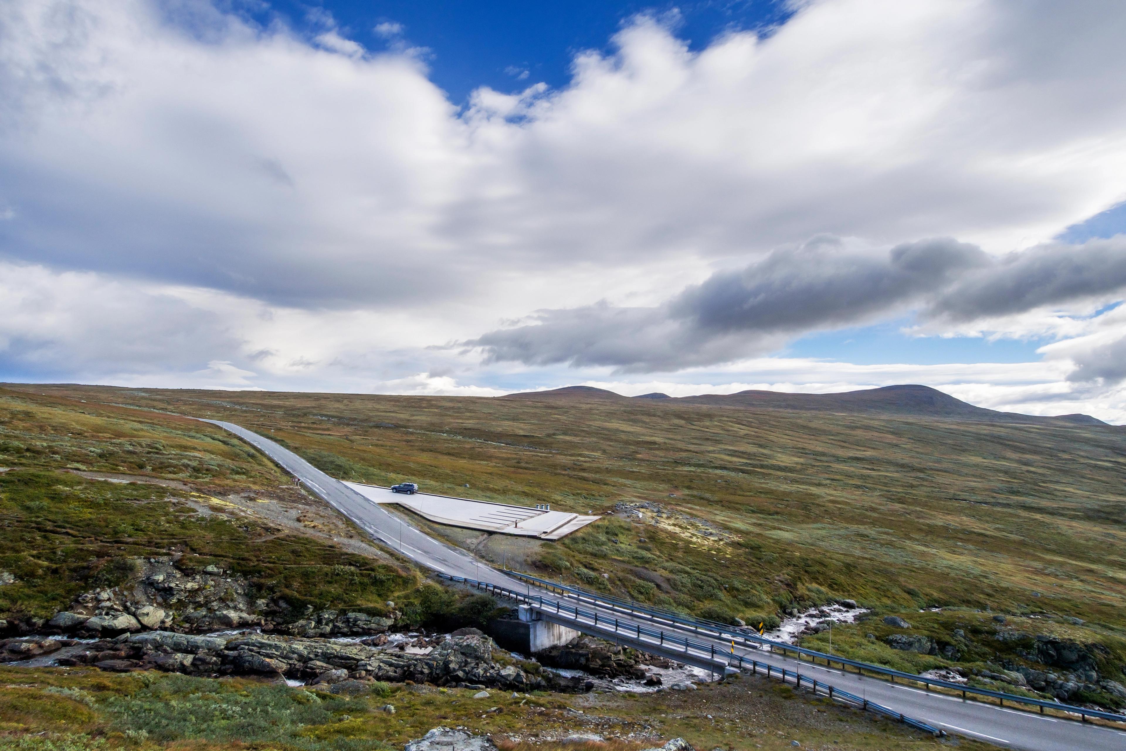
Cette route incroyable vous emmène sur 49 kilomètres à travers Valdresflye, entre Garli (près de Beitostølen à Valdres) et Besstrondsæter à Vågå.
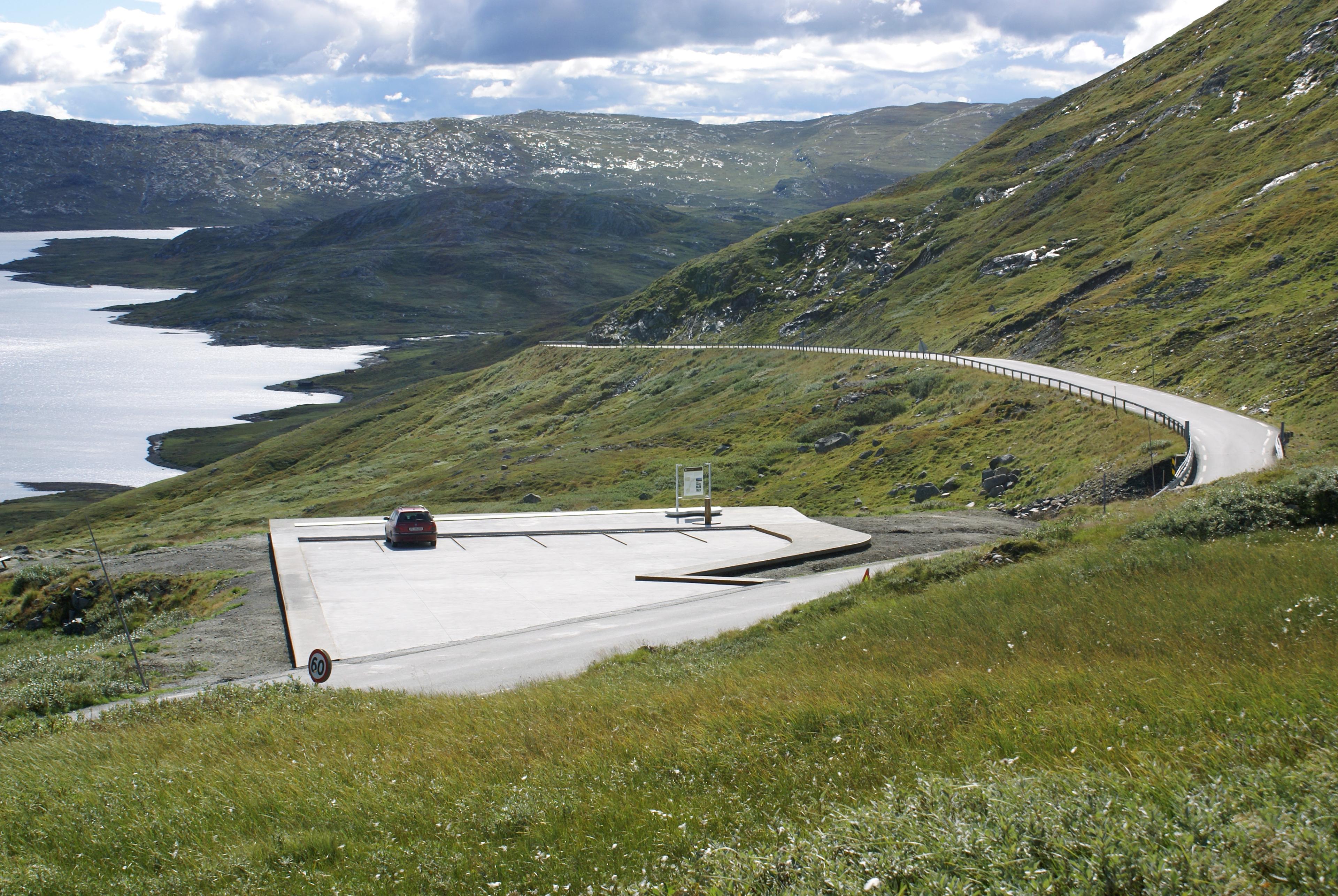
Le point culminant de la route, à 1389 mètres d'altitude, offre une vue fantastique sur les montagnes, et plusieurs points de vue vous permettent de faire une pause en cours de route.
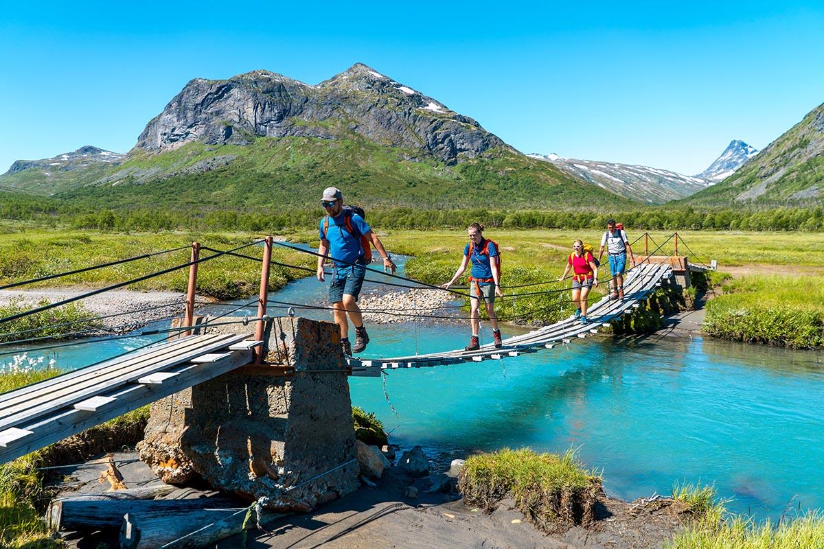
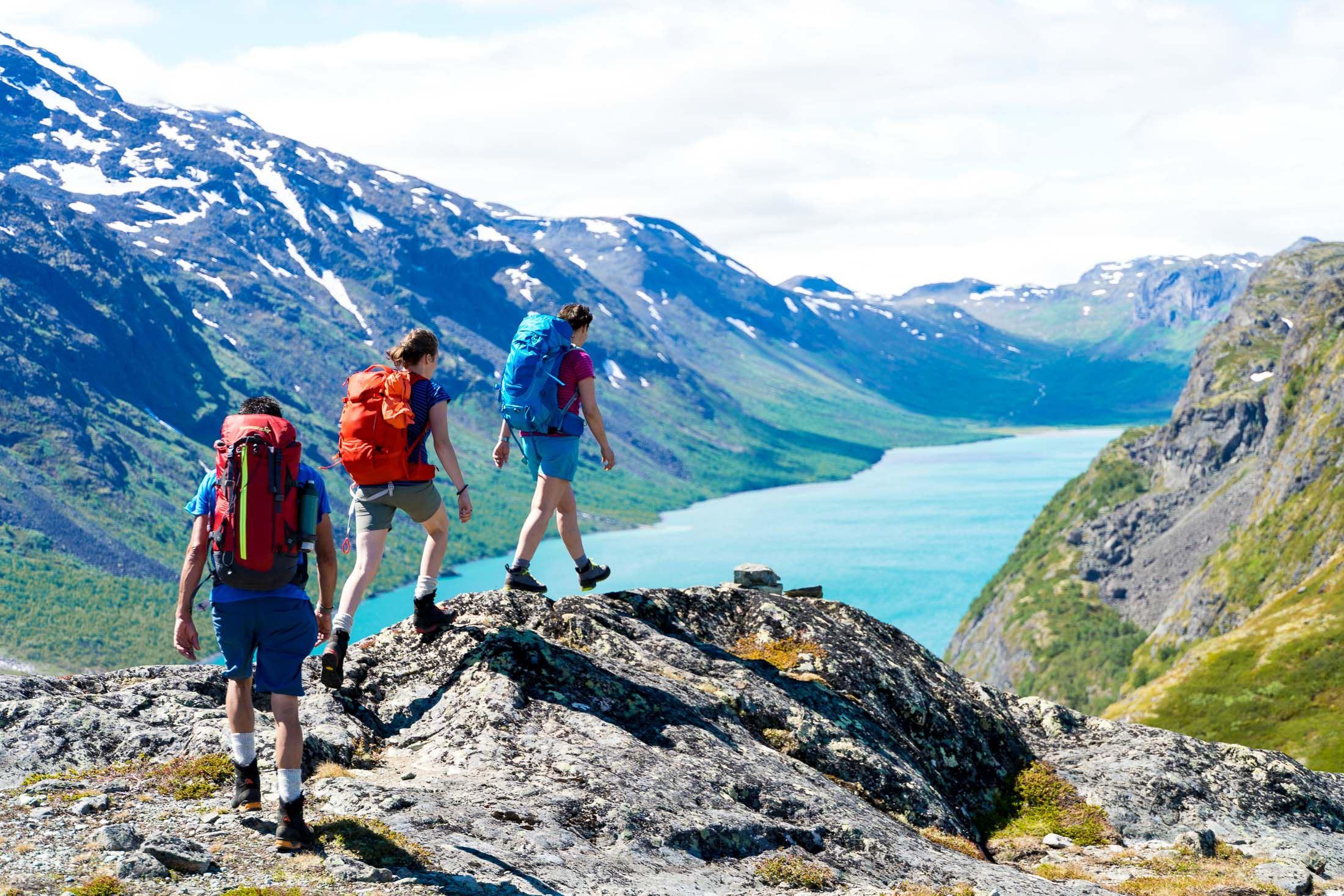
Elle vous mènera également à Gjende, où se trouve le point de départ de la randonnée Besseggen.
Notez que la route est généralement ouverte du début avril à la mi-novembre, en fonction des conditions météorologiques et d'enneigement. Le tronçon entre Vågå et Gjendesheim, dans la partie nord de l'itinéraire, est ouvert toute l'année.
Remarque : l'utilisation de vélos électriques (peu importe que le moteur fonctionne ou non) est interdite dans la nature, de même que sur tous les sentiers de randonnée et chemins qui la traversent. Cette interdiction a été introduite afin de protéger la faune sauvage vulnérable, la flore et les autres utilisateurs des sentiers. Il est toutefois autorisé de pédaler sur les pistes cyclables, comme la très populaire Mjølkevegen. Veuillez vous renseigner auprès de l'office de tourisme local avant de partir.
En voiture : Si vous partez d'Oslo ou de Bergen, vous pouvez suivre la route E16 jusqu'à Beitostølen et Garli. Depuis Trondheim, suivez la route E6. Vous pouvez planifier votre itinéraire, trouver des alertes trafic et plus encore sur Statens Vegvesen.
En transport public : Le bus Valdresekspressen circule tous les jours, toute l'année, entre Oslo, Fagernes et Beitostølen. Pendant l'été, l'itinéraire est prolongé avec des départs supplémentaires vers Gjendesheim. La saison s'étend du 7 juin au 6 octobre.
Vous pouvez réserver vos billets avec Norwegian, Widerøe, ou SAS.
Suivons l'itinéraire du sud au nord !
Mais avant de commencer votre route panoramique depuis Beitostølen, vous pourrez d'abord profiter du trajet à travers la luxuriante région de Valdres.
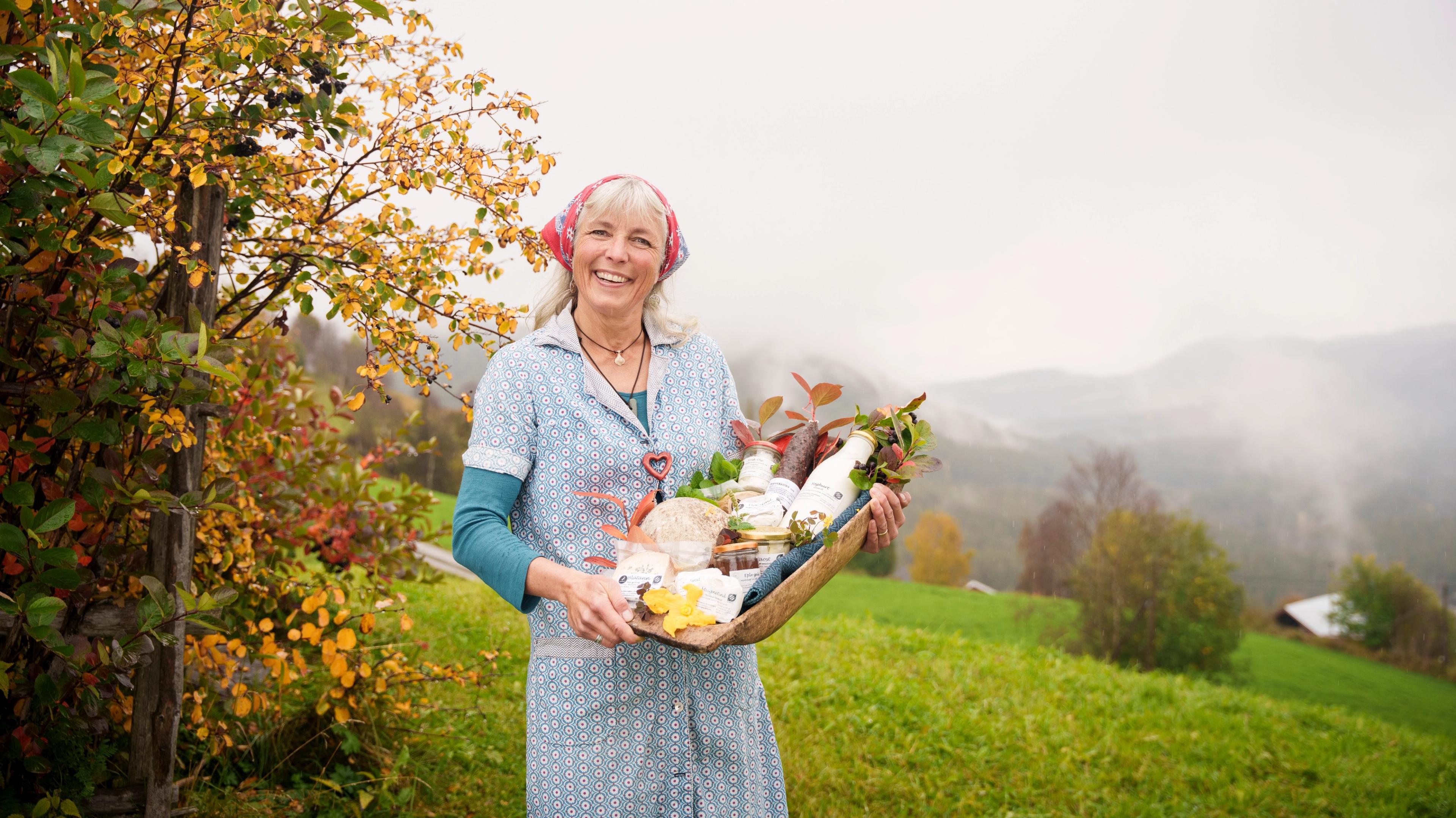
Aucune autre région d'Europe du Nord ne compte autant d’estives en activité que la région de Valdres.
Cela signifie qu'il y a de nombreux cafés et magasins fermiers, ainsi que des hébergements confortables où vous pourrez goûter à la vie montagnarde.
Ne manquez pas de goûter la spécialité locale, le kurv, une saucisse séchée qui constitue un en-cas salé idéal.
Suivez la route départementale 51 jusqu'à Beitostølen.
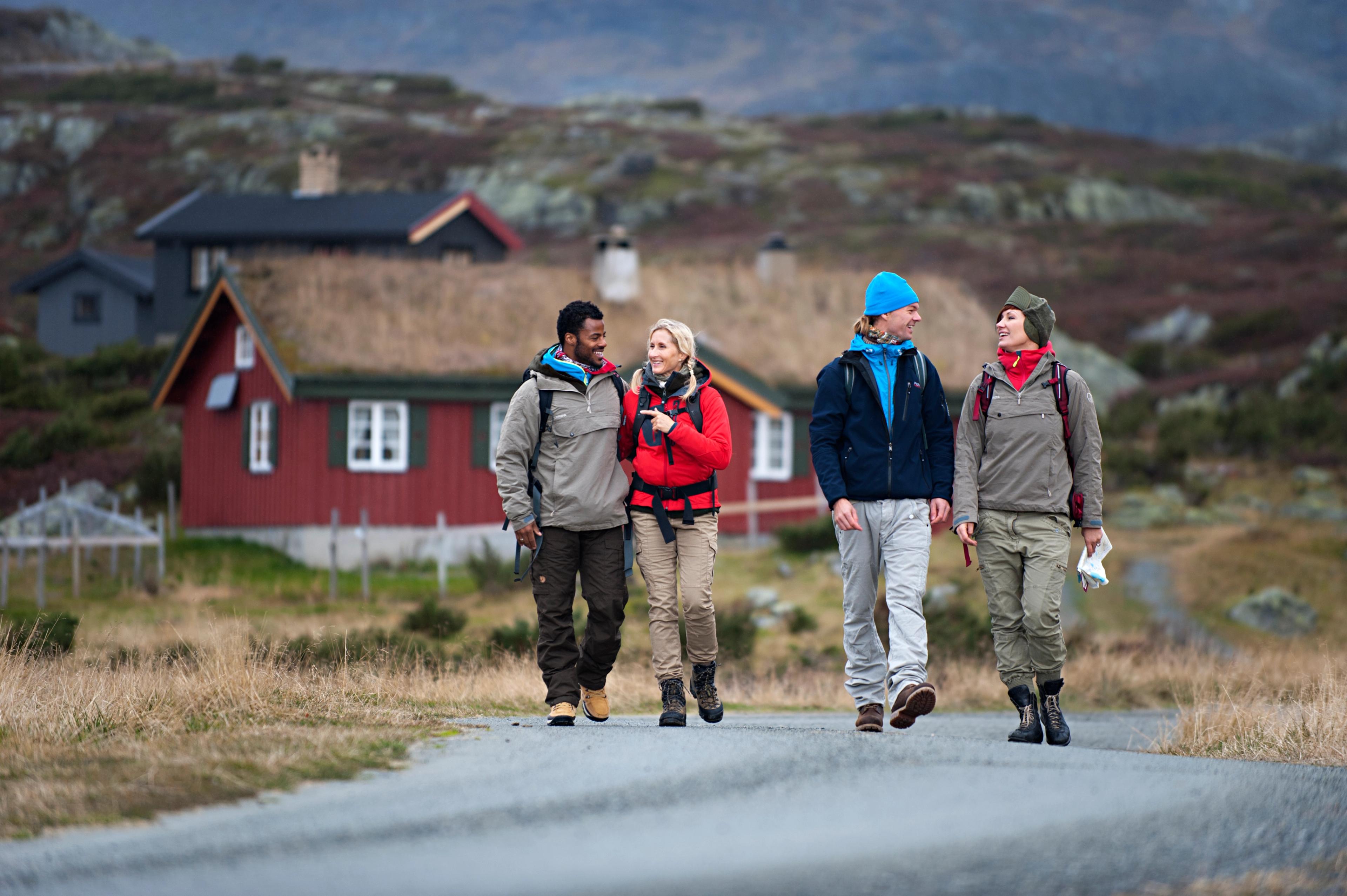
Cette région est un paradis pour les activités tout au long de l'année et un point de départ idéal pour explorer les grands espaces.
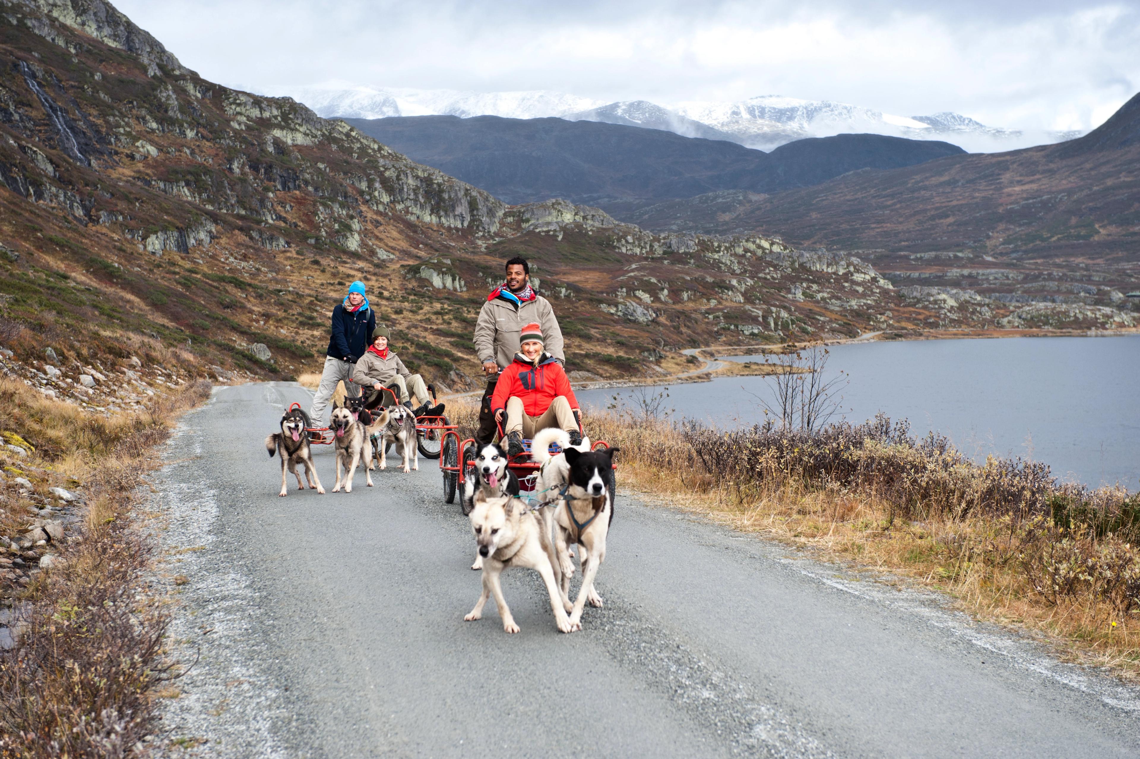
Faites du traîneau à chiens sur roues, essayez l'escalade et explorez les nombreux itinéraires cyclables et pédestres pittoresques, pour ne citer que quelques exemples !
Il existe également de nombreux hôtels, chalets et terrains de camping où vous pouvez séjourner.
Hébergements
Trouvez un hôtel ou un chalet près de Beitostølen, point de départ de la route panoramique au sud.
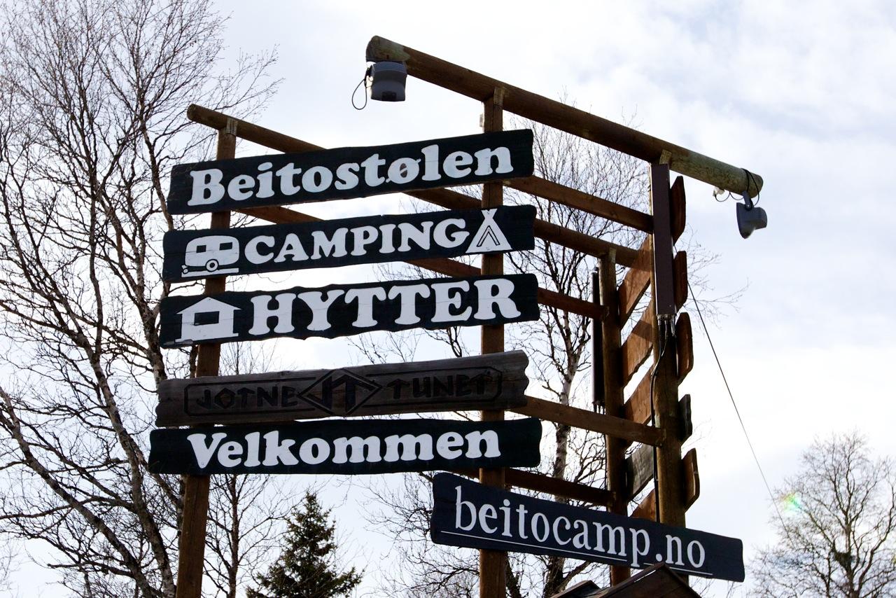
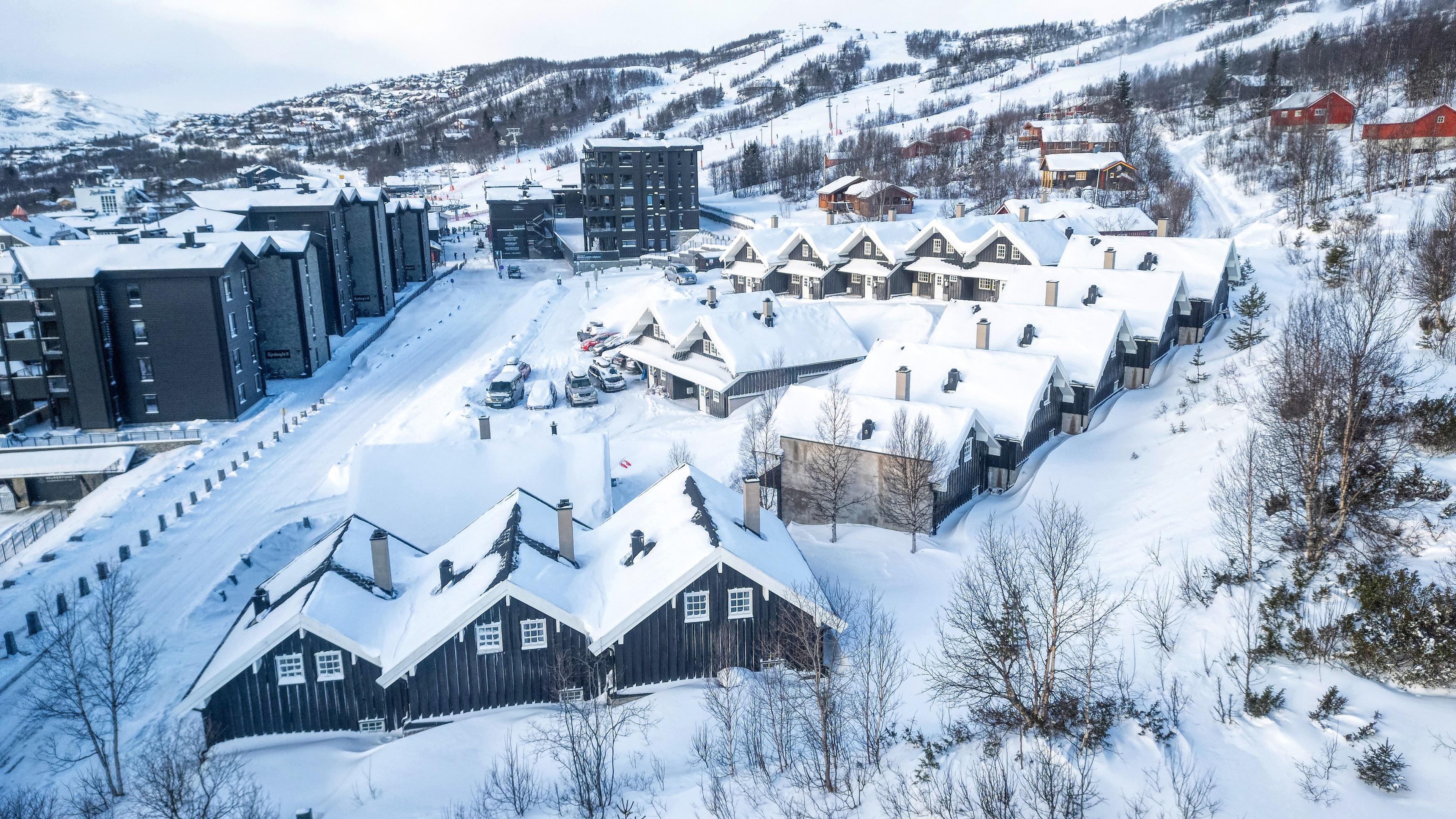
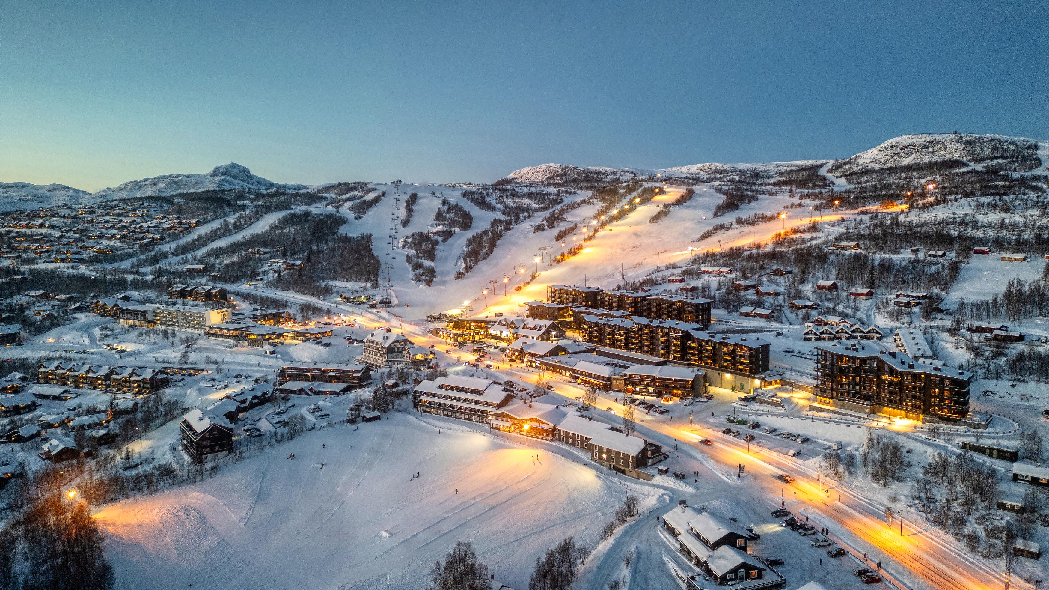 Beitostølen
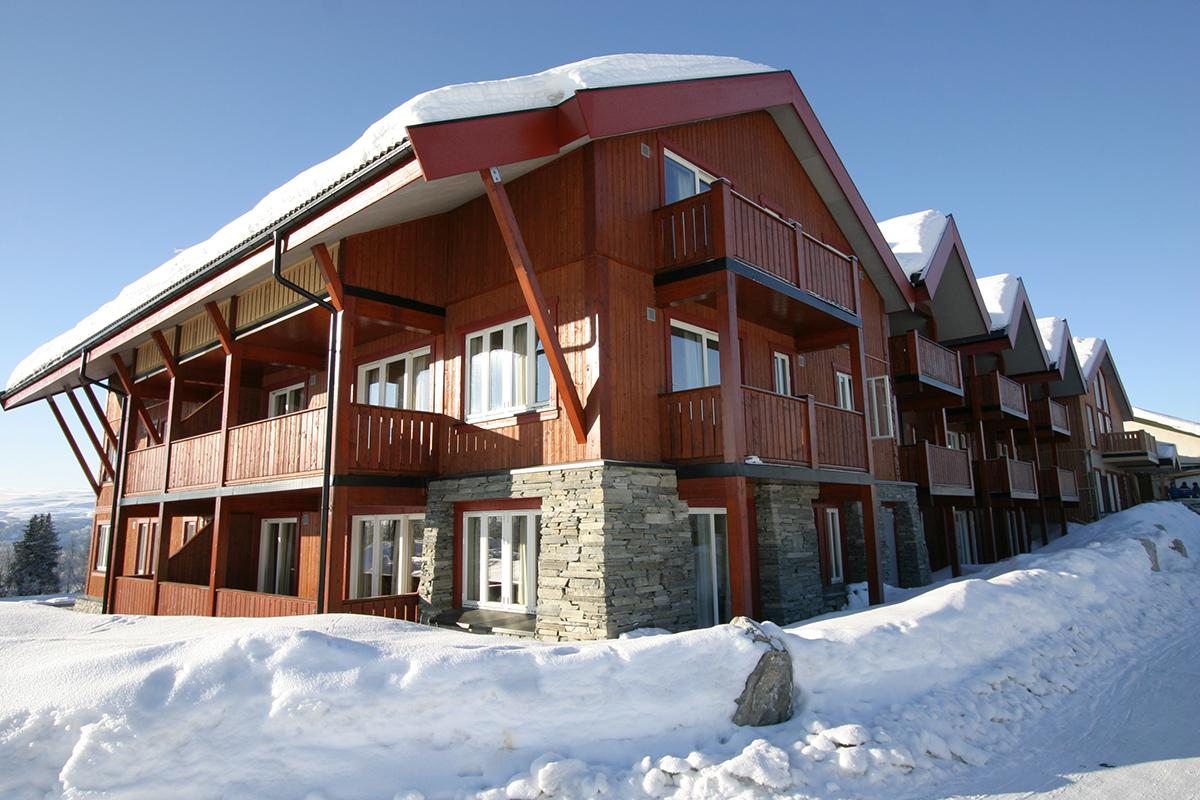
Ridder Apartments
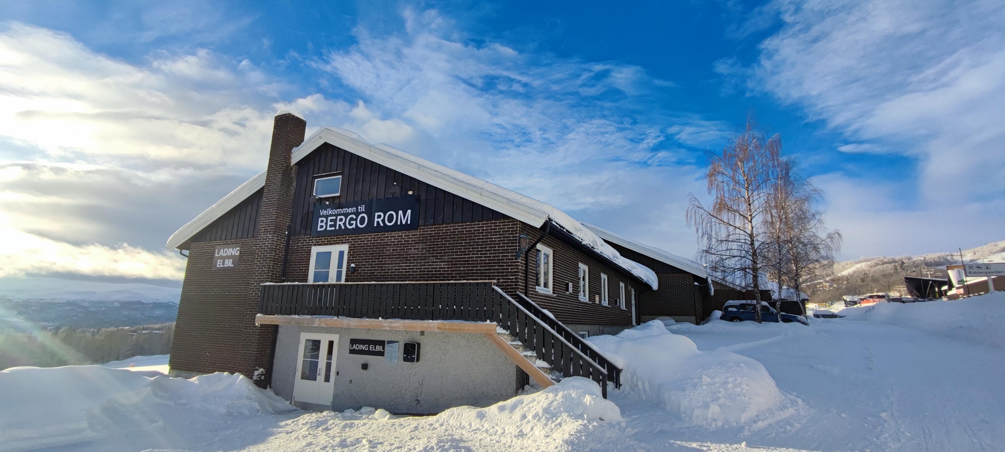
Our RIDDER APARTMENTS are stylish and practical new apartments, part of the iconic skyline of rooftops leading up toward the ski area and Knausen. Living here means being close to everything, right at the base of the ski slopes. In winter, you have ski-in/ski-out access, and you live comfortably near the square and the vibrant heart of Beitostølen. RIDDER APARTMENTS In our Ridder buildings, you’ll find modern apartments accommodating – 2 to 6 guests – ranging from 40m² to 90m². (You’ll get detailed information about the different layouts and options in the next step.) All apartments feature a well-equipped kitchen — with a dishwasher as standard — a cozy dining area, living room, and balcony or ground-floor terrace. There is free Wi-Fi in all units and underground parking with elevator access to all floors. Beitostølen offers extensive charging facilities for electric cars, including several close to the Ridder apartments. If you’re arriving by bus, the stop is just across the street from the town square — only a snowball’s throw away from the Ridder Apartments. The Ridder Apartments are located along Skjenhauglie 37, 38, 39, 40, 43, and 44. Information about your specific building number can be found in your booking confirmation. Several of the apartments are pet-friendly (dogs allowed for an additional fee). Please let us know in advance if you plan to bring your dog.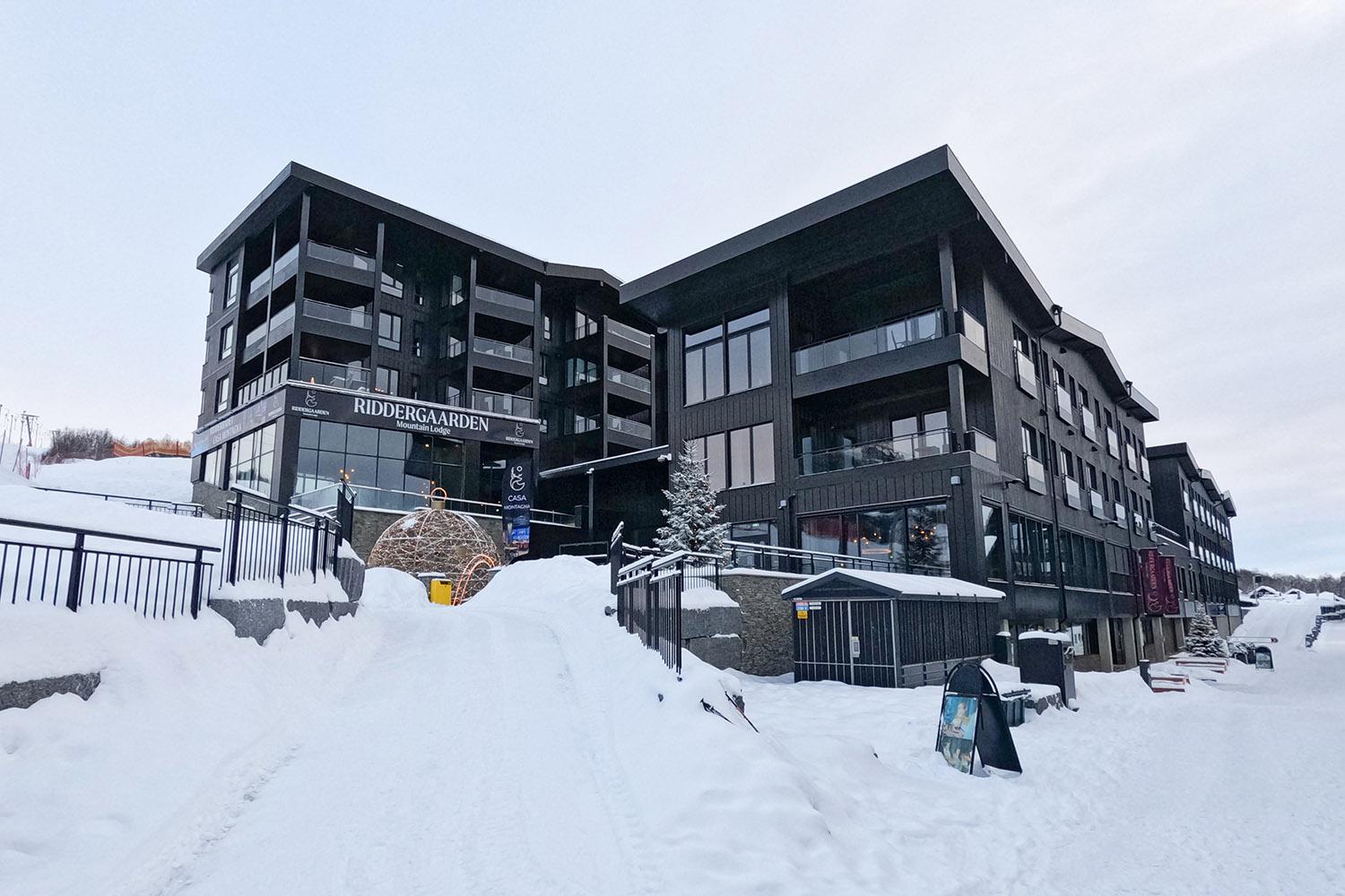 Beitostølen
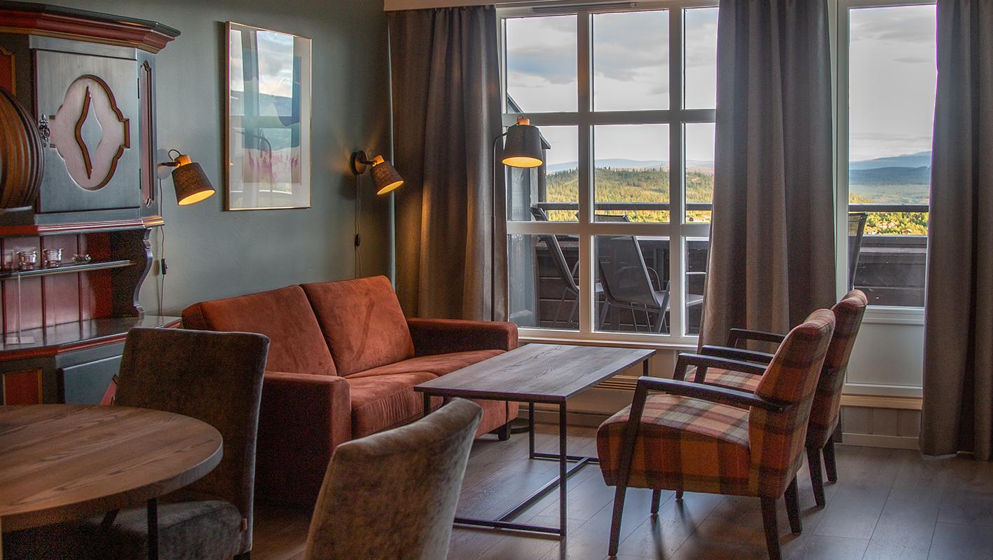
Riddergaarden Mountain Lodge
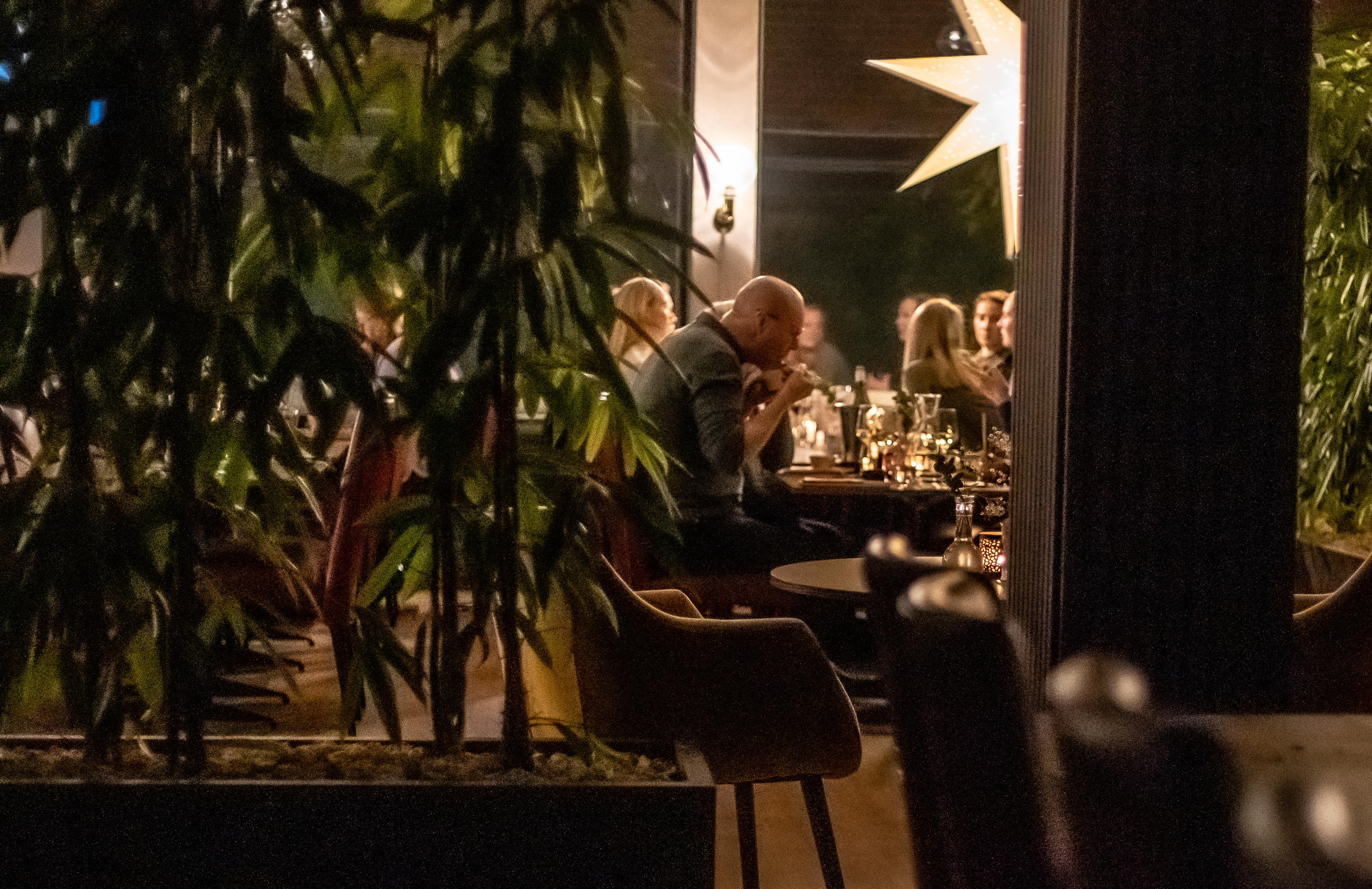
Riddergaarden Mountain Lodge – comfort in the heart of Beitostølen You have been searching for the perfect place to spend a holiday in the mountains? At Riddergaarden Mountain Lodge you will find everything you need – and then some. Here, at the foot of the alpine skiing slope and surrounded by scenic mountains, you can find a modern apartment hotel that blends comfort, nature experiences and wellness blend into an exquisit experience. During winter, you can acees the adjacent alpine slopes directly with ski in/ski out, while hiking paths and the Beitostølen Trail Arena invite to enjoy the fresh air during the summer season. Riddergaarden is the perfect place to recharge at all seasons. Treat yourself to a swim at Ridderbadet, our exclusive wellness department with with swim-in & swim-out all year. Enjoy a warm jaccuzzi under the sun or the stars even in mid-winter, a quiet moment in the sauna. Children have their own pool to play and have fun. Please remember to prebook your slot. Enjoy continental breakfast, lunch and dinner with homemade pasta, real stonebaked pizza and homemade ice cream at our Italy-inspired restaurant Casa Montagna. Riddergaarden Mountain Lodge is more than a place to sleep. It is an experience for your senses that combines relaxation, activities, tastes and wellness, all in one place.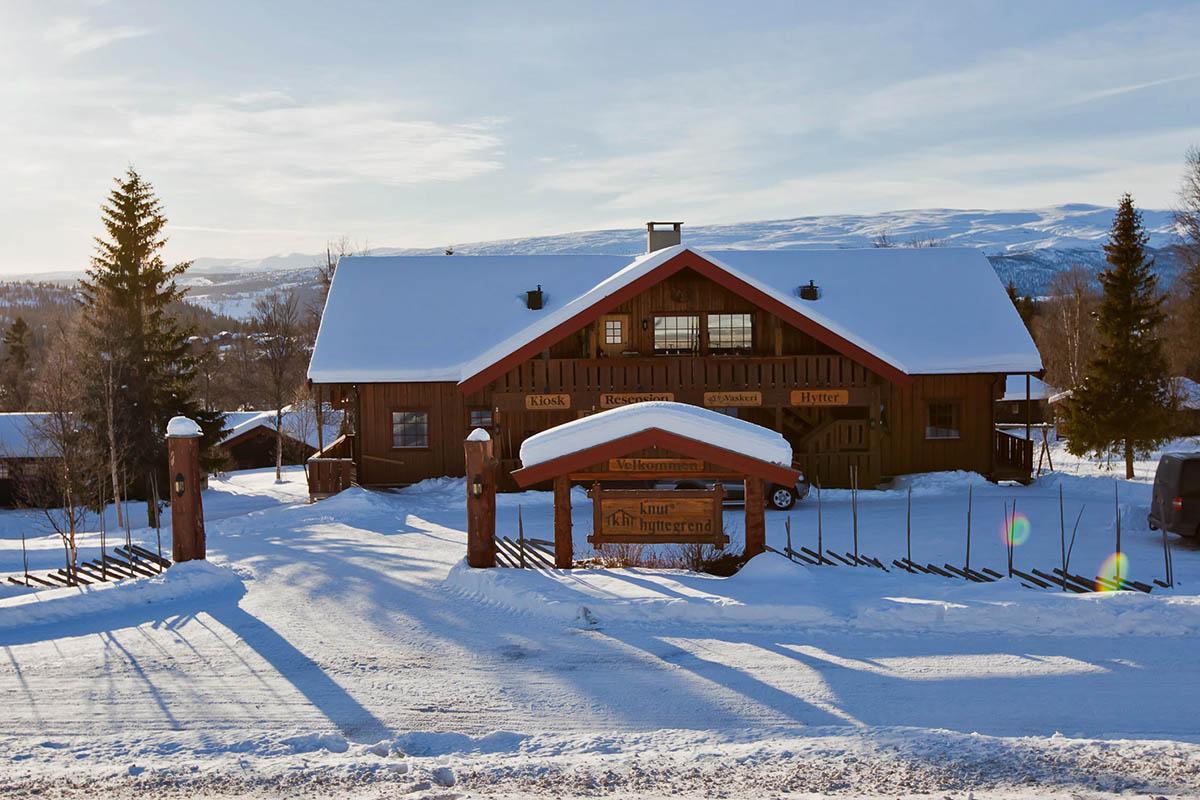 RéserverBeitostølen
Knuts Hyttegrend
The family-run Knuts Hyttegrend is just 650 metres from the slopes of Beitostølen Ski Resort and 40 minutes' drive from Fagernes. It offers modern, spacious apartments and cottages with free Wi-Fi. All accommodation options at Knuts Hyttegrend feature private bathrooms and living rooms with a TV, CD player and fireplace. Kitchen facilities include a tea and coffee maker and refrigerator. A communal laundry room is located nearby in the main building. Relaxation options include terraces, while the large grounds offer plenty of space for kids to run around in. In summer, fishing and hiking are popular activities in the area. Downhill and cross-country skiing can be enjoyed during winter months. A supermarket is 200 metres away.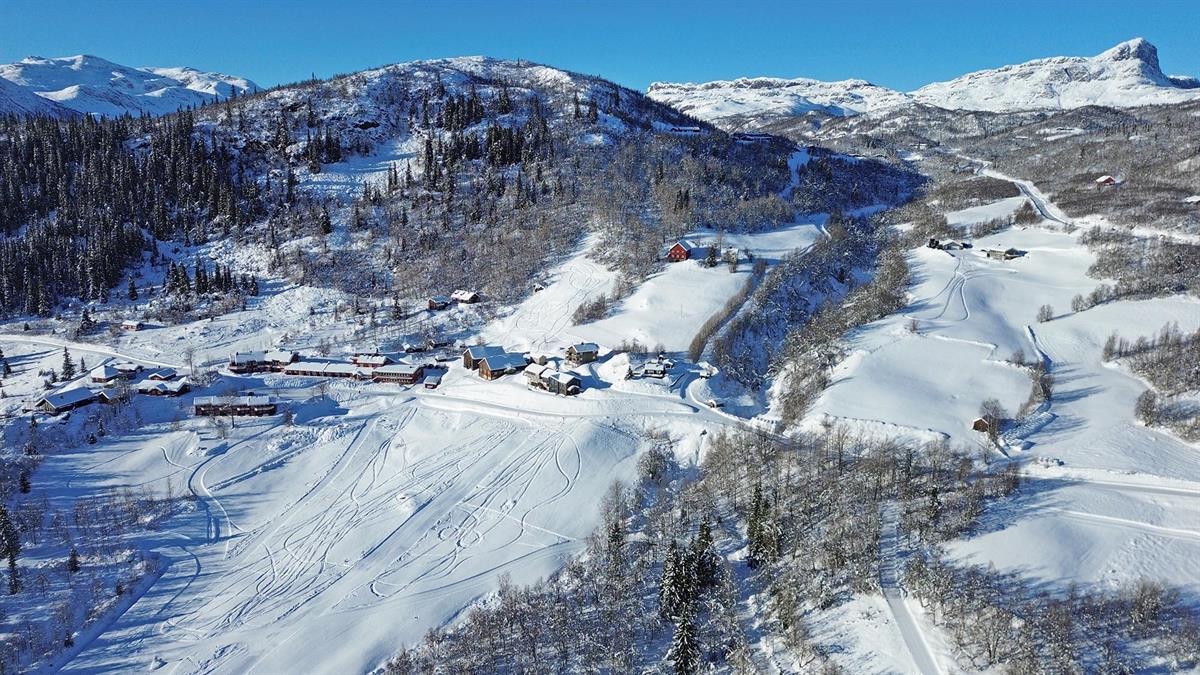 RéserverBeito
Grønolen Fjellgard
Grønolen Fjellgård is located 800 metres above sea level, surrounded by mountains and open highland landscapes. We have a wellness area with a counter-current pool, hot tub, sauna, and fitness room, and are well-known for our delicious, homemade food. In total, our Mountain Lodge sleeps 110 guests in 22 family, single and double rooms, all with private bathroom facilities. We also have 12 comfortable apartments. Grønolen Fjellgård offers a good standard, attentive service, and a rural style rooted in local traditions. The lodge is decorated with work by local artists, creating an atmosphere that is both distinctive and welcoming. Guests can expect a warm and personal hospitality. From our sheltered surroundings, guests can look out over the beautiful Lake Øyangen and experience the varied mountain landscape. Grønolen Fjellgård is located along the Mjølkevegen cycling route and is a Mjølkevegen Partner. Courses and conferences At Grønolen Fjellgård, you and your colleagues can work in a calm setting, combined with opportunities for a range of on-site activities which makes stays both focused and refreshing. In winter, cross-country ski trails start just outside the door, making it possible to head straight onto the tracks after lunch, or take a short mountain walk before dinner during summer. Grønolen Fjellgård is a pleasant venue with a good standard and a recently upgraded and expanded meeting room accommodating up to 45 participants. Our experience is that groups benefit from having the entire lodge to themselves, which contributes to both strong professional outcomes and a cohesive stay.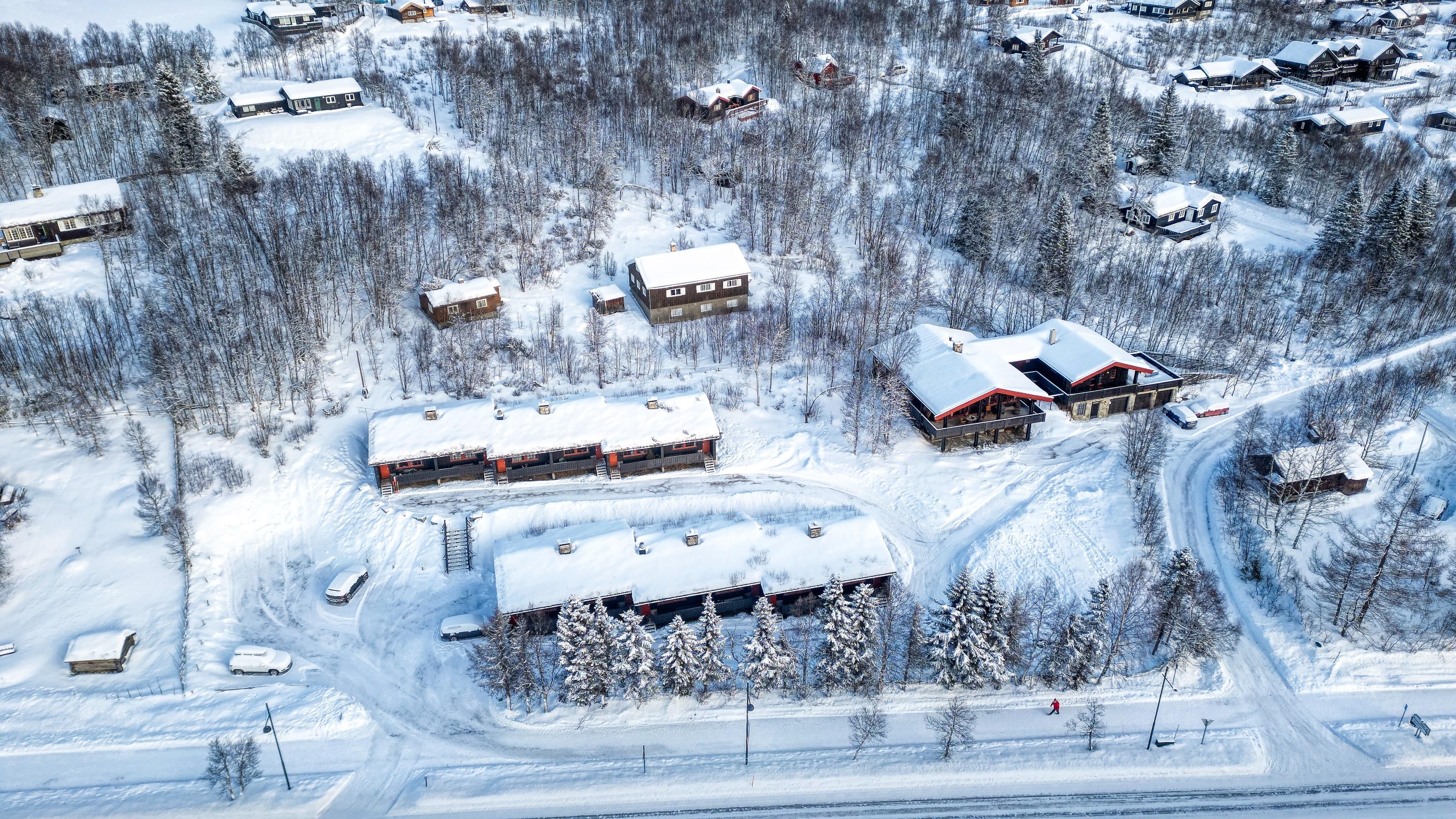 RéserverBeitostølen
Hovi Hytter
12 semi-detached traditional cabins, 50sq.m, situated close to the centre of Beitostølen. The cabins sleep six people, one double bedroom and one with two bunk beds. The cabins have a living area with cable TV, fully equipped kitchen area with a breakfast table and an outdoor patio. Booking and check-in at Beito Resort Hotel

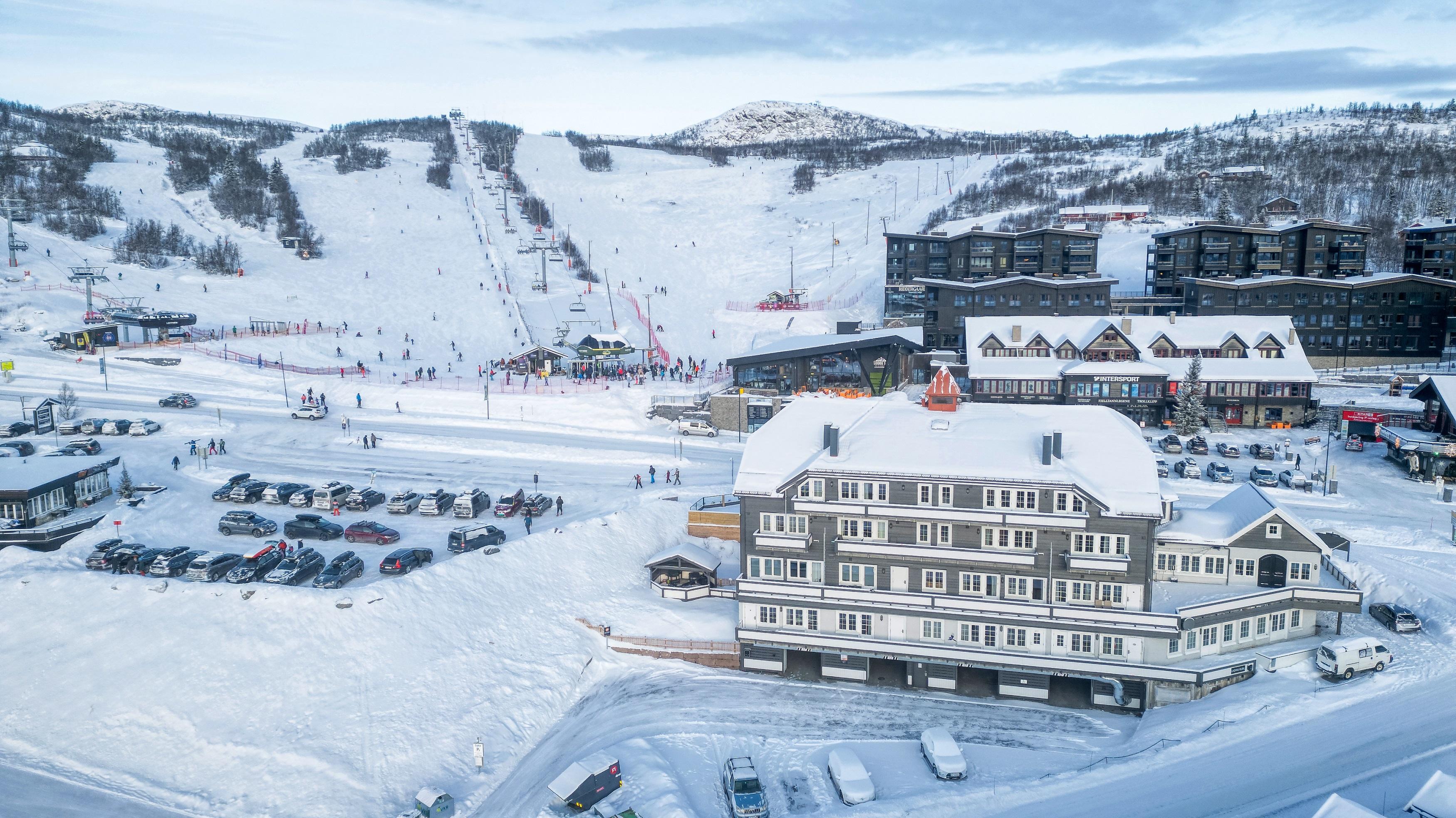
Activités près de Beitostølen
Utilisez la région comme base pour d'autres aventures !
 RéserverBeitostølen
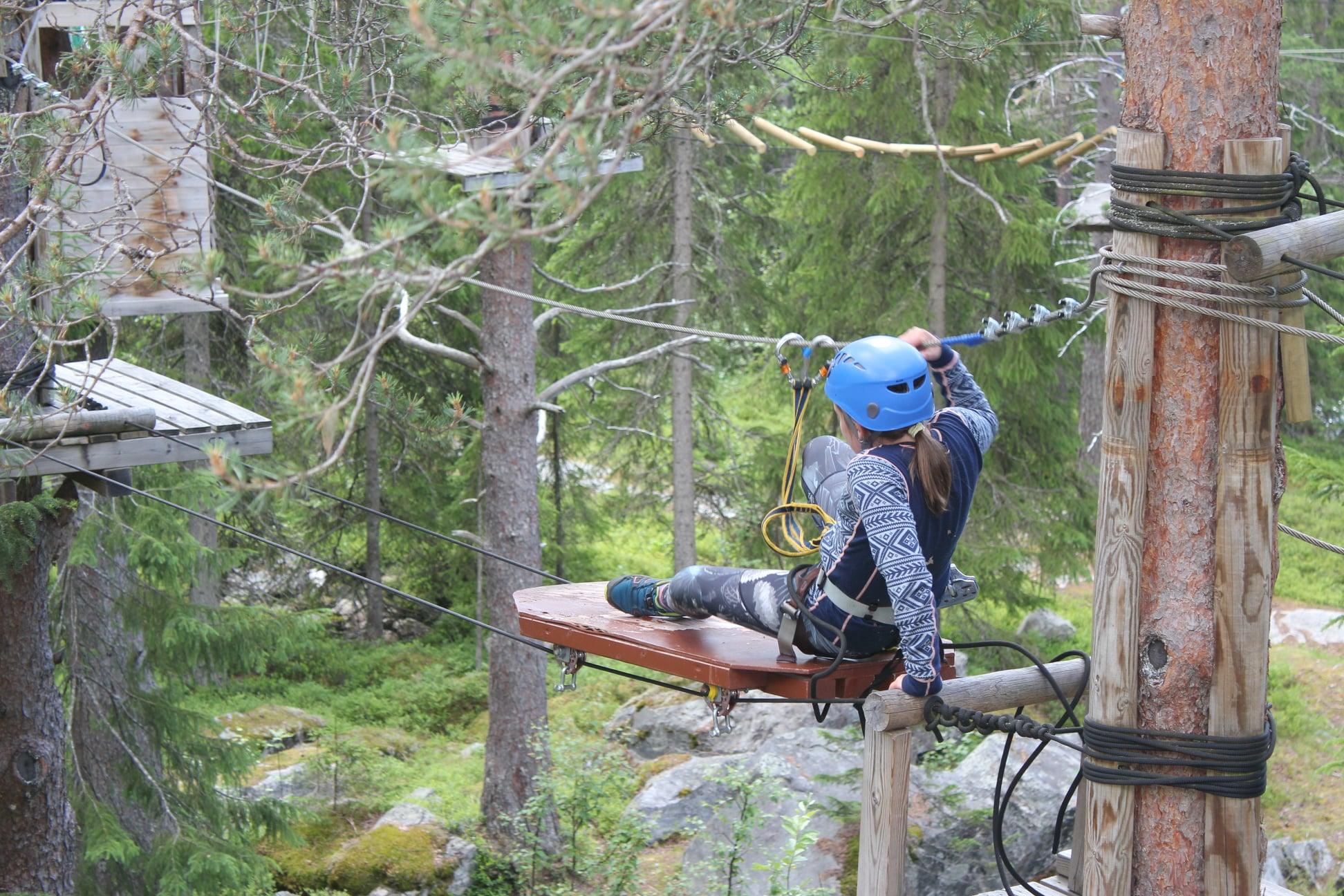
Beito's High Rope Course
Beito High Ropes Course is located in scenic surroundings in the Beito forest, a few kilometres from Beitostølen. There are three different trails marked green, red and black. The black trail is the most challenging of the three trails. On warm summer days, after finishing the course, a swim in the lake might be tempting. The park is located on private property and need to be prebooked. The park is open during spring, summer and autumn. User must be at least 10 years of age and have a minimum height of 130 cm. The maximum weight is 100 kg. We also have a climbing park for the youngest children from 4 years old and 105cm, max 30 kg. Please read more about that here. On rainy days a waterproof jacket is highly recommended. During thunderstorms, the park can be closed on short notice until the weather passes. Click here for more information.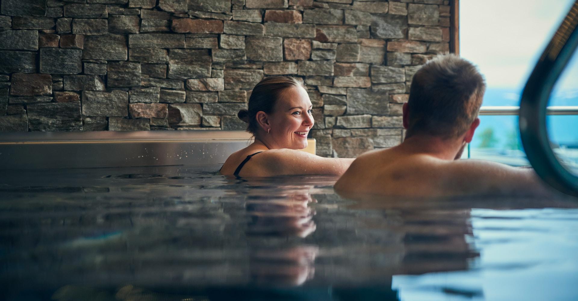 Beitostølen
Ridderbadet
Ridderbadet – Wellness in the mountains for the whole family A visit at Ridderbadet makes your stay at Beitostølen complete – a modern and inviting wellness centre where body and sould can replenish and adults and children can experience water fun and relax in pleasant surroundings with a spectacular mountain view. Swim out into the fresh mountain air in our spacious indoor and outdoor pool – a rare combination of nature and comfort. The ultimate relaxation is to immerse yourself in the outdoor jaccuzzi, where warm steam and quiteness hug you with healing calm. Let the day's experiences sink in in the sauna, whith the heat's healthy and calming impact. Or treat yourself to exclusive skin and hair care products from BABOR and ELM to take the wellness feeling home. Children have their own little paradise – vår children's department has two pools with a waterfall and fountains, water play and fun. Hungry after swimming? Our bar is open throuout the opening hours of the pool area, and you can also order food from our restaurant Casa Montagna, which can tempt with hommade Italian dishes. Ridderbadet is the place where the whole family can relax and enjoy the mountains – in- and outside.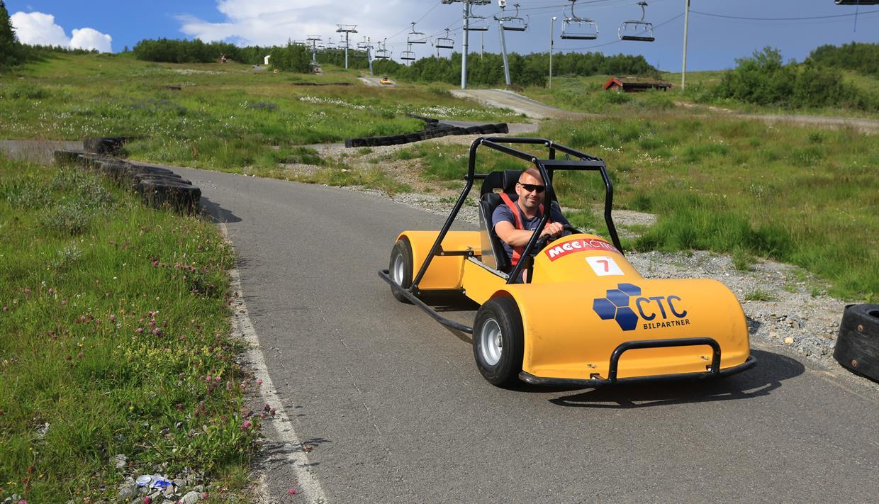 Beitostølen
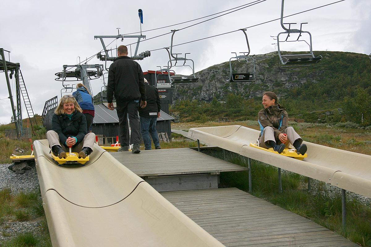
Beitostølen Summer Park
Beitostølen Summer Park - Activity park for the whole family The summer park is located in the bottom of the ski center at Beitostølen. Here you will find exciting activities for the whole family all summer and throughout autumn. The activities you will find are - Hopping pillow - Downhill carting track (Olabil - course) - Kiddy Bumper Boats - Gyrotrampolines - Bouncy castle - Chair lift - for bikes, hiking or the trip itself Activities that don't require a ticket are - Balance line - Sandbox - Swing - Climbing net (new 2023) - Giant chess At Beitostølen Stadium (approx. 1 km south of the town centre) you can find a Frisbee golf / Discgolf couse and a pump track. Klikk her for mer informasjon om priser og åpningstider.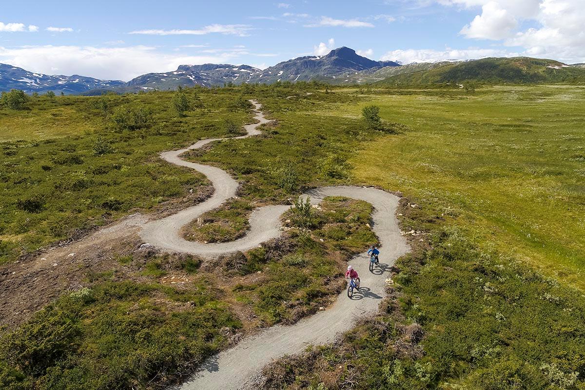 Beitostølen
Beitostølen Trail Arena
Welcome to the Beitostølen Trail Arena, Norway’s new trail cycling destination! At Beitostølen Trail Arena cyclists find challenges on natural trails and family friendly cycling on built trails in the mountains around Beitostølen. The view towards the mountain top Bitihorn, Beitostølen's landmark, is unique. You might actually be cycling the country’s most beautiful trails. Beitostølen Trail Arena builds new cycling trails and improves existing ones. Our goal is that cyclists easily can find their way around, having a great cycling experience and lots of fun on the trails. Our main focus is aimed at family friendly trails of green and blue difficulty where you can challenge yourself with berms, rollers, bridges and small jumps. Until now a green trail of 3.4 km length has been built that stretches around Garlimyra and connects the parking area at Garli with the top station of the lift at Beitostølen ski center and the Nørre Knausen mountain top. The trail is cycled counterclockwise and can easily be reached from the parking area at Garli or the top station of the lift. It can also be used by terrain wheelchairs. All built trails are and will be based on the principles of sustainable cycling trails. Have fun, watch out for each other and follow the conduct of trails.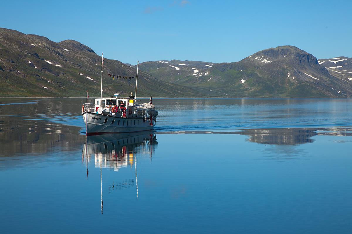 Beitostølen
Mjølkevegen round trip from Beitostølen (95 km)
This is a roud trip in the central part of Mjølkevegen (approx. 95 km) which combines the two route alternatives over Slettefjellet and along Tyin in great scenery. For less experienced cyclists and a more enjoyable ride we recommend to plan for an overnight or even two along the route. You can travel to Beitostølen by bus or car. Our Mjølkevegen partners at Beitostølen are Beito Resort Hotel and Riddergaarden, as well as Grønolen Fjellgard 4 km along the route towards Slettefjellet. When you book, please inform them that you are cycling the Mjølkevegen route. In the small and friendly town of Beitostølen you can enjoy a wide variety of activities, restaurants and shops as well as many hiking and cycling possibilities. From Beitostølen, turn right onto Beitestølevegen and follow the Mjølkevegen signs towards Slettefjellvegen. The ascend to up the Slettefjell mountain pass is spectacular although challenging - a climb of approx. 500 meters to the top at 1315 masl. The view in clear weather, though, is stunning and very rewarding, both behind you towards Jotunheimen and ahead of you towards Vang. The following descent is even steeper, so watch out and take care! We recommend a stop and a 15 min. walk to the Sputrefossen waterfallon the right side of the road, before you reach Slettefjellkiosken, a good place for refuelling - for both riders and bike batteries! ___ For an overnight in this area, from Slettefjellkiosken it is a 4.5 km sidetrip down into the valley floor (240 m elevation) to Rogn Camping, a Mjølkevegen partner. ___ At Slettefjellkiosken, turn right and follow Liagardsvegen and Vennisvegen along Lake Vangsmjøse towards Øye. At the end of the lake you start the climb up to Tyinkrysset, either by following the main road E16 or - our recommended choice - choosing the historical Kongevegen (King's Road) between Øye and Tyinkrysset. On the first, watch out for traffic, on the second, you might have to walk your bike along some trail sections in the upper parts before Tyinkrysset. The signage follows Kongevegen. At Tyinkrysset you can find a grocery store, Intersport store and Tourist Information, where you also can charge your e-bike batteries, either inside the store or outside on the wall next to the garbage containers. Also, there are chargers available for Shimano, Bosch og Yamaha. For a meal or an overnight, Filefjellstuene is a Mjølkevegen partner. From Tyinkrysset, follow the Mjølkevegen signage uphill in the direction of Lake Tyin and then cycle alonside the shoreline in the direction of Eidsbugarden. At Tyinholmen Lodge, a Mjølkevegen partner, you can enjoy a cozy and traditional accommodation and a homemade meal. The natural surroundings are breathtaking, and this is definitely an area to explore more thoroughly, i.e. on a side trip into the Koldedalen Valley! From Eidsbugarden, the historical boat M/B Bitihorn will take you across Lake Bygdin. For info and time schedule: www.jvb.no. Remember to prebook for both riders and bicycles. From Bygdin, it's approx. 12 km back to Beitostølen along road 51 (mind the traffic!).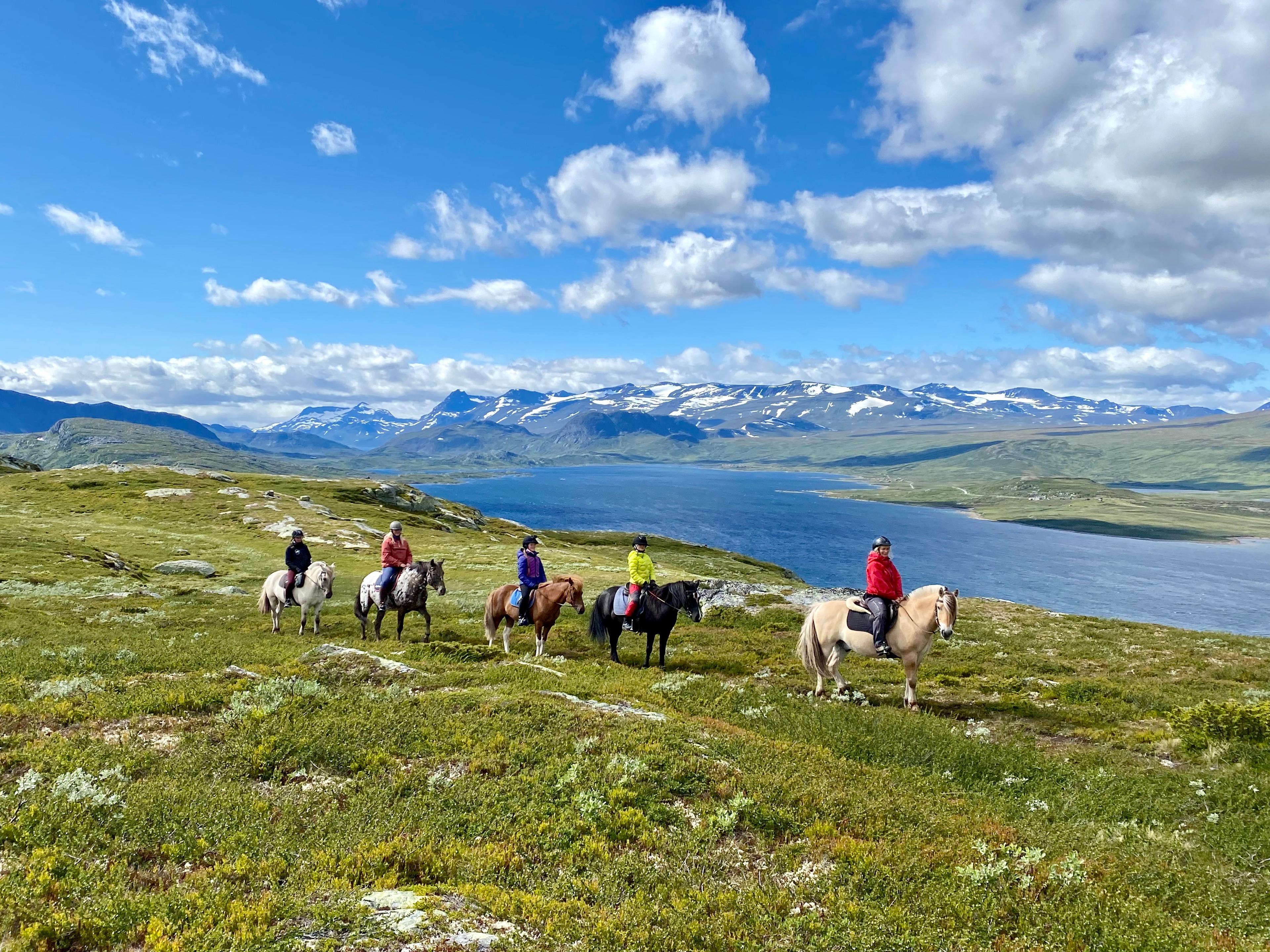 RéserverSkammestein
Myhre Gård
Myhre Gård offers horseback riding trips and farm visits in fantastic mountain scenery close to Beitostølen. Open all year. Horseback riding At the riding centre you can sign up for various classes, horseback riding for people with disabilities, and you can request tailor-made riding activities for larger groups. The length and difficulty can be adjusted to the client's wishes. We ride mostly in the scenic mountain landscape around Beitostølen and in the Langsua National Park. During the school holidays we arrange horseback riding camps for children and youths. During summer you can join us on overnight trips into the mountains to our summer mountain farm. Myhre Gård is a member of the association "Hest i turistnæring" ("Horses in tourism"), which cares for quality and safety. Farm holidays There are other animals at the riding centre, and you can spend a farm holiday at Myhre Gård. Join us with daily chores and caretaking of the various animals, collect your own eggs in the hen's inclosure for breakfast, experience the births of lambs in spring and join us on horseback riding trips to the summer farm to have a cozy lunch around a bonfire. Please visit our homepage for more information about the different horseback riding trips and other activities.
Si vous continuez sur la route départementale, vous arriverez au point de départ de la route panoramique.
Admirez cette vue !
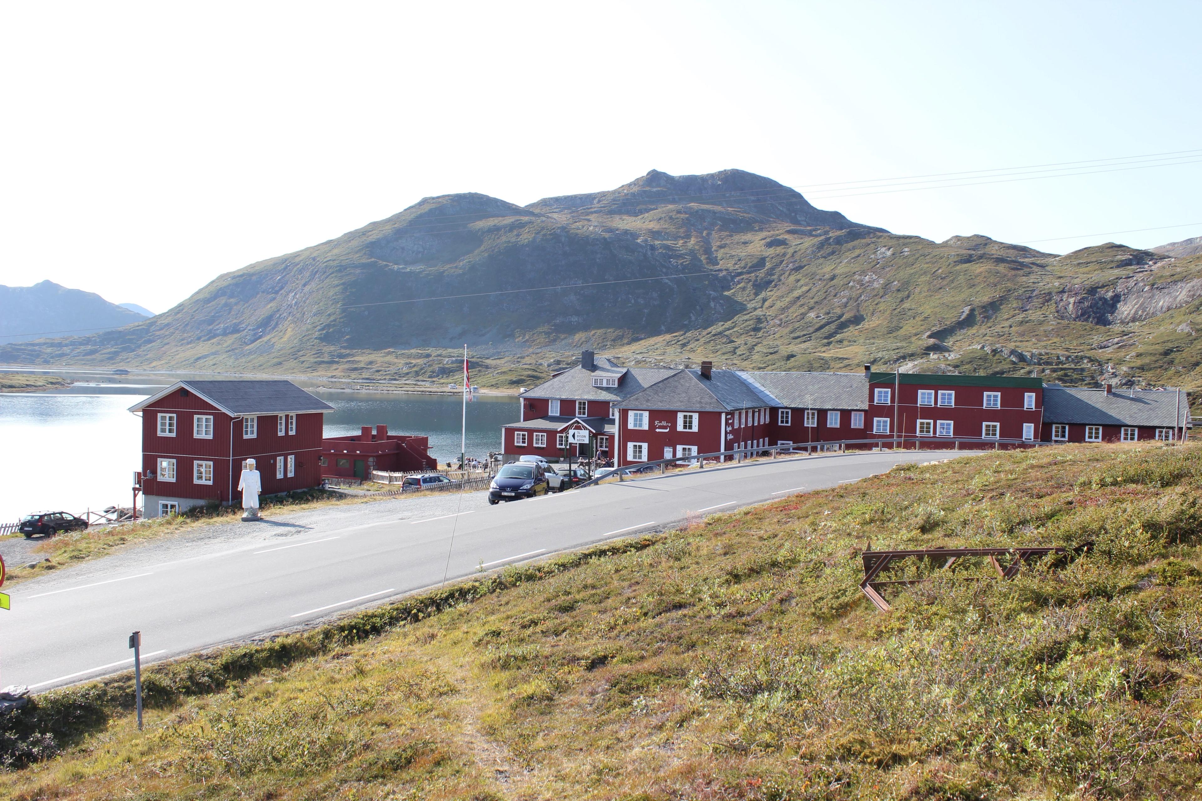
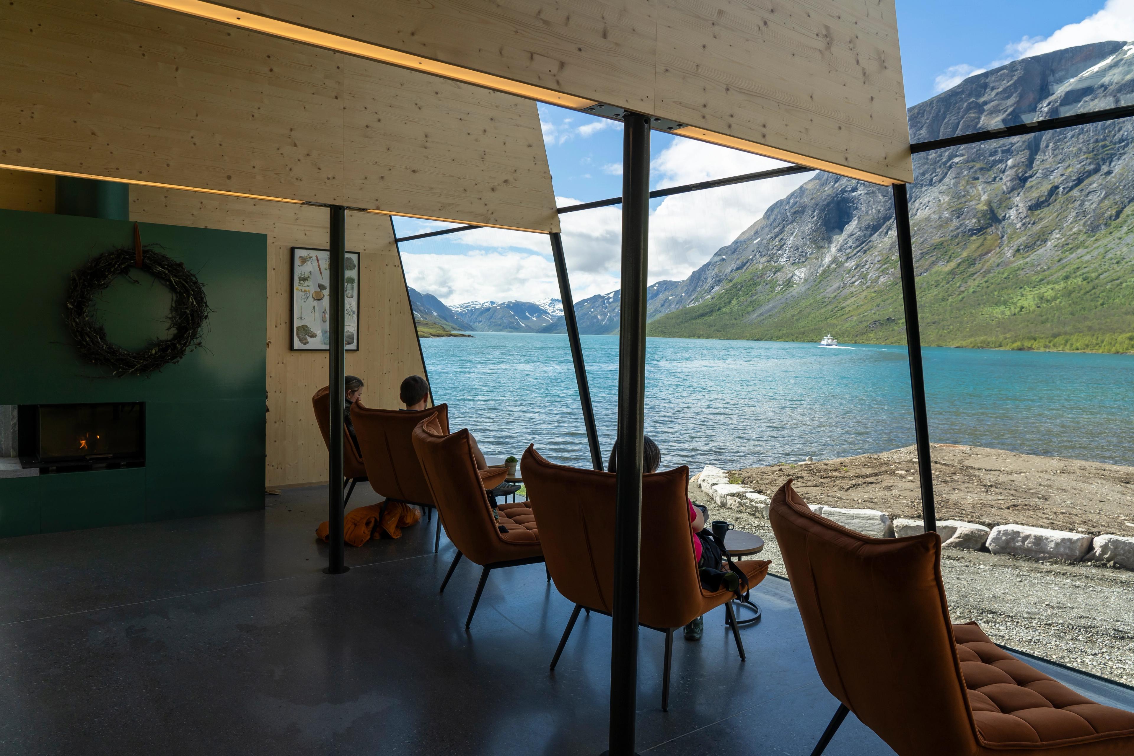
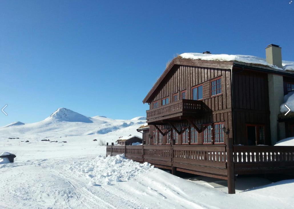
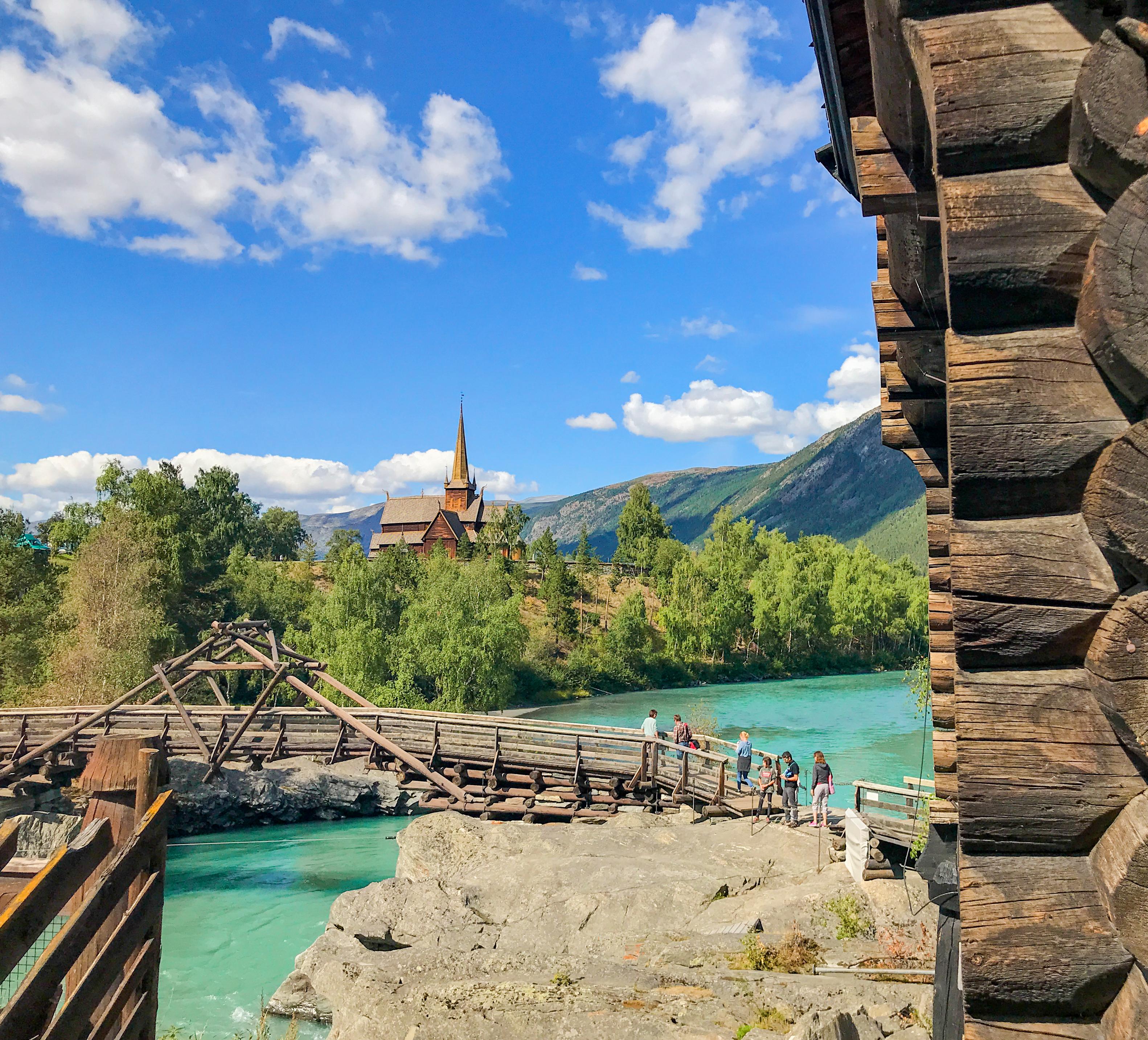
Au pied de la chaîne de montagnes Jotunheimen, à environ 12 kilomètres de Beitostølen, se trouve l'historique Bygdin Høifieldshotel, dont les origines remontent à 1897.
Tout au long de l'année, le café de l'hôtel sert des gaufres et, en été, vous pourrez déguster son porridge traditionnel à la crème aigre accompagné de viande séchée, un incontournable dans les montagnes !
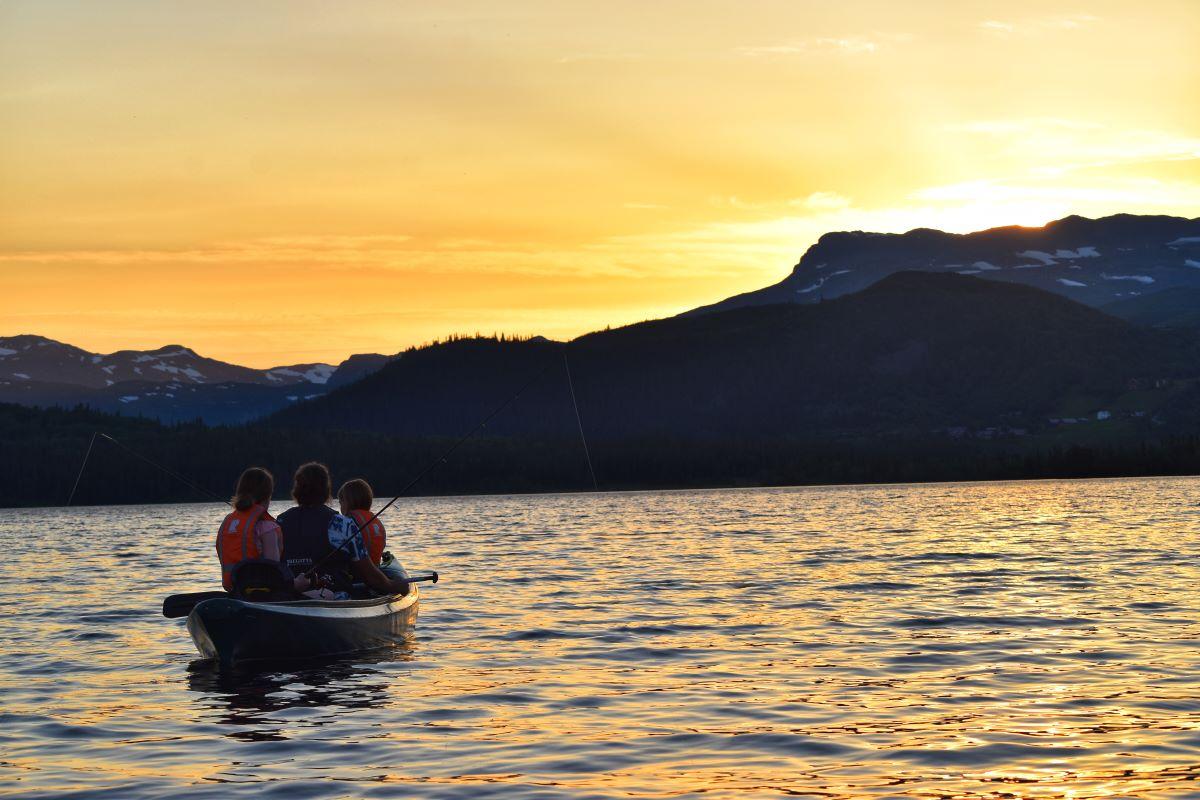
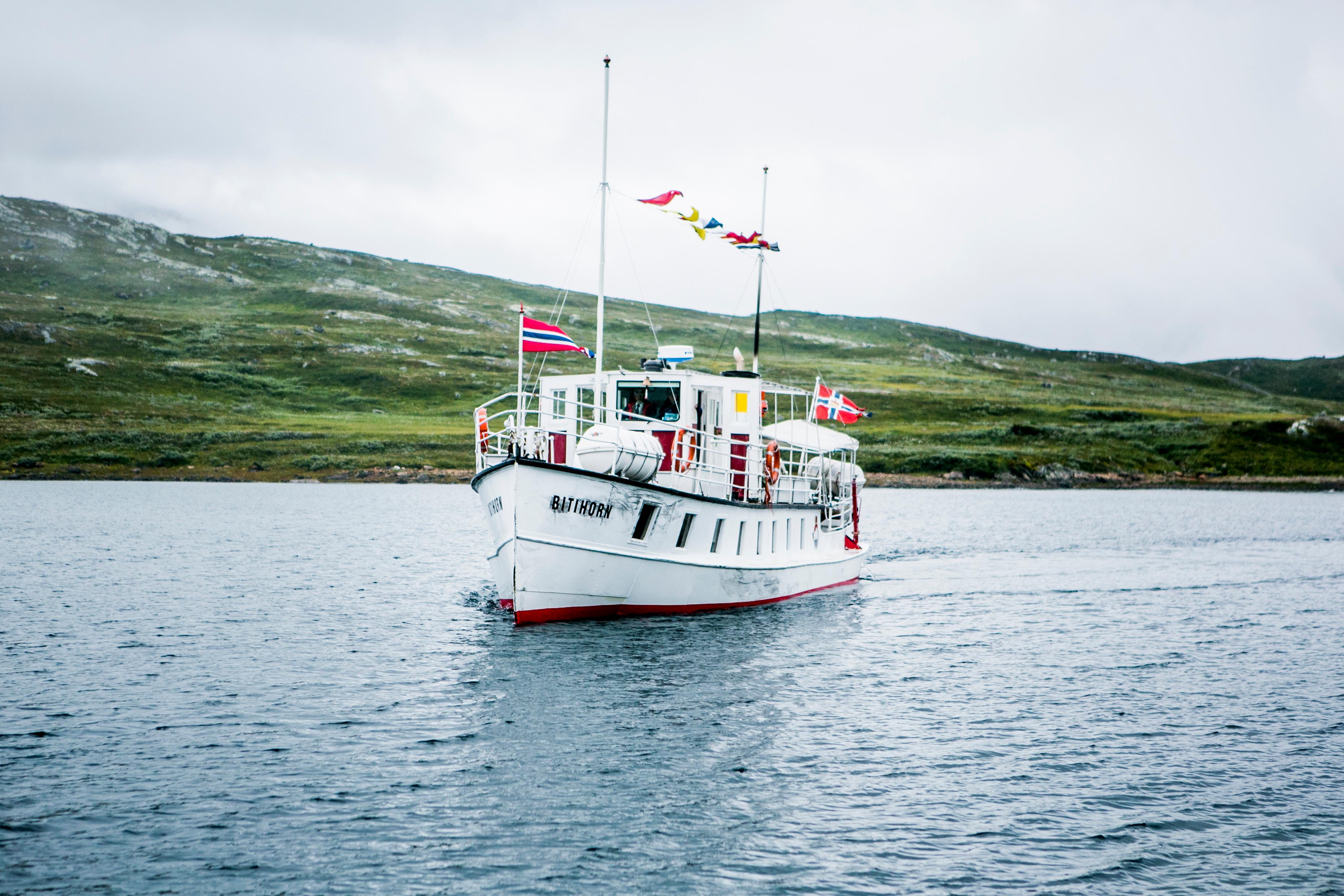
De là, vous pouvez également faire l'une des excursions en bateau les plus en hauteur d'Europe du Nord. Le M/B Bitihorn vous emmène en excursion sur le lac Bygdin, avec vue sur certains des 2000 sommets de la région.
Les bateaux font escale à Bygdin, Torfinnsbu et Eidsbugarden, tous d'excellents points de départ pour des randonnées !
Autres activités près de Bygdin
La région est un vrai paradis pour les activités en extérieur.
 RéserverBeito
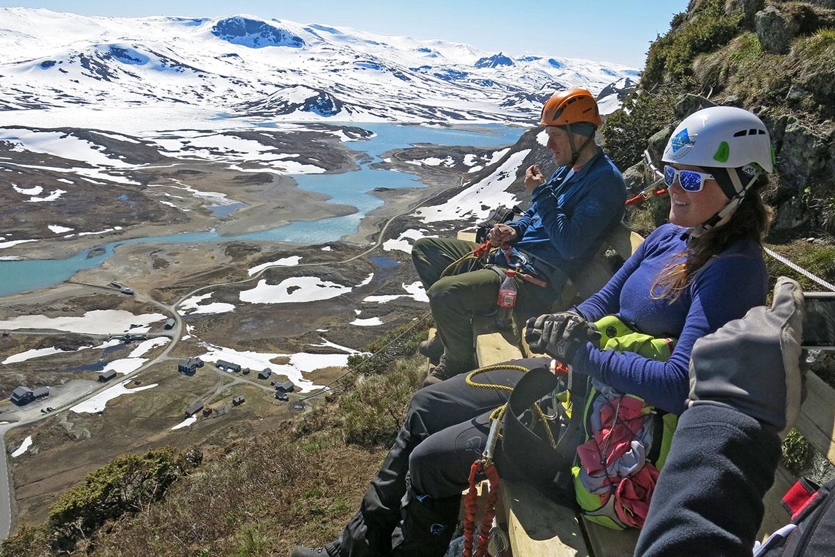
Synshorn Via Ferrata
Synshorn Via Ferrata The Synshorn Mountain is situated between the lakes Bygdin and Vinstre. Experienced guides take you safely up the steep rock face at the front of the mountain. The view is simply breathtaking. There are a couple of resting areas (bench/cliff gallery) on the way. The name Via ferrata originates in Italy, where iron paths were constructed in the Dolomites under the First Word War to improve the accessibility of the mountains for the troops. The modern Via ferrata is a climbing path with iron steps and wires in steep rock faces. You don't need any former climbing experience, but you should be in reasonably good physical shape. Minimum age 12 years. For more information and booking, visit www.synshorn.no Beitostølen
Around Lake Bygdin in four days
Bygdin rundt is a four-day hike around Lake Bygdin. It is mostly easy, but day 2 and 3 around the western end of the Lake are of intermediate difficulty with some rocky terrain. The entire hike is above the tree line. We suggest that you use the mountain cabins for sleeping along the route, but you are by no means limited to them. There are plenty of nice camp sites to be found on all legs (again, day 2 and 3 are partly rocky). If you want to camp in the direct vicinity of one of the huts, you are supposed to pay a camping fee there and use their facilities in order to limit human waste around the huts. Please hike responsibly, stay on the trails, minimize your impact on vegetation and wildlife and take all your garbage with you. Day 1 - Bygdin-Yksendalsbu Distance: 20.5 km Ascends: 790 m; descends: 800 m Highest point along the route: 1366 m.a.s.l. The first leg starts right across the Sami camp along road 51, approx. 1 km south of Bygdin Høifieldshotel. For several kilometers, the terrain is quite flat, with bushy salix vegetation. After 1 km, the trail towards the summit of Bitihorn turns left, but you keep going straight ahead in the direction of Yksendalsbu. After passing Lake Seksin you start gaining height and the trail ascends towards the small summit of Marabotthornet. Up here you are rewarded with a great view across Lake Bygdin towards the ragged peaks of Torfinnstindane and Galdeberget further west. For a while, you hike along this broad ridge, high and free, with some high points around 1350 m elevation and small lakes, to the high point of Skjeldrehornet. Now you leave the ridge and descend to the northwestern shore of Lake Olefjorden, over a small saddle and up the Yksendalen Valley to the self-serviced mountain cabin Yksendalsbu. Day 2 - Yksendalsbu-Fondsbu Distance: 16.5 km Ascends: 1100 m; descends 1080 m Highest point along the route: 1424 m.a.s.l. Day two is the toughest as it incudes two quite steep ascends of 400 and 200 meters respectively. The first one starts right behind the hut. Later, you descend into Vølodalen Valley and ascend right out of it again on the other side. Here you reach the eastern shore of Lake Dryllin. If you are in good shape and used to navigating off marked trails, we highly recommend a side trip to the summit of Dryllenøse (1510 m.a.s.l.) for an exceptional view towards the Gjende Alps north of lake Bygdin. You can leave your backpack by the trail. The trail now continues in easy terrain over the highland and down the valley Vennisstøldalen to the western end of lake Bygdin with the full-serviced cabin Fondsbu. Despite the easy terrain, the cairns with the trail markings are low and far between, so you need to pay attention in order to not to lose the trail. Day 3 - Fondsbu-Torfinnsbu Distance: 20 km Ascends/descends: 680 m Highest point along the route: 1545 m.a.s.l. At Fondsbu, follow the gravel road until you cross over the River Mjølkedøla where the road turns into a trail. Now you hike 3 km along the shore of Lake Bygdin to the River Høystakka. In 2019 the route to Torfinnsbu was rerouted on a new bridge over the Høystakka river mouth and around the southern foot of Galdebergtinden to avoid the terrible boulder fields north of the mountain in the Uksendalen valley. The new route now ascends slowly up to the Langedalen valley east of Galdebergtinden where it meets the old route before descending again to the lakeshore. The last two kilometers are easy along the shoreline to the self-serviced cabin Torfinnsbu. Day 4 - Torfinnsbu-Bygdin Distance: 13.5 km Ascends/descends: 270 m Highest point along the route: 1124 m.a.s.l. The last day of the trek around Lake Bygdin is the easiest and shortest. The trail follows more or less the shoreline all the time, with the exception of three smaller ascends over some rocky parts. The last three kilometers from Bygdisheim back to Bygdin Høifieldshotel are on a gravel road closed for motorized traffic. Alternatively, legs 3 and 4 can be done by boat during the summer season. The entire hike can be booked as a tour package with all accommodations, boat legs and transport by bus from Oslo to Bygdin through Jotunheimen Travel (tailormade inquiry). Beitostølen
Synshorn and Fagerdalen
Fagerdalen and Synshorn are two very nice hikes that can either be combined or hiked separately. Starting and ending point is at Fagerstrand on the eastern shore of Lake Bygdin, close to Bygdinstøga Kafé and Bygdin Høifieldshotel. Getting there is by bus (summer route) from Beitostølen or Fagernes or by car along road 51 (parking against fee). Tour details Fagerdalen valley circuit: approx. 8 km in total and 220 m ascend/descend Synshorn (1475 m.a.s.l.): 4.5 km return and 400 m ascend/descend Description The unmarked but clear trail starts more or less right uphill on the left-hand side of the stream running downhill from the Fagerdalen valley. After an ascend of approx. 180 m, the stream is crossed on rocks and approx. 100 m after, the trail splits. To the left you enter the Fagerdalen valley, while straight ahead/right you continue uphill to the summit of Synshorn. You first reach a high point with a stunning view down to the road, Lake Bygdin and towards the mountain of Bitihorn (and most people will claim the mountain here), but the true summit lies 250-300 m further to the north. Return on the same way. For the Fagerdalen circuit, turn left approx. 100 m after crossing the stream. This junction can be a bit unclear, but heading towards the northern shore of Lake Heimre Fagerdalstjernet, you will re-encounter it shortly. The trail is unmarked. You pass by a nice spot for a swim in the lake and continue straight ahead until you meet the DNT trail (red T's) from Valdresflye to Lake Bygdin, just before the stream Synsbekken. Turn left and follow it downhill (this junction is very unclear, but when reaching Synsbekken you are not supposed to follow the path towards the right uphill, but hold left downhill. Just 50 meters after the intersection, the path is clear again, see last picture) to the lakeshore and then left again along Lake Bygdin back to Fagerstrand. The last 3 km are on a private gravel road (some traffic can occur, be considerate towards each other).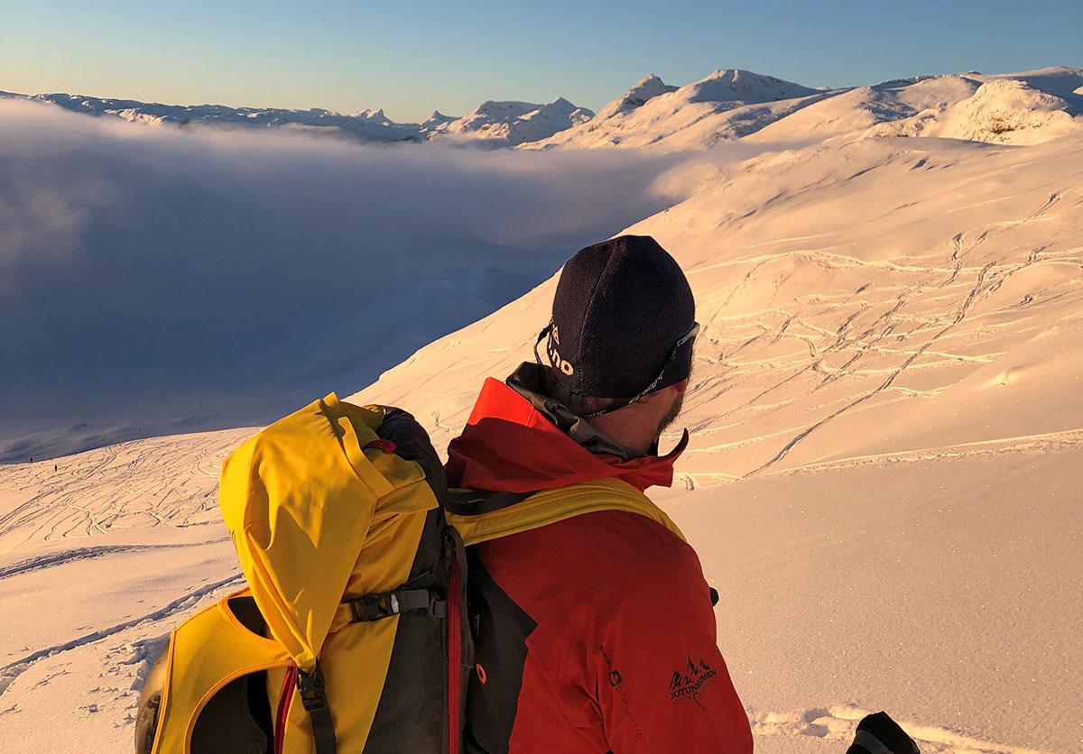 RéserverBeitostølen
Guided tours with Jotunheimen Mountaineering
At Jotunheimen Mountaineering, we offer guided mountain tours all year. Our range of activity is mainly concentrated in the area around Beitostølen and the "Gjende Alps"; the part of Jotunheimen that is located between the Bygdin and Gjende lakes. We also arrange tours in other parts of Jotunheimen upon request. During winter, in addition to ski touring, we set up courses in off-piste skiing and avalanche rescue, with emphasis on safety on mountain tours. Visit us on facebook for an overview of our scheduled tours.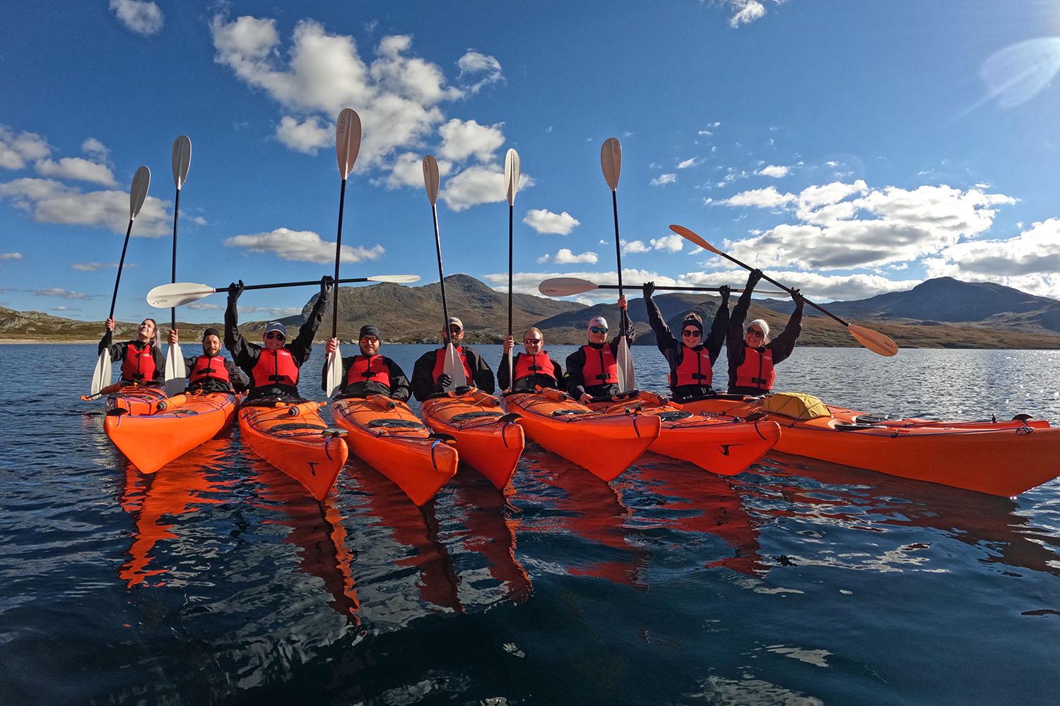 RéserverBeitostølen
Guided kayak tours on Lake Bygdin
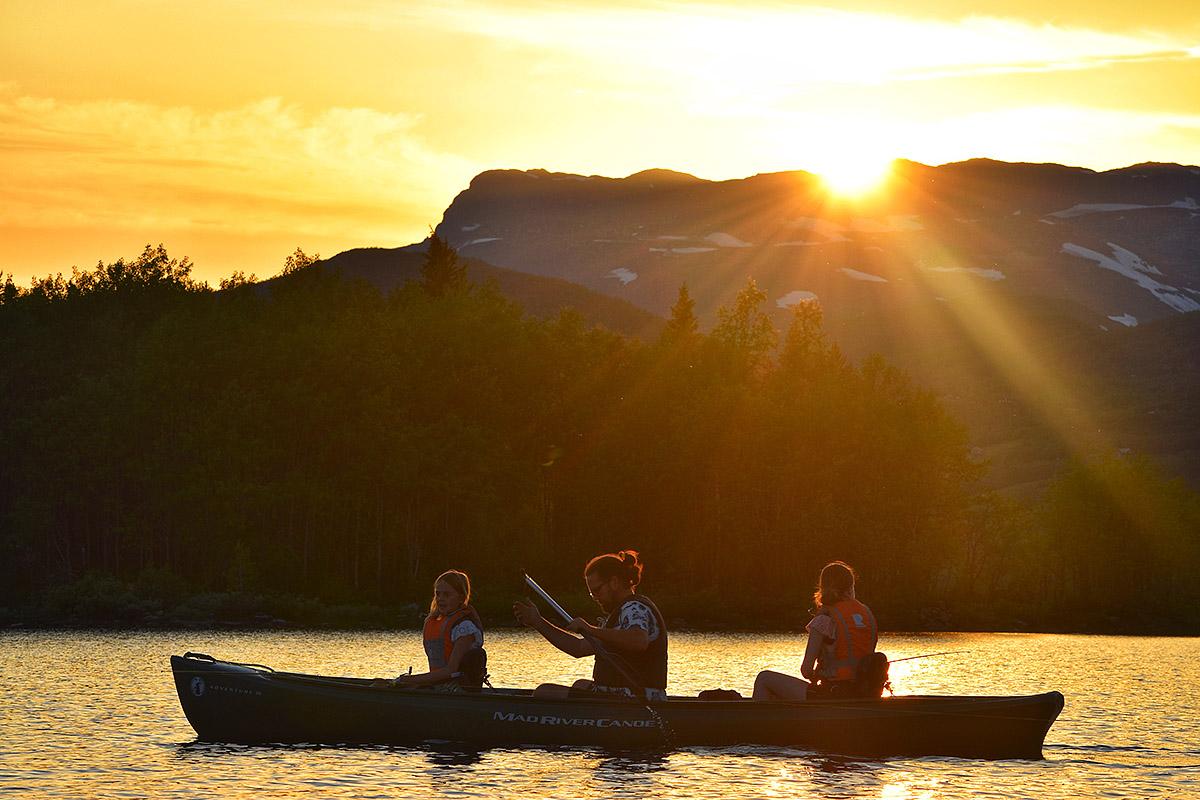
We offer fantastic kayaking tours on the mountain lake Bygdin. Join us on a half day-tour with information about local history or a full day trip to Torfinnsbu. There are different packages to choose from, some of which also combine kayking and alpine mountain ascends. Read more on www.bygdin.com/aktiviteter (in Norwegian) and contact us for information and offers!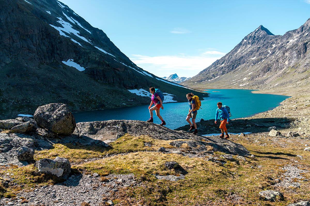 RéserverBeitostølen
Discover Jotunheimen - The Green Route
Self-guided hiking package in Jotunheimen. The Green Route is suitable for hikers with average experience and condition. Along the route you will visit some of the most renowned, historical accommodations in Jotunheimen. When booking this tour package with Jotunheimen Travel, accommodation, meals and baggage transport are included. All your need to do is carry a day pack with essential gear and get out and experience the breathtaking mountain scenery yourself. Itinerary: Day 1: Arrival at Bygdin Day 2: Day hike to the summit of the mountain Bitihorn Day 3: Boat Bygdin-Torfinnsbu and hike through the Svartdalen Valley to Gjendebu Day 4: Free day at your disposal at Gjendebu Day 5: Hike from Gjendebu to Eidsbugarden Day 6: Departure from Eidsbugarden. For more information and booking, visit the homepage of Jotunheimen TravelRéserverBeitostølenBesseggen and Svartdalen Valley - Hiking package
Try our Jotunheimen highlight combo hike with two of the best hikes in Norway, Svartdalen and Besseggen. All meals and transportation is included. The tour includes transportation between the hikes and Bygdin, as well as the tickets for the three boat trips needed for this excursion. You can also add transfer to and from Oslo, making this a complete roundtrip from the Norwegian capital. For this excursion/trip we offer our Jotunheimen Travel “Hiking-Board” meal plan with 3 meals a day included in the price! Around 60 000 people hike over the popular and spectacular Besseggen ridge every year. Join and find out why! Close by is one of the lesser known, but just as beautiful valleys, Svartdalen. This is a great opportunity to do both in two days. We will arrange all the details, and you only need tie your hiking shoes and enjoy the hike! More information on Svartdalen More information on Besseggen Accommodation Bygdin Høifieldshotel: For this package you will be offered a double room with a private bath at Bygdin Høifieldshotel. Bygdin Høifieldshotell try to keep the old style and atmosphere. Furnitures and other equipment around the building can be traces back through history and gives the building its soul. The hotel also offers space for mountain boots, ski shoes, bikes and of course space for your dogs.
Prenez votre temps et arrêtez-vous aux points de vue qui jalonnent le parcours.
L'aire de repos de Rjupa offre une vue panoramique sur les hameaux traditionnels de montagne et la vallée de Valdres.
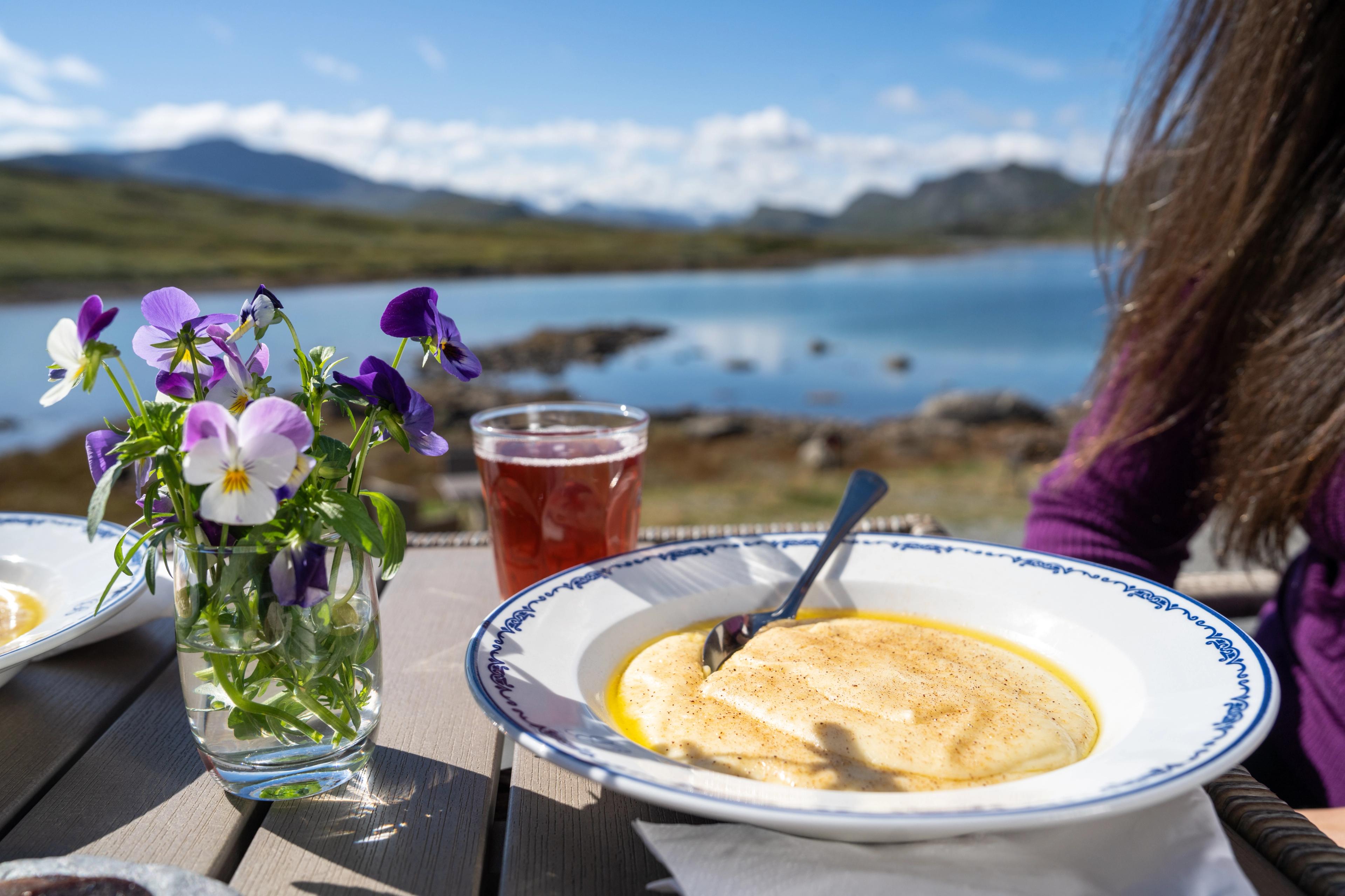
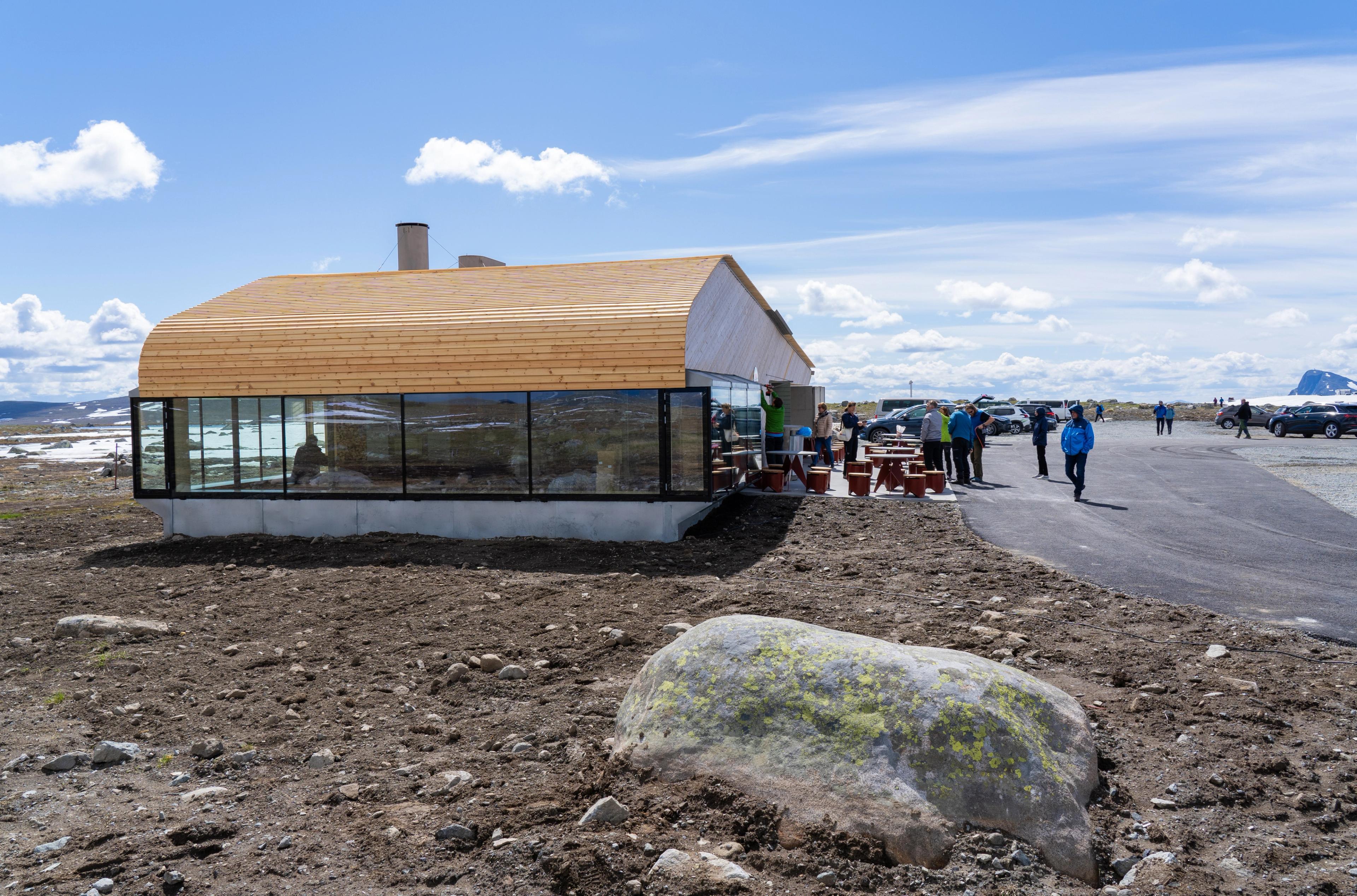
Lorsque la route atteint son point culminant à 1389 mètres d'altitude, vous arrivez au Valdresflye Kafé où vous pouvez vous arrêter pour déguster des spécialités locales.
Par temps clair, vous pouvez voir depuis le café les sommets des montagnes Besshøe, Høgdebrotet, Tjønnholstinden et Rasletinden.
De là, vous pouvez également revenir à pied à Bygdin. En été, vous pouvez prendre le bus depuis Fagernes ou Beitostølen jusqu'au point de départ, au café.
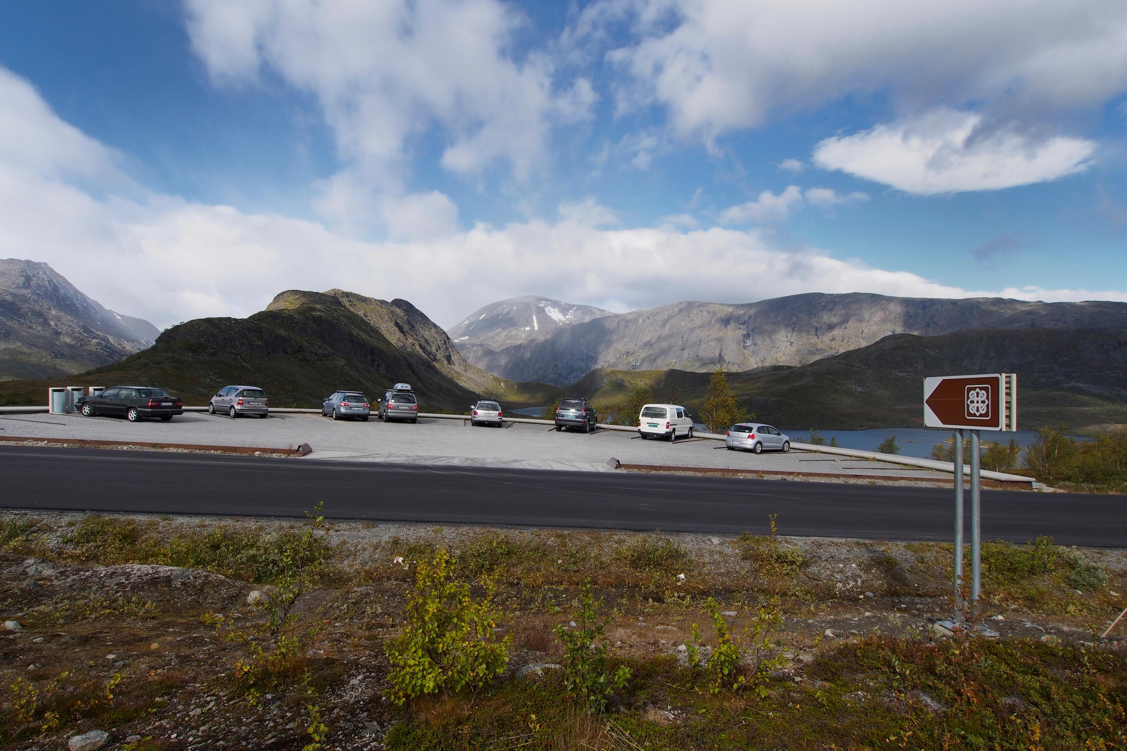
En suivant la route qui serpente à travers le plateau montagneux, vous arriverez à Vargebakkane, un petit parking qui est aussi un point de vue très apprécié.
Non loin de là, l'une des principales attractions de la région vous attend.
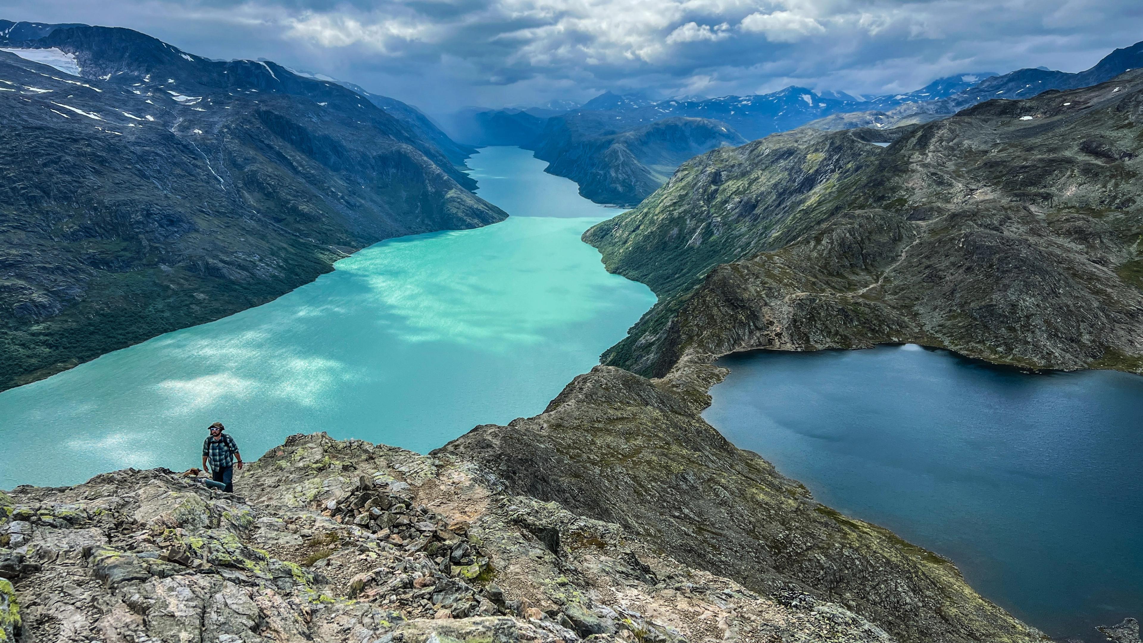
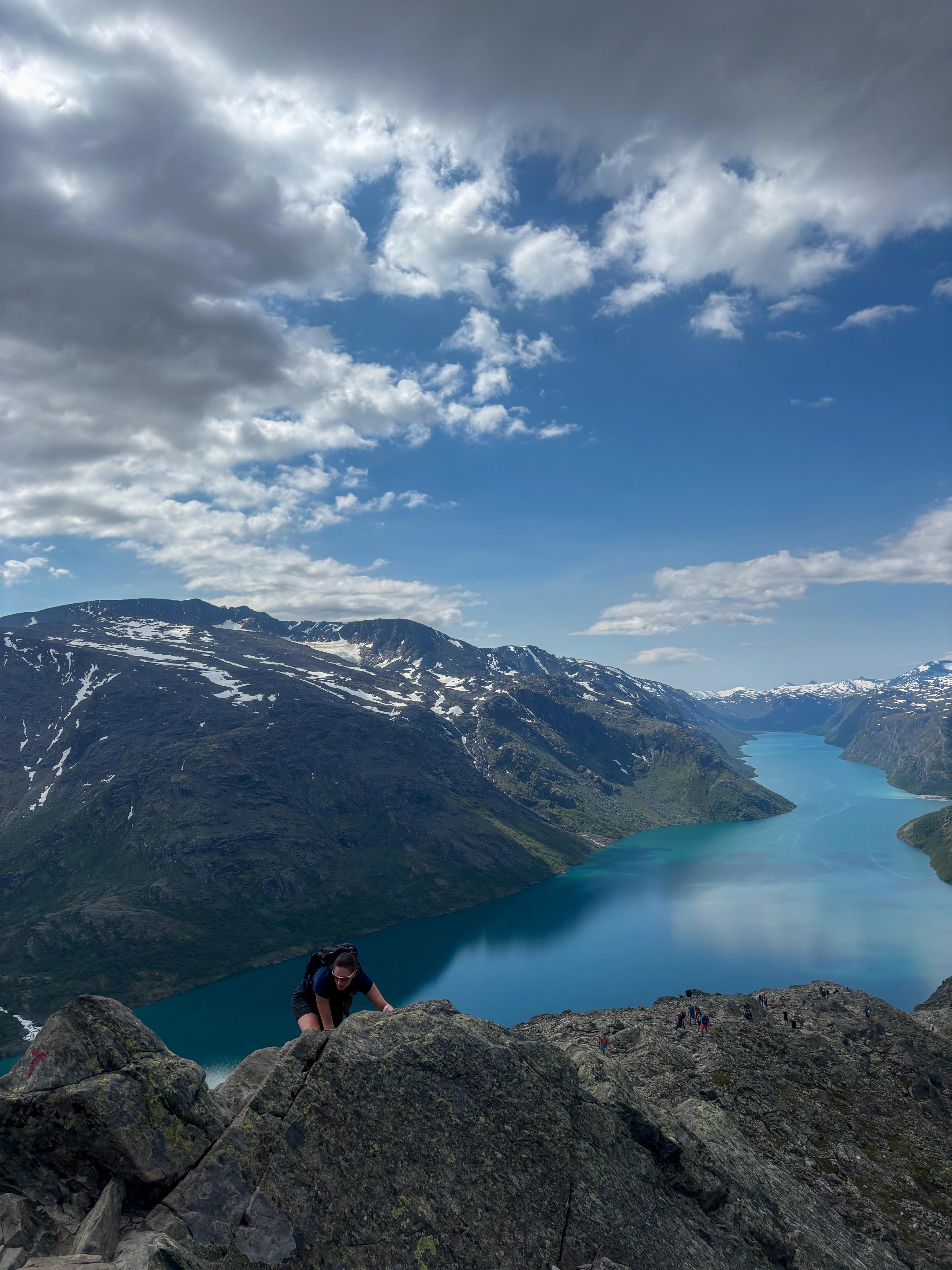
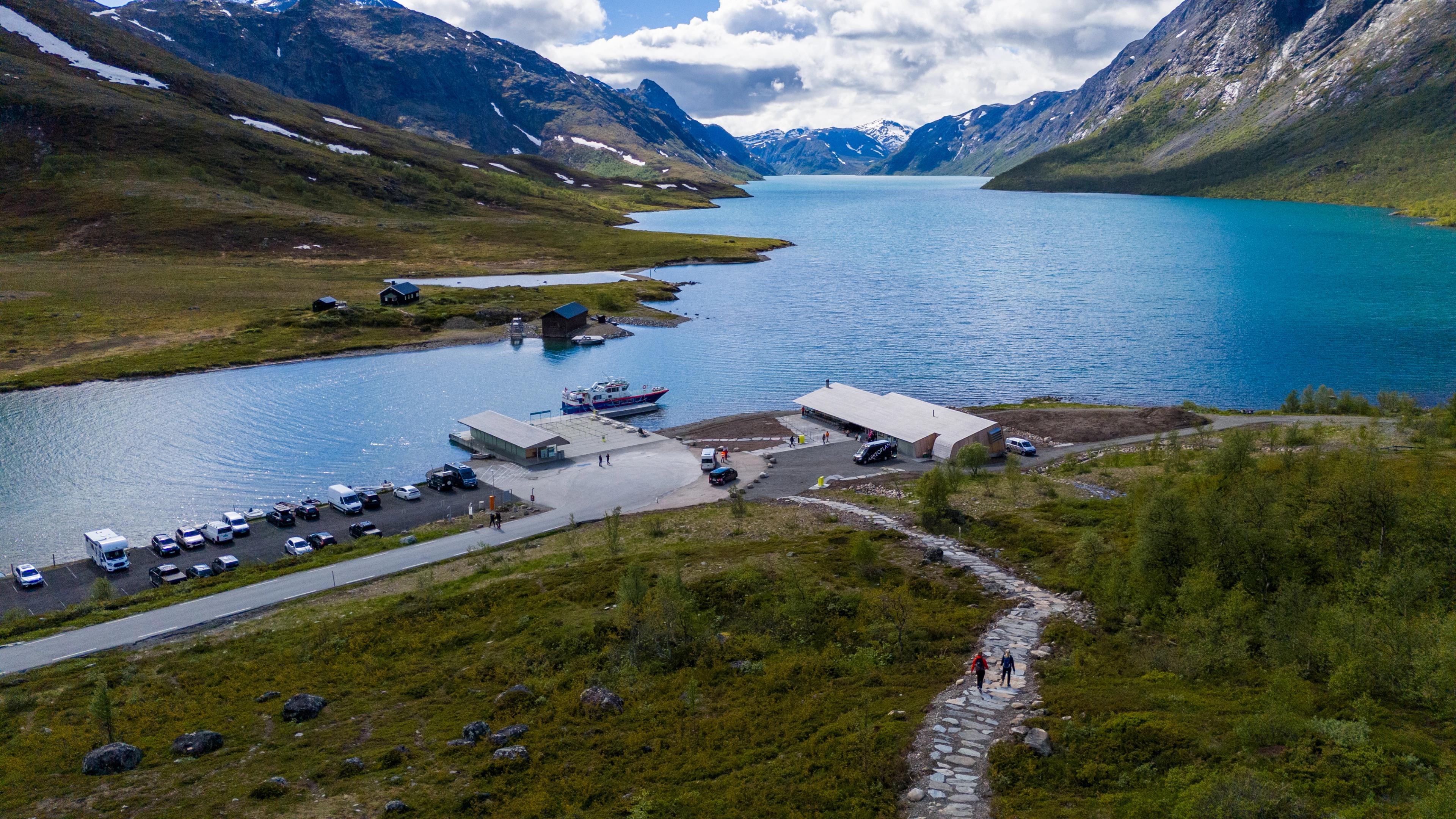
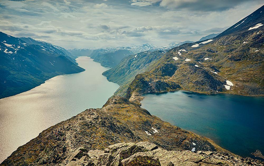
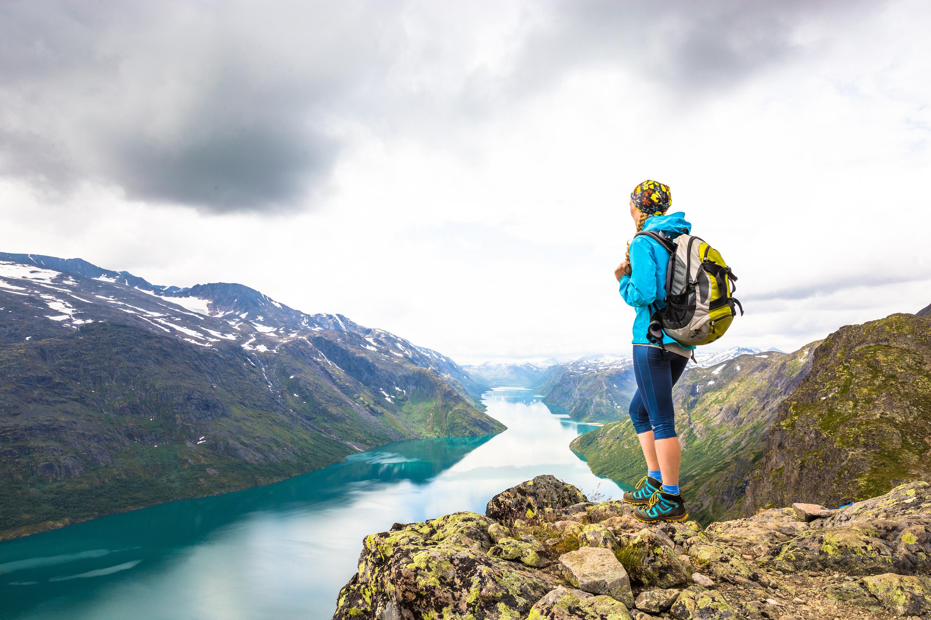
Gjendeosen est un point de rencontre à l'entrée du parc national de Jotunheimen. Vous y trouverez le magnifique lac Gjende, célèbre pour ses eaux turquoise éclatantes.
Et, bien sûr, le point de départ de la randonnée le long de Besseggen.
Juste à côté du café Gjendeosen, vous pouvez prendre un bateau pour Memurubu. De là, vous pouvez marcher sur la crête pour revenir au point de départ près du café. Il est également possible de faire la randonnée dans l'autre sens, mais assurez-vous de vous coordonner avec les départs du ferry.
En haute saison estivale, il est recommandé de réserver vos billets de ferry à l'avance.
Notez que certaines parties du sentier sont escarpées et nécessitent un peu d'escalade. Il faut compter entre 7 et 8 heures pour effectuer la randonnée, ce qui ne convient pas à tout le monde !
Veillez à toujours vous munir d'un équipement de randonnée adapté, d'eau et des provisions nécessaires pour garantir votre sécurité en montagne. Informez quelqu’un de votre destination, ainsi que du moment de votre retour.
Autres randonnées à proximité
Explorez les montagnes et les vallées de Jotunheimen ! Et n'oubliez pas qu'il existe également de nombreuses visites guidées fantastiques.
 RéserverTessanden
The Historical Hiking Route in Jotunheimen
The Historical Hiking Route Jotunheimen leads through one of the most beautiful parts of Jotunheimen. It follows the historical path that the explorers of the mountain area took during the 19th century. This package tour is with a trained and knowledgeable guide who knows the local history and stories behind the route, and will take you safely through this breathtaking mountain landscape. Tour itinerary: Day 1: Arrival Gjendesheim Day 2: from Gjendesheim to Memurubu over the Besseggen ridge Day 3: from Memurubu to Gjendebu via Bukkelægret Day 4: Day at free disposal at Gjendebu Day 5: from Gjendebu to Torfinnsbu through the Svartdalen Valley Day 6: from Torfinnsbu to Eidsbugarden Day 7: Departure Learn more about this trip and book on the homepage of Jotunheimen Travel.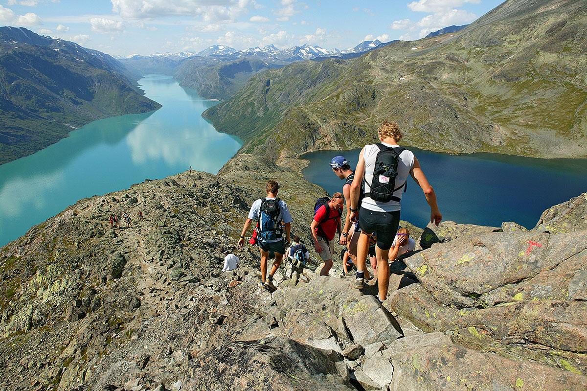 Tessanden
The Besseggen Ridge in Jotunheimen
There is a reason for the Besseggen being one of the most popular mountain hikes in Norway. The spectacular panoramic view over Jotunheimen's peaks and the two lakes - the deep blue Bessvatnet and the turquoise Gjende - draws more than 60 000 hikers during the short season that lasts from late June to early September. Tour information: The 14 km long trail leads between the two DNT cabins Gjendesheim and Memurubu. It climbs/falls 1200 m in total and is quite demanding over its entire length, so you need to be in a good physical shape to hike it. The Besseggen ridge, approx. one kilometer long and 250 meters in elevation, is located midways along the trail. It involves some scrambling, and people sensitive to heights should mentally prepare for a challenge. For most people, it takes approx. 7-8 hrs to complete the hike. Parkering is at Reinsvangen, 1.5 km before Gjendesheim. From there, a shuttle takes the hikers to the trailhead and the boat (https://gjendepark.no). There’s a kiosk and toilets at Gjendeosen. Choice of route: The most popular way to hike the Besseggen is to take the boat from Gjendesheim to Memurubu and walk back. Many may experience the ridge easier to climb up than down, especially if one is afraid of heights. Another advantage is that you don’t have to rush in order to reach a boat. The disadvantages of this direction, however, are that there is no good way out in case you need to break and that you’re walking away from the view. The greatest advantage of hiking in the opposite direction, from Gjendesheim to Memurubu, is that you can start at any time and don't share the trail with a boat load of people. Early birds may even reach over the ridge before the meeting traffic starts. Later during the day when it gets crowded you may have to wait your turn at the narrowest passages. Plus, you don’t have to remember to turn around to take in the view. Should you be in doubt whether you can accomplish the Besseggen, we recommend that you start at Gjendesheim. That way you can turn around at any time and you can even walk to the viewpoint on top of the ridge and back without having to accomplish the ridge itself. This is also the best way to experience Besseggen outside the boat season. On the return, you can choose the trail towards Bessheim that exits on Veslefjellet and return to Gjendesheim on the trail from Glitterheim which you meet at Bessosen. This is a less steep and demanding return, but a little farther than the direct descend to Gjendesheim. Boat information Since most people take the boat in and walk back from Memurubu, the departures from Gjendesheim in the mornings tend to be more crowded than the afternoon departures from Memurubu. It is highly recommended that you book the boat trip in advance. For timetables, terms and booking, visit www.gjende.no The boat service runs daily from the middle of June to the middle of September and during the weekends before and after the season until the first week in October. In peak periods and weekends there are often extra departures, so check online before travelling. Equipment Remember to wear solid hiking shoes with profile soles. Bring warm and weatherproof clothing even in nice weather, enough food and drink for the entire hike and on warm summer days, a small towel and some swim wear for a refreshing dip in Lake Bessvatnet. Erosion The heavy traffic has left its toll on the trail, leading to erosion and destroyed vegetation. An enormous effort has been put into repairing the trail and revegetating the worst sections on both the Gjendesheim and the Memurubu side. Please keep on the trail when walking the Besseggen!
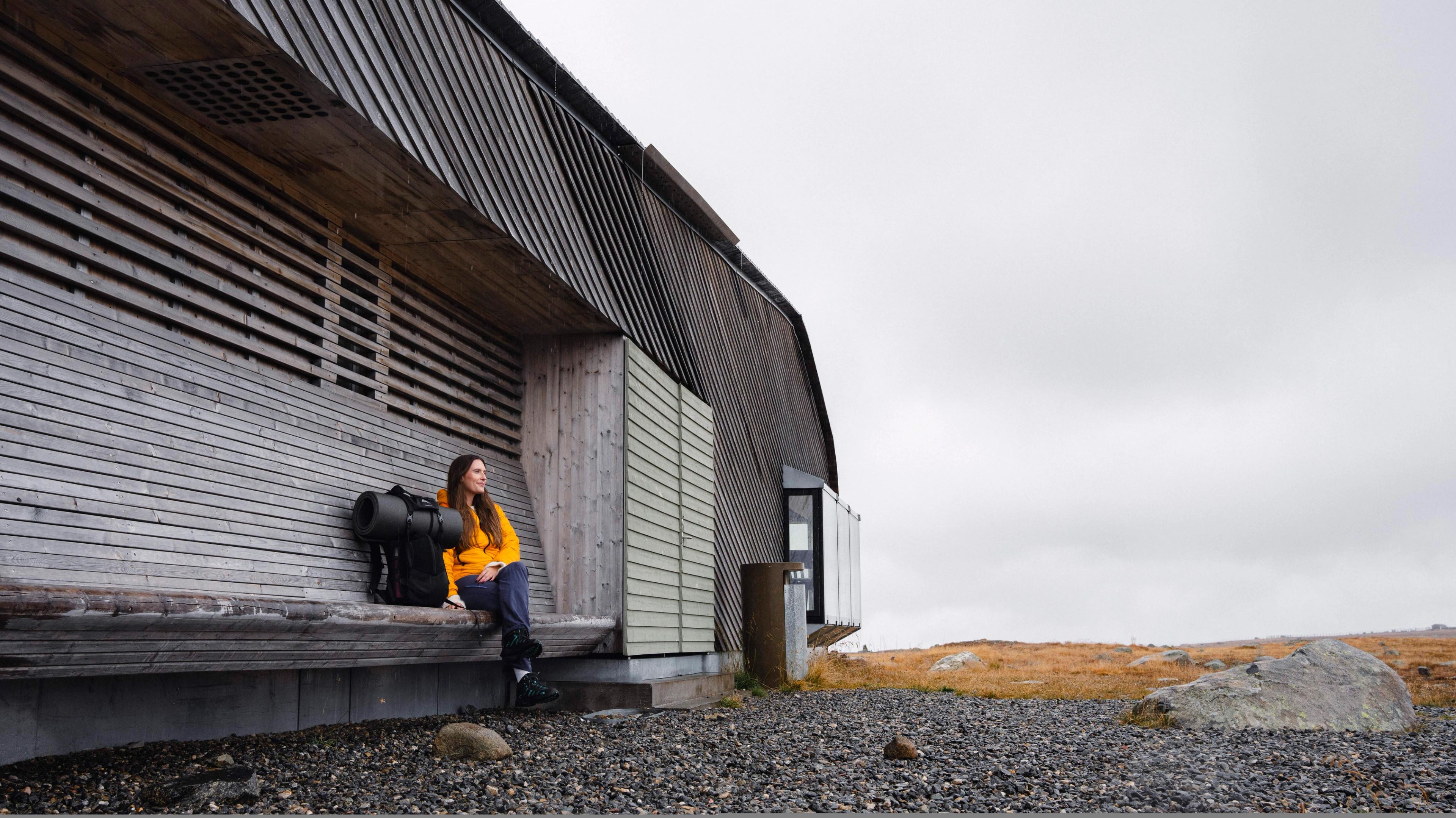
Séjournez dans un refuge de montagne traditionnel
Profitez au maximum de votre séjour à la montagne en séjournant dans un refuge traditionnel, appelé fjellstue en norvégien !
De nombreux refuges de montagne servent également des plats chauds et réconfortants préparés à partir d'ingrédients locaux, parfaits pour faire le plein d'énergie avant ou après votre randonnée.
Juste à côté de Besseggen, vous trouverez le célèbre refuge de montagne Gjendesheim, géré par l'Association norvégienne de randonnée. Il a même son propre « manifeste alimentaire », qui garantit aux clients non seulement un repas savoureux, mais aussi écoresponsable.
« On insiste beaucoup sur le fait de manger moins de viande, mais je pense qu'il est tout aussi important d'encourager les gens à finir leur assiette pour éviter le gaspillage alimentaire, et de leur faire comprendre pourquoi les produits locaux sont capitaux », explique Marius Haugaløkken, le propriétaire.
Les porcs élevés en liberté dans le Sveen Gard, les agneaux qui paissent dans les montagnes dans le Snerle Gard et les pommes de terre récoltées dans le Sve Gard à Vågå ne sont que quelques-uns des produits locaux utilisés dans la cuisine de Gjendesheim. Ils sont aussi délicieux pour vous que bénéfiques pour les agriculteurs de la région.
Spécialités montagnardes
Bessheim, situé juste à côté de la route nationale 51, est un autre excellent refuge de montagne dans la région. Il accueille des clients depuis 1890. Au menu, vous trouverez les meilleurs produits de la région, notamment de la truite de montagne, de l'élan, du cerf et de l'agneau.
Une spécialité à goûter absolument dans la région ? La viande de renne. Selon le chef Bjørn Ekkerbakke, elle a le goût des montagnes.
Il a cette incroyable saveur sauvage et sa viande est tendre », explique Bjørn, qui ajoute qu'ils se procurent toute leur viande auprès de Vågå Tamrein, une association locale active à Jotunheimen depuis 1942.
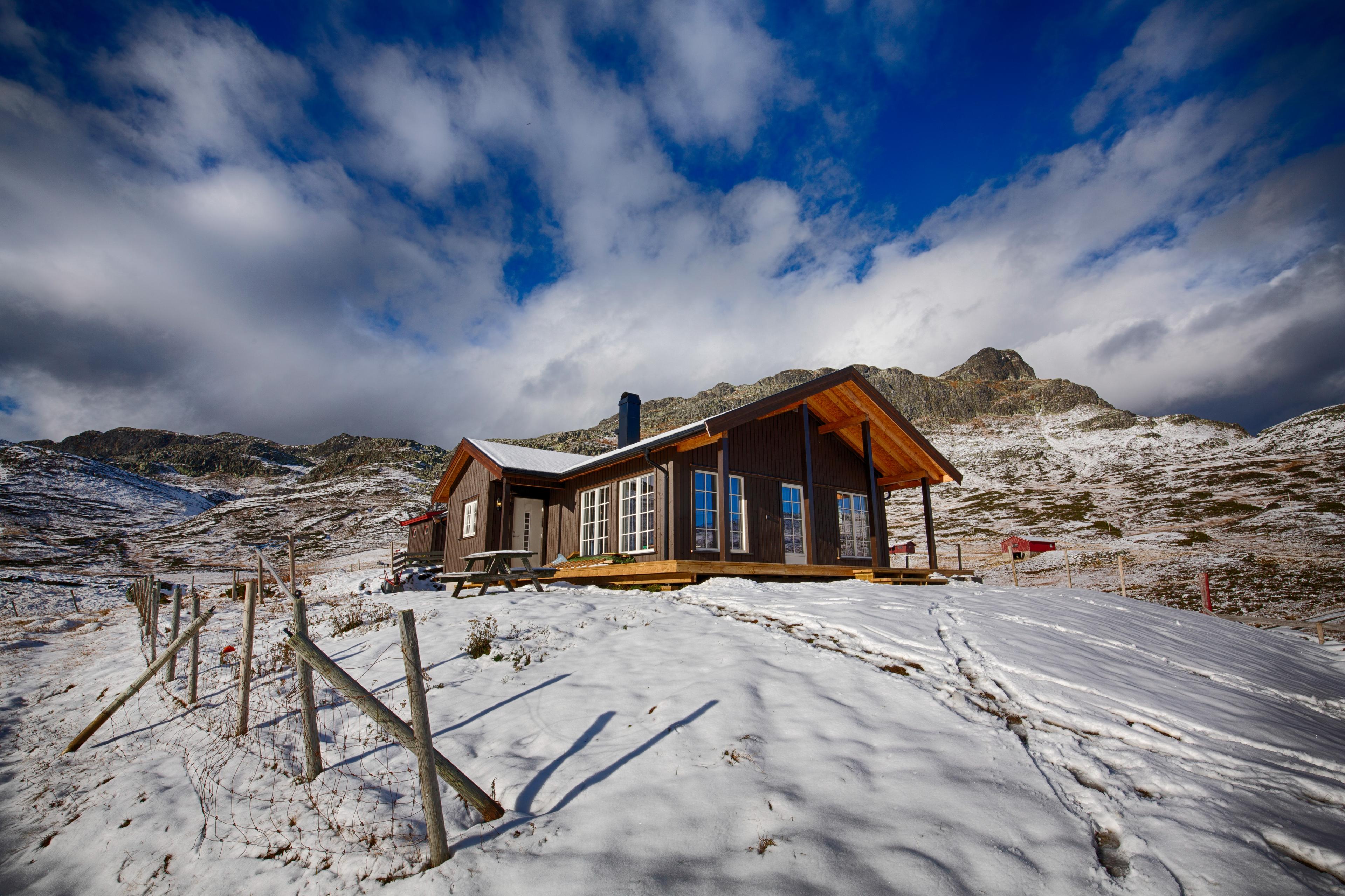
L'hôtel historique Hindsæter, situé juste au-dessus de la route panoramique de Valdresflya, vaut également le détour. L'hôtel offre un luxe montagnard et une cuisine locale savoureuse avec vue sur la rivière Sjoa et Jotunheimen.
Hébergement près de Valdresflye
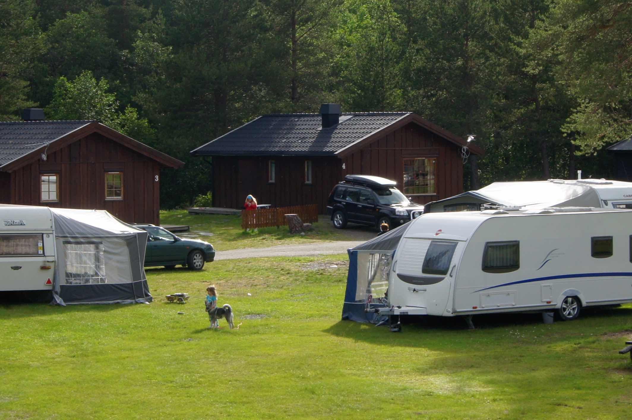
Passez un séjour savoureux et confortable dans les montagnes en séjournant dans un chalet traditionnel ou en faisant du camping !
 RéserverBeitostølen
Haugseter Mountain Lodge
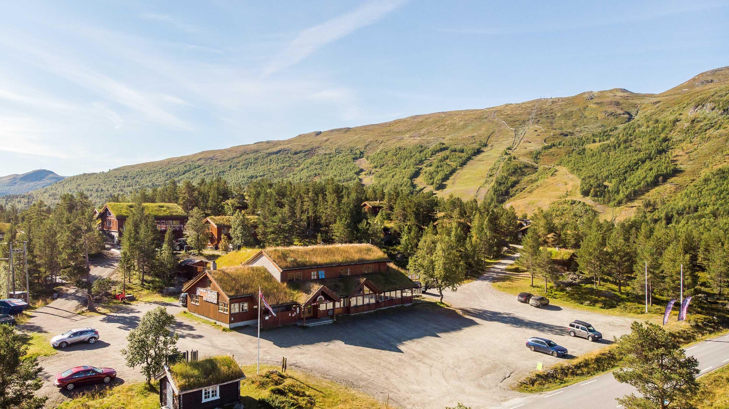
Haugseter Fjellstue is a traditional mountain lodge with 140 years of history in the high mountains. It is located along Jotunheimvegen, a mountain road that runs through a landscape of old summer farms and pasture cabins. At Haugseter, guests can enjoy a calm and welcoming atmosphere indoors, with homemade food and drinks, often by the fireplace. The surrounding area offers a wide range of outdoor activities, including hiking, cycling, horseback riding, and skiing. The landscape varies from high peaks with wide views to gentle terrain with old livestock paths, providing opportunities in all directions. This is one of the few areas where traditional summer farming is still active, and fishing is available both in Lake Vinstervann and in several other lakes nearby. Dining The food at Haugseter is well regarded in the area. We serve everything from traditional stølslapper (Norwegian pancakes) with jam to homemade, traditional meals and larger set dinners, often based on game, fish from Lake Vinstre, and other local ingredients. We welcome groups, meetings, and smaller conferences. If you are looking for a scenic setting and a warm, informal atmosphere for your gathering, we are happy to tailor the event to your needs. Menus and wine pairings can be suggested on request. Haugseter Fjellstue is fully licensed. Hunting A tailor-made offering for private groups, combining hunting experiences, professional guidance, and good food. Only a limited number of packages are available each year. Cycling Haugseter is located along the Mjølkevegen cycling route and is a Mjølkevegen Partner. The route offers varied terrain and breathtaking scenic surroundings. Fishing Haugseter is well suited for mountain fishing trips. Lake Vinstervann is known for its trout, used in traditional rakfisk production. Fishing permits and boat rental are available, and a small selection of fishing equipment is sold on site. Hiking Several hiking routes start directly from Haugseter Fjellstue, whether you are hiking between cabins, staying at the lodge, or heading out for a shorter day trip. Langsua National Park is located nearby. We offer: Accommodation in cabins and apartments Homemade food with a focus on local ingredients Boat rental Fishing permits and maps Free loan of fishing rods for children Private and corporate events Free Wi-Fi Winter Haugseter Fjellstue is closed during the winter season, but cabins can be rented, and snowmobile transport can be arranged. With sufficient advance bookings, the lodge opens during the Easter holidays. Please contact us for more information. Marked back country ski routes run from Haugseter toward both Langsua and Jotunheimen National Parks from mid-February until Easter. Welcome!
Profitez de la dernière partie de la route panoramique qui descend vers Hindsæter.
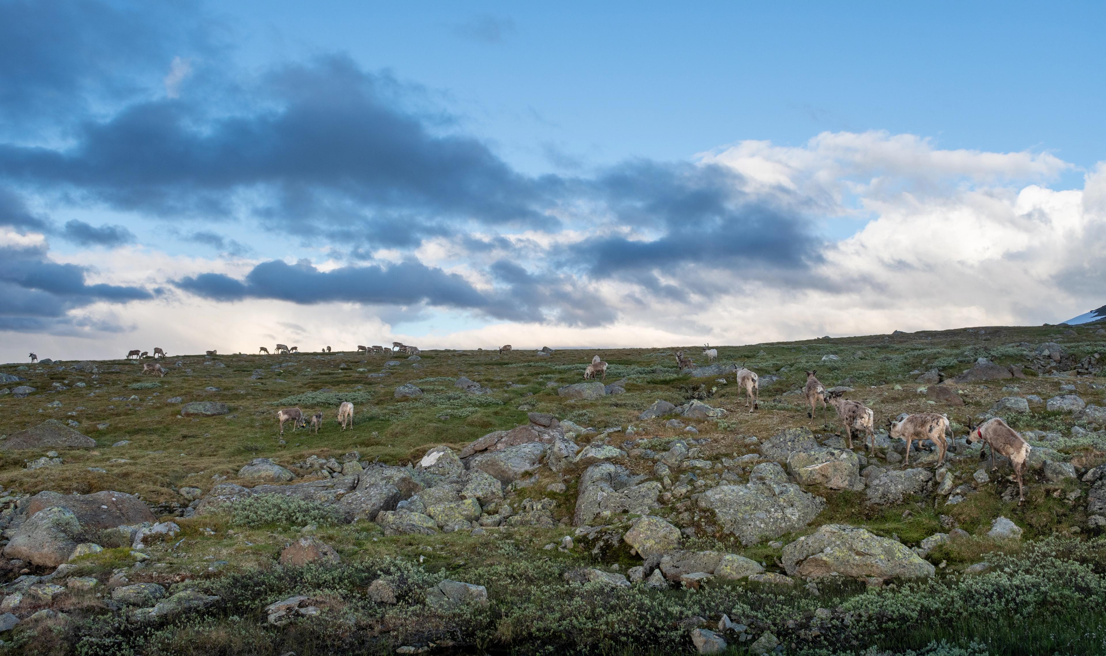
N'oubliez pas de toujours faire attention aux rennes sur la route et de garder vos distances si vous en voyez pendant votre randonnée.
Continuez jusqu'à Lom et la vallée d'Ottadalen pour un voyage inoubliable !
Et explorez en profondeur les montagnes de Jotunheimen.
La route panoramique de Valdresflye
Découvrez les points d’orgue !
Voir aussi


 9 Days ・ All yearBook now
Fjords & Hurtigruten
Fjords, scenic railways & coastal cruiseEmbark on a 2-day Norwegian coastal cruise, visit Bergen, Oslo, Trondheim, the Nærøyfjord, the Geirangerfjord (summer) or Hjørundfjord (autumn) and ride the scenic Bergen, Flåm and Dovre Railways. / Authentic ScandinaviaPrix Du 16 630 NOK 4+ Days ・ September - MarchBook now
Short winter cruise
Tromsø and a Hurtigruten CruiseThis tour includes a cruise with Hurtigruten. Choose from a wide selection of winter activities including dog sledding and northern lights excursions. / Authentic ScandinaviaPrix Du 7 355 NOK 6+ Days ・ September - MarchBook now
Northern lights cruise
Tromsø, the North Cape and KirkenesTour including a return cruise from Tromsø to Kirkenes with Hurtigruten. Visit the North Cape and try winter activities including dog sledding and snowmobiling. / Authentic ScandinaviaPrix Du 14 500 NOK 6+ Days ・ November - MarchBook now
Arctic winter adventure
Snowhotel Kirkenes, Hurtigruten & TromsøWinter adventure tour including an overnight stay at Kirkenes Snow Hotel, a cruise with Hurtigruten to Tromsø, and a wide selection of optional winter activities. / Authentic ScandinaviaPrix Du 11 500 NOK 7+ Days ・ April - OctoberBook now
Sognefjord adventure
Oslo, Bergen, Flåm and BalestrandTravel independently by train and boat to experience the breathtaking Norwegian fjords. Visit Oslo and Bergen, as well as the fjord villages of Flåm and Balestrand. / Authentic ScandinaviaPrix Du 11 490 NOK 8+ Days ・ May - SeptemberBook now
Norwegian fjords & glaciers
Oslo, Bergen, Sognefjord, Hardangerfjord.Travel by train, boat, and bus to experience the Sognefjord and Hardangerfjord. Visit Oslo, Bergen, and the fjord villages of Flåm, Balestrand and Ulvik. / Authentic ScandinaviaPrix Du 16 060 NOK 9+ Days ・ All yearBook now
Coast & fjords of Norway
Oslo, Bergen, fjords, Pulpit RockExperience the highlights of Southern Norway, including the Norwegian fjords and coast, scenic railways, the Pulpit Rock and the cities of Oslo, Bergen, Stavanger, and Kristiansand. / Authentic ScandinaviaPrix Du 16 775 NOK 4+ Days ・ All yearBook now
Oslo, Bergen & fjord experience
Oslo, Flåm & BergenExperience the amazing Norwegian fjords. Travel by train on the Bergen & Flåm Railways, spend the night in beautiful Flåm, and join a cruise on the Nærøyfjord. / Authentic ScandinaviaPrix Du 6 745 NOK 17 Days ・ May - SeptemberBook now
Escorted tour Oslo - Bergen - Trondheim
Visit the stave church at Lom and experience the Sognefjord and Gudbrandsdalen valleyJoin the Norway in a Nutshell journey, with ride on scenic trains and express boats along the coast, and enjoy two skylift gondola rides and scenic routes, including Trollstigen. / 50 Degrees North NordicPrix Du 68 975 NOK 10 Days ・ June - SeptemberBook now
Scenic fjords of Norway
Experience the fjords on this premium group tourTour the Western Fjords of Norway, starting from Bergen and finishing in Trondheim on this escorted tour. Travel along the coast on an express boat before driving the Trollstigen Road and Atlantic Highway. Stay in historic waterfront and fjord hotels along the way. / 50 Degrees North NordicPrix Du 43 835 NOK 1+ Days ・ All yearBook now
Norway in a Nutshell®
Norway's most popular tourThis legendary tour takes you through Norway’s most breathtaking UNESCO-listed fjord and mountain scenery, and includes a ride one of Europe’s top scenic rail journeys. / Fjord ToursPrix Du 2 460 NOK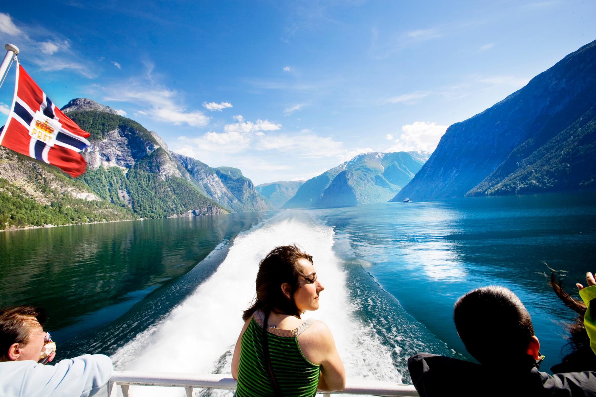 1+ Days ・ April - OctoberBook now
Sognefjord in a Nutshell™
Experience Sognefjord by rail and cruiseTravel the waterway into the heart of the Norwegian fjord- and mountain landscape and experience the beautiful Sognefjord. This relaxing fjord experience also includes scenic train journeys with the Flåm Railway and Bergen Railway. / Fjord ToursPrix Du 2 745 NOK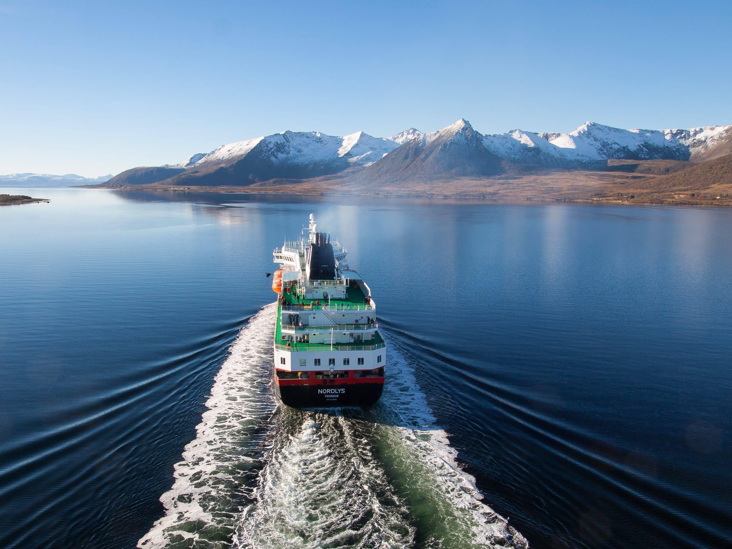 12+ Days ・ All yearBook now
Grand tour of Norway
Oslo, Flåm, Bergen & Hurtigruten cruiseAn amazing rail tour from Oslo via the Norwegian fjords to Bergen. From Bergen you will continue on a 7-day cruise through incredible scenery along the Norwegian coast to Kirkenes. / Authentic ScandinaviaPrix Du 23 205 NOK 8 Days ・ May - SeptemberBook now
Beautiful Norway
Touring Fjord Norway on our premium mini-coachIndependent tour from Oslo to Bergen using our premium mini-coach to explore 'off the beaten track' fjord locations. / 50 Degrees North NordicPrix Du 23 875 NOK 10 Days ・ June - SeptemberBook now
Give me Møre!
A beautiful shortcutThe world’s most beautiful shortcut – from east to northwest through the Norwegian sierra. Recharge your batteries in stunning, ever-changing surroundings - relax and gain new perspectives. / Up NorwayPrix Du 43 450 NOK 7 Days ・ June - SeptemberBook now
Far out in Svalbard
A remote Arctic adventureSvalbard – 1300 km (810 miles) from the North Pole – is an escape from the escape. As one of the last great wildernesses, Svalbard takes the Norwegian experience to a whole new level. / Up NorwayPrix Du 42 000 NOK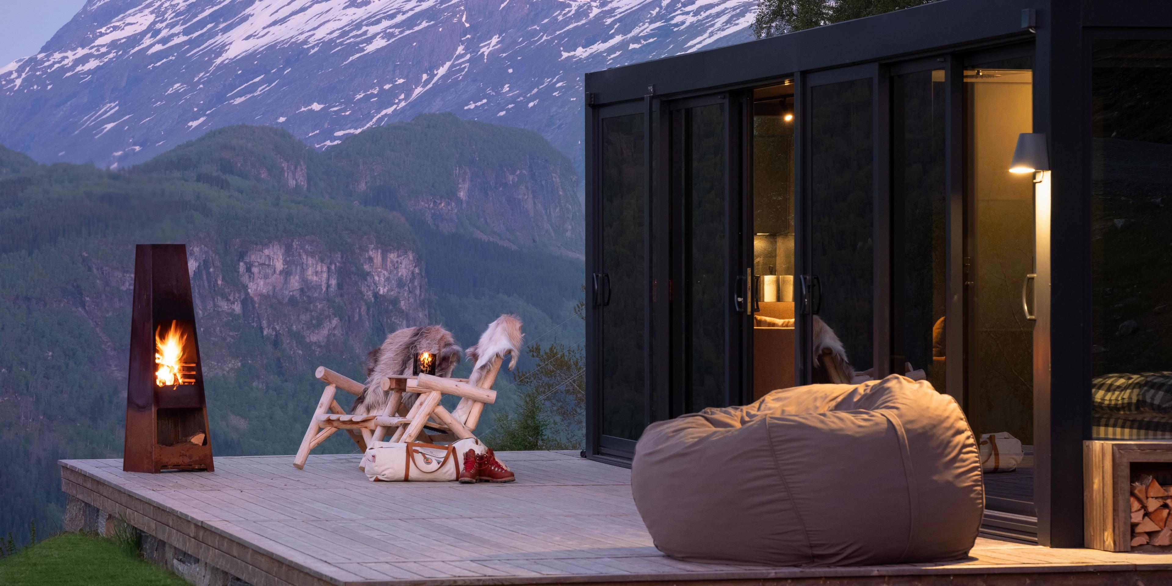 12 Days ・ March - OctoberBook now
Bergen, Ålesund & beyond
Fjords and UNESCO World Heritage SitesFind a place where time stands still, feel the wind gently touch your face, and taste the richness that lives in the soil. Discover people and places that touch your heart. / Up NorwayPrix Du 87 450 NOK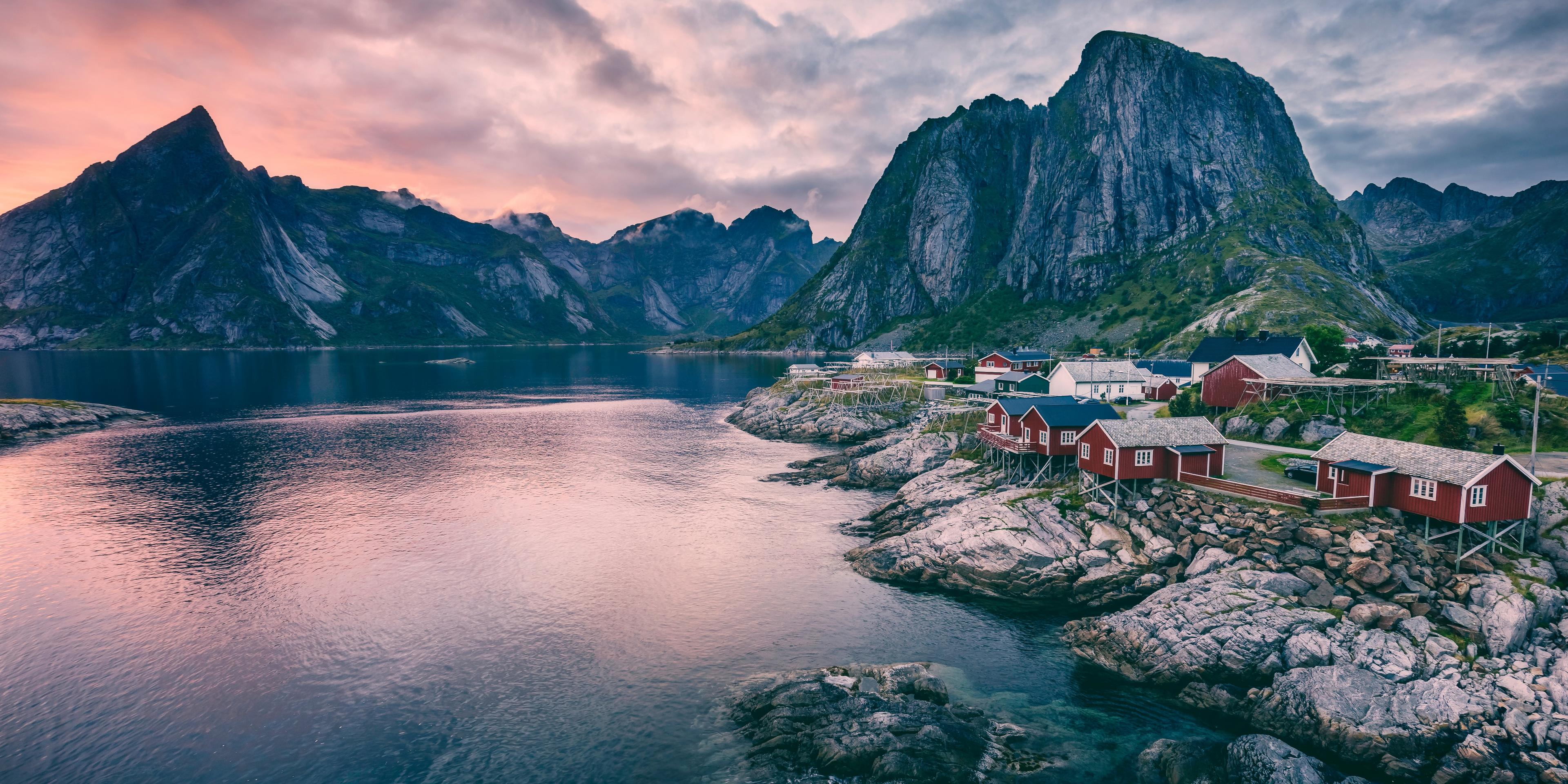 12 Days ・ April - OctoberBook now
The Arctic circle region
Myths and Marvels in HelgelandOn this journey, you will immerse yourself in the mythical fairy tales of Norway, and become a part of the story of the eternally immortalised trolls in the peculiar mountains around you. / Up NorwayPrix Du 53 100 NOK 12 Days ・ May - SeptemberBook now
The Arctic circle express
Slow Travel is Back in FashionTake your seat on an epic rail journey through tranquil landscapes peppered with majestic mountains, fjords and waterfalls – on foot, by boat or even in a kayak. / Up NorwayPrix Du 59 000 NOK 13 Days ・ April - OctoberBook now
Norwegian folklore
Road-trip through entrancing landscapesExperience the same landscapes that have entranced Norway's most famous artists for centuries while travelling through mountains, fjords and coastal landscapes, and from cities to villages. / Up NorwayPrix Du 67 100 NOK 6+ Days ・ September - MarchBook now
Fjords & northern lights
Oslo, Bergen, Flåm and TromsøWinter adventure. See the fjords and the Arctic city of Tromsø. Winter activities like dog sledding, a northern lights safari, and much more can be added. / Authentic ScandinaviaPrix Du 10 170 NOK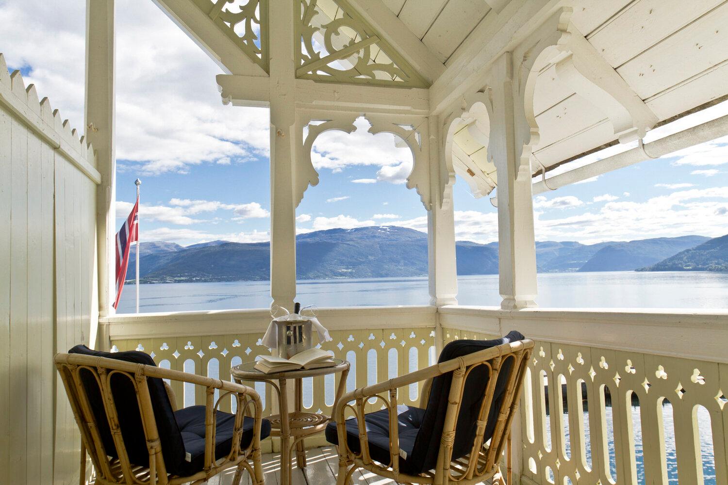 6 Days ・ June - AugustBook now
Kviknes hotel, Norway fjords and Bergen
All the fjord favourites in one tourThis classic self-guided fjord tour will have you sailing under towering fjord cliffs and RIB boating along the stunning fjords. Explore Hanseatic heritage and enjoy the warm hospitality of Norway's former capital, Bergen. / 50 Degrees North NordicPrix Du 19 072 NOK 6+ Days ・ All yearBook now
Discover fjord Norway
Oslo, Bergen, fjords & mountainsIndependent rail tour including Oslo, Bergen and Vatnahalsen. Experience scenic railways and breathtaking fjords as you travel across the mountain to the Norwegian fjord region. / Authentic ScandinaviaPrix Du 9 550 NOK 9+ Days ・ June - SeptemberBook now
The golden route
Oslo, Geiranger, Ålesund and Bergen.Explore Oslo, Geiranger, Ålesund, and Bergen on an independent rail tour. Travel with the impressive Rauma and Bergen Railway lines and enjoy a cruise with Hurtigruten on the Geirangerfjord. / Authentic ScandinaviaPrix Du 19 945 NOK 10 Days ・ All yearBook now
Norway's super women
Can full equality ever be achieved?We have curated an itinerary that invites travellers to explore Norway from a gender equality perspective, and discover why Norway ranks so highly in the UN sustainable development chart. / Up NorwayPrix Du 53 000 NOK 3 Days ・ April - OctoberBook now
Bergen & the fjords
Enjoy Bergen and the beautiful fjord areaCruise on the Sognefjord, ride the Flåm Railway and explore picturesque scenery. / Fjord Travel NorwayPrix Du 12 650 NOK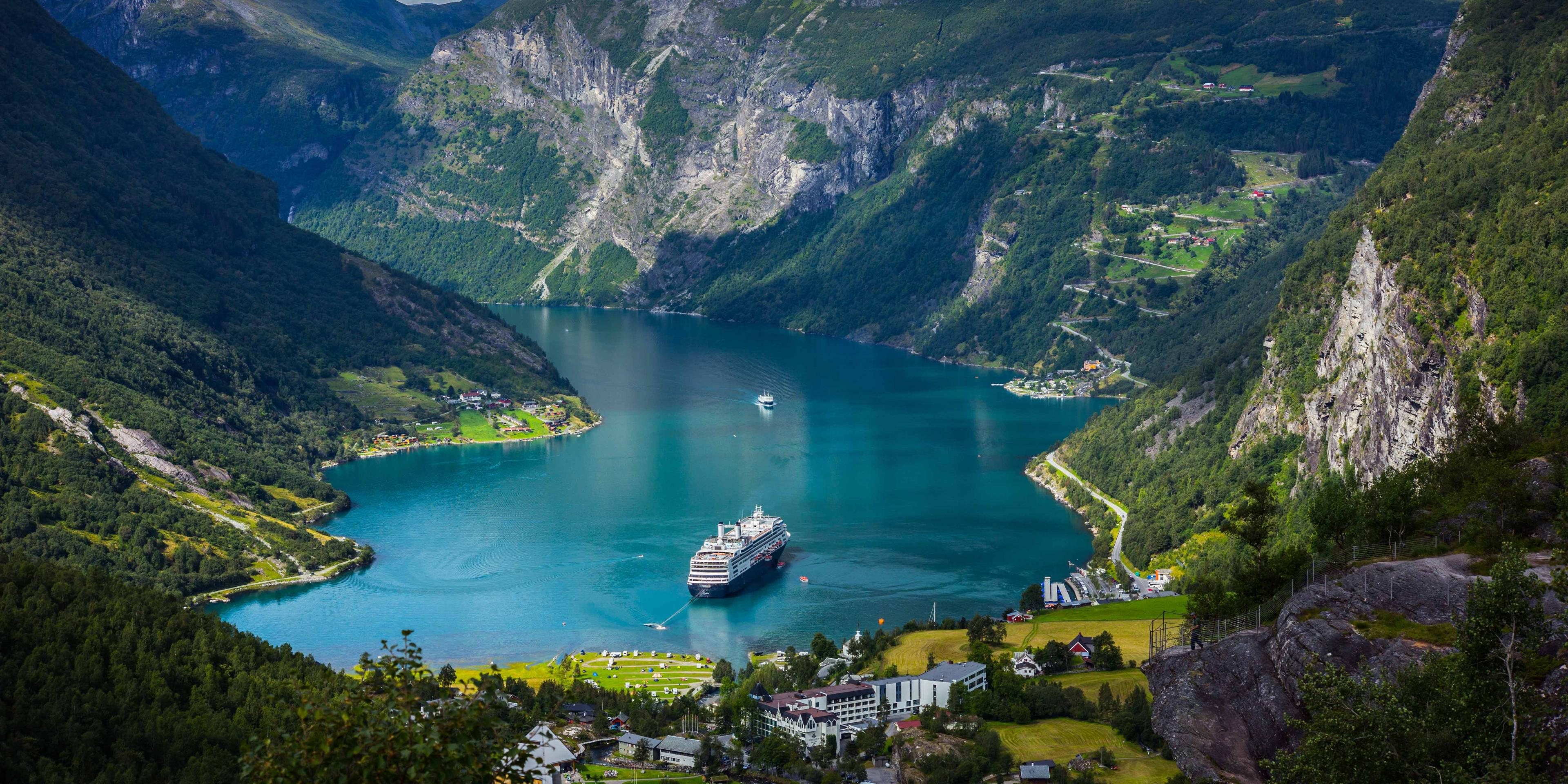 7 Days ・ May - SeptemberBook now
Norway's fjord & city tour
Unesco Fjord cruise package; Geirangerfjord & NærøyfjordCruises on the two UNESCO listed fjords Geirangerfjord & Nærøyfjord. Ride the world famous Flåm Railway and explore urban Oslo. picturesque Bergen and the Art Nouveau town of Ålesund. / Fjord Travel NorwayPrix Du 20 950 NOK 6+ Days ・ June - SeptemberBook now
Oslo & fjord adventure
Oslo, Bergen, downhill biking & fjord safari.Norway activity tour including Oslo, the Norwegian fjord region, Voss, and Bergen. Experience activities like cycling, fjord safaris by RIB boat, and spectacular train journeys. / Authentic ScandinaviaPrix Du 12 510 NOK 11 Days ・ April - SeptemberBook now
Norwegian Havila voyage
Bergen to Tromsø with an overnight stay in LofotenThis Norwegian Coastal Voyage from Bergen stops in at Ålesund, Geirangerfjord, Trondheim, and Saltstraumen, then disembarks for an overnight stay in Lofoten before continuing to Tromsø. / 50 Degrees North NordicPrix Du 26 215 NOK 7 Days ・ All yearBook now
Norway for foodies
A road trip in and around TrondheimThis journey includes tasty culinary experiences: tastings and talks on biodynamic farming, microbrews, local food, foraging, sustainable food production, and Norwegian culinary traditions. Delicious! / Up NorwayPrix Du 42 900 NOK 7 Days ・ September - AprilBook now
Lofoten Islands and Manshausen
The perfect autumn or spring adventureSteigen and the Lofoten Islands make up the perfect autumn or spring travel adventure for those seeking an authentic immersion in Norwegian culture, nature, architecture, art and design. / Up NorwayPrix Du 47 850 NOK 10 Days ・ April - OctoberBook now
New views of the old country
Oslo, Finse, Balestrand, Halvåg, BergenWho are you and where do you come from? The answer lies in the past. We invite you to embark on a journey of discovery where we will curate connections which may bring you much closer to your own ancestry. / Up NorwayPrix Du 49 600 NOK 5 Days ・ Juni - SeptemberBook now
Aurland, Flåm and Hardanger
Fjord cruise, farm visits and Flåm railwayFjord cruise from Bergen through Sognefjord, farm visits with tastings, hike to get views of the Aurlandsfjord, enjoy a fjord sauna in Flåm, ride the famous Flåm Railway. Experience cider tasting in Hardanger, visit Rosendal Barony, and stay at quality hotels with 3-course dinners included. / Norrøna AdventurePrix Du 28 500 NOK 8 Days ・ June - AugustBook now
From mountains to fjords
Jotunheimen and AurlandOn this adventure, you can hike the historical route through mountainous Jotunheimen National Park towards the beautiful fjords in the west. / Norrøna AdventurePrix Du 26 000 NOK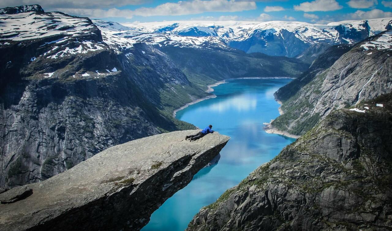 6 Days ・ June - SeptemberBook now
Trolltunga, Preikestolen and Folgefonna glacier
Iconic hikes and Lysefjord cruiseOslo roundtrip: Hike Trolltunga and Preikestolen, explore Hardangervidda, walk on Folgefonna glacier (equipment provided). Cruise Lysefjorden and stay at Canvas Hotel with saunas and outdoor tubs. / Norrøna AdventurePrix Du 29 000 NOK 24 Hours ・ All yearBook now
Flåm railway and cruise
A round trip to the fjordsExperience UNESCO-protected fjords with a self-guided round tour from Oslo. This trip includes the tickets Oslo-Myrdal-Flåm (train), Flåm-Bergen (boat, bus, train) and Bergen-Oslo (train) with sleeping compartment. / Booknordics.comPrix Du 5 190 NOK 7 Days ・ All yearBook now
Roundtrip by cruise and rail
Complete holiday package from OsloExperience the Flåm Railway, cruise the Sognefjord and continue to Bergen. Cruise further to Stavanger and witness the Pulpit Rock, and visit picturesque towns on your return to Oslo by train. / Booknordics.comPrix Du 19 220 NOK 8 Days ・ May - JulyBook now
Midnight sun tour
Group experience in Lofoten and SenjaIncludes sea eagle RIB safari, dining at award-winning Kvitnes Gård, visit to the Viking Museum, coastal cruise with Hurtigruten or Havila, tour to Hamn i Senja, and more. / 50 Degrees North NordicPrix Du 49 652 NOK 2-3 Days ・ November - MarchBook now
Geirangerfjord in a Nutshell™ Winter Tour
UNESCO fjord, Rauma railway and fjord cruiseExperience the Geirangerfjord in winter. The trip includes a scenic train ride, a guided fjord cruise, and the Flydalsjuvet Viewpoint. You can personalize with activities and overnight stays. / Fjord ToursDu 4 295 NOK 5 Days ・ All yearBook now
Norway Cities, Trains & Fjords
Including Norway in a Nutshell®A 5-day self-guided tour, that includes travel to Oslo, Bergen and Trondheim, some of the world’s most scenic railways, cruises on UNESCO fjords, and breathtaking coastal landscapes. / Fjord ToursPrix Du 11 803 NOK 3 Days ・ May - SeptemberBook now
Sognefjord & Balestrand
Scenic journey between Oslo & Bergen3-day rail and fjord journey from Oslo or Bergen. Sleep 2 nights at historic Kviknes Hotel. Ride the Flåm Railway, cruise the Sognefjord, and visit Bøyabreen glacier. Includes an orchard lunch. / Fjord ToursPrix Du 9 096 NOK 7 Days ・ June - AugustBook now
Tromsø, Senja & Lofoten
Arctic summer in Tromsø, Senja & SvolværEmbark on a self-guided bus tour of Tromsø, Senja & Lofoten. Visit charming villages off the beaten track and enjoy scenic backdrops of dramatic cliffs, crystal-clear bays and white sandy beaches. / Authentic ScandinaviaPrix Du 8 785 NOK