Sunde i Sunnhordland
Hike to Fenafjell
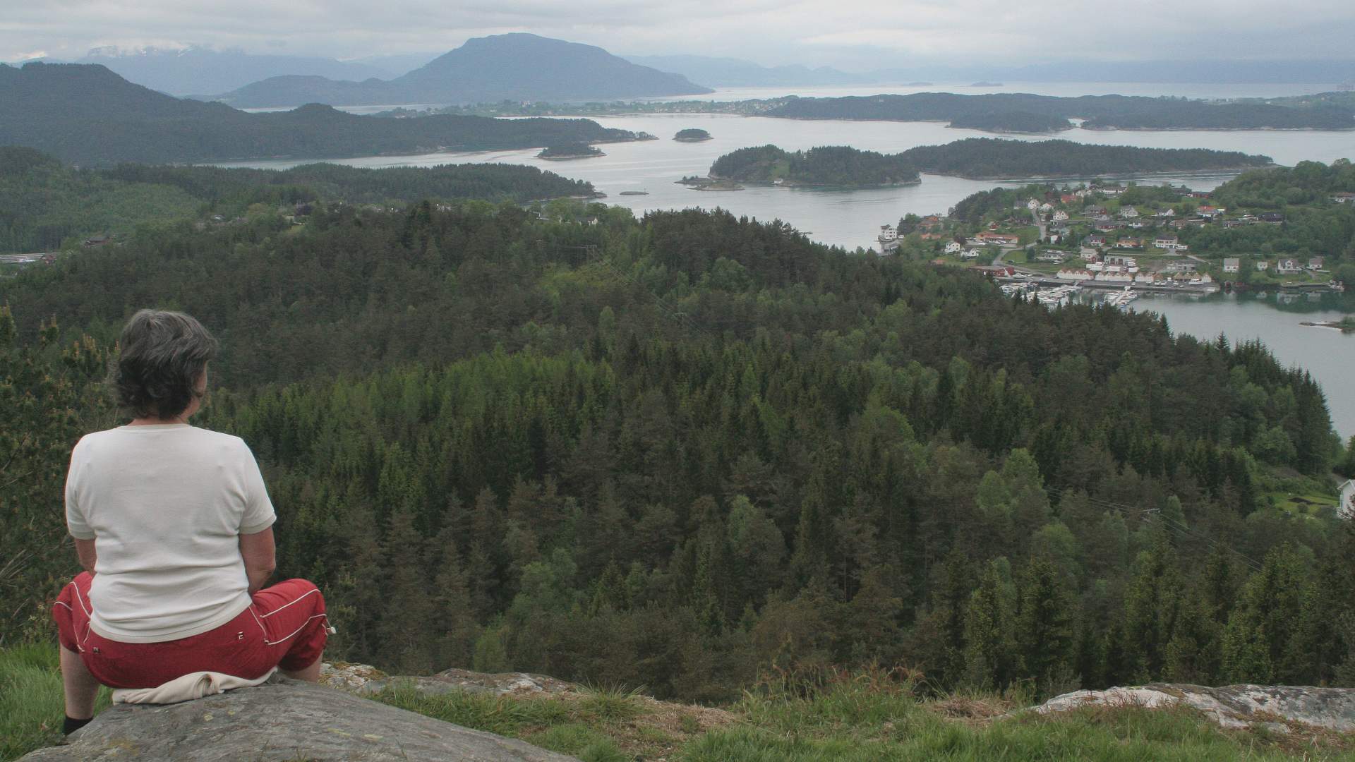
Hike with a beautiful view of Sunde and large parts of the "Sunnhordland Basin".
Sunde
MapFolgefonna National Park Topographical map series – M711, sheet 1214 IV – Husnes.
Start and stopping pointBy the traffic roundabout before the entrance to the Halsnøy Tunnel, "Podlen".
ParkingBy the traffic roundabout before the entrance to the Halsnøy Tunnel, "Podlen".
MarkingInformation Board by the starting point. Red markings and signs.
GradingGreen Easy hike, one boot according to the DNT system.
Difference in altitude20 - 160m AMSL
Estimated time1 hour round trip
Recommended adviceIf you wish to make this hike a round trip, you may walk the route via Kaldestadåsen. There are several alternative ways up and down. Use the route map, be creative and use your imagination to plan interesting hikes.
OverviewFollow the road from the parking lot for 50 meters up towards the left (west), where the path enters the forest. The first part goes over flat terrain, partly on an overgrown forest road and then a moderate incline to the top. The destination has a designated rest area with tables and benches. There is a beautiful view of Sunde and large parts of the Sunnhordland Basin.
Last updated: 01/29/2024
Source: Samarbeidsrådet for Sunnhordland
Hike to Fenafjell